Points to Line
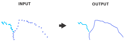
Function Description: Creates line features based on points.
Data Description
Input and Output Relationships

Input and Output Relationships for Points to Line
Note:
- Only lines with two or more vertices will be written to the output.
Steps
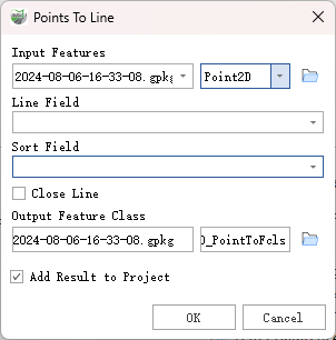
Find the Points To Line tool in the toolbox and double-click to open the tool's dialog.

Points to Line
Parameter Description:
- Input Features: Point features to be converted into lines.
- Line Field (Optional): Field used to identify unique attribute values. Points with unique attribute values will be merged to form output line features.
- Sort Field (Optional): Field used to sort the points. By default, points used to create each output line feature are processed in the order they are found.
- Close Line (Optional): Specifies whether the output line features should be closed.
- Checked: Additional vertices will be added to ensure the end point of each output line feature matches the start point.
- Unchecked: No additional vertices will be added to close the output line features. This is the default setting.
- Output Feature Class: Line feature class created from the input points.
- Add Result to Project: This option is only effective when the output feature class result is saved to a geodatabase within the project. When checked, a layer will be automatically built for the result data and added to the project.