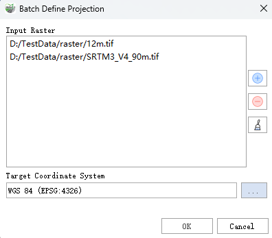
Batch Define Projection
Function Description: Overlay with coordinate system information (map projection and datum) stored with a set of raster data.
Data Description
- All geographic data has a coordinate system for displaying, measuring, and converting geographic data. If the coordinate system of a particular dataset is unknown or incorrect, you can use this tool to specify the correct coordinate system.
- This tool only updates the existing coordinate system information; it does not modify any data. To convert data to another coordinate system, please use the Batch Project tool.
Steps
- Locate the Batch Define Projection tool under Raster Tools in the toolbox, and double-click to open the tool's window.

Batch Define Projection
Parameter Description:
- Input Rasters: The raster data for which you want to define the projection. Multiple raster datasets can be selected.
- Target Coordinate System: The coordinate system to be applied to the input rasters.