Data Conversion
Feature Description: Convert point cloud data in *.las, *.ply, *.e57 formats into *.LiData format
Steps
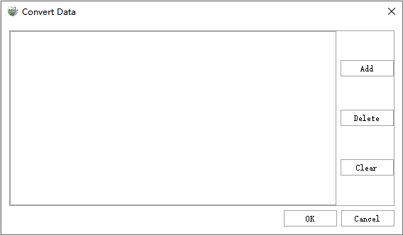
1.After starting the software, click the Data Conversion ![]() button to access the data conversion page:
button to access the data conversion page:

- Add: Add point cloud data files, multiple selections are supported.
- Delete: Deletes the point cloud file path selected on the left.
- Clear: Clears all point cloud file paths.
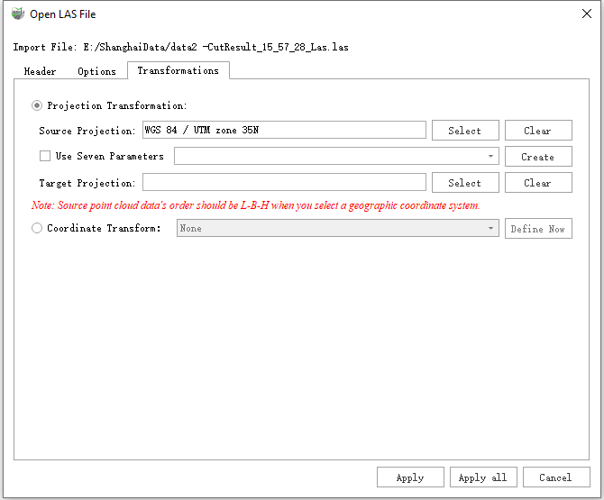
2.After clicking OK, a parameter setting interface for importing data will pop up:

- Source Projection: The software automatically reads the coordinate system of point cloud and vector files and displays it in the output box. Users can also manually select it by clicking the browse button.
- Target Projection: Click the browse button on the right, choose the target coordinate system to which you want to project, and you can set both horizontal and vertical coordinate systems.
- Seven Parameters: Add seven parameters to the projection relationship.
- Coordinate Transform: You can refer to Creating Conversion Relationships