Colorize Point Cloud
Step
1.Click Colorize Point Cloud![]() . The interface settings are as follows:
. The interface settings are as follows:
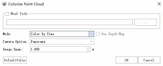
2.After setting the parameters, click OK to assign the point cloud color.
3.After the point cloud is colored, a pop-up window asks "replace data or change project".
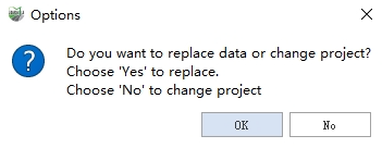
- Replace data: Overwrite the original point cloud data.
- change project: Retain the original point cloud and modify the project file. Change the point cloud path in the project file to the new color point cloud path, and the result is in the original point cloud sibling directory. The new point cloud file name is 'original-filename-colorized'.
Mask File
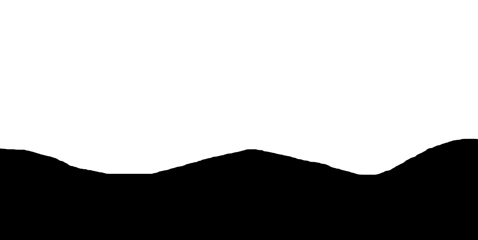
Make: It is used to mask the wrong pixels such as the capture device and the collector in the scene. During the coloring process, the black area on the mask does not participate in the coloring, and the pixels in the white area participate in the coloring.
Function: It is a photo file composed of black and white and scaled in the same proportion of the resolution as the original photo. The specific generation method is to use black filling for the acquisition equipment on the image and the area where the collector is located. The rest of the normal pixel area, filled with white.
Parameter Settings
Mask: This feature eliminates pixels situated in areas obscured from the sensor. It offers two methods for specifying these areas: using a mask file or setting a radius. Using a mask file is highly recommended.
- File: Using a mask file offers a more accurate masking area compared to the radius mode, leading to improved coloring results.
- Radius:Setting a radius offers an approximate masking area.
Mode:
- Colorize by Time: Select photos by closest time to color.
- Colorize by Distance: Select photos by closest distance to color.
- Use Depth Map : It is used to solve occlusion problems in coloring, such as street lights being assigned to the ground behind them. This option is more time-consuming and only supports the distance assignment mode based on panoramic images.
- Blend: Used to smooth the seams in the colorized image, resulting in a more natural transition.
- Optimize Sky-coloured Points: This is used to improve instances where sky colors are incorrectly applied to trees. This option is more time-consuming and only supports colorization based on panoramic images.
Camera Option: Select the camera image data used for coloring, and you can select a panoramic camera or a flat camera. For planar cameras, you can select any one or more.
Image Span: It is used for thinning of photos, and the photos are extracted at equal intervals for coloring. The larger the spacing setting, the fewer photos will be colored.