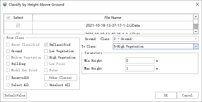
Classify by Height Above Ground
Function Description: This function classifies the points on the surface of the terrain with a certain height, which can quickly classify vegetation at different heights.
Steps
1.Click Classify by Height Above Ground![]() button, pop up the Classify by Height Above Ground dialog box.
button, pop up the Classify by Height Above Ground dialog box.

Parameter description:
- Input Data: The input file can be a single point cloud data or a point cloud dataset.
- From Class: Source class(es).
- Ground Class: The default ground point is 2-class.
- To Class: Target class.
- Minimum Height (meters): The default is "0", the minimum height difference of the area to be classified above the ground points.
- Maximum Height (meters): The default is "1", the maximum height difference of the area to be classified above the ground points.
- DefaultValue: Click this button to set all parameters as default.
Note: This function need to contain the ground point in the cloud.