Cut Long Range
Function Description:By removing longer measurement values, noise is reduced, and accuracy is improved to optimize data quality. This feature is primarily applied to point cloud data generated by mobile, backpack, or handheld scanners, which may capture the same location multiple times during scanning. Longer measurement values are typically less accurate due to factors such as measurement angle, occlusion, or device movement.
Steps:
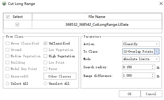
1.Open the toolbox, Click on Data Management > Point Cloud Tools > Cut Long Range button, Pop up the parameter settings interface:
Description:
Type:
- Classify: Classify the overlap points to the target class and keep the points in the original point cloud file.
- Delete: Classify the overlap points to the target class and delete the points from the point cloud file
To Class: The target class of classifying.
Mode: Define how the measurement length is determined:
- Absolute Limit: Uses a fixed search radius and range difference settings.
- Relative Limit: The search radius depends on the scanner's range.
Search Radius: The radius within which to search for shorter points. If a longer distance point is found within the given radius, it will either be deleted or categorized into the target class.
Range Difference: The maximum range difference allowed between two points. Only when the range difference is significant will the longer distance point be truncated.
Note: The "Cut Long Range" point cloud function requires at least one trajectory data.