Directory Tree Management
Function Description: Manage the data contained in the project.
Operation Instructions
1.By checking or unchecking the *.liscan project checkbox, users can control whether the corresponding processing steps are performed.
2.By checking or unchecking the data checkbox, you can control the display and hiding of the current data and all its sub-node data (if any).
3.The right-click menu provides options for querying, displaying, removing, and other operations on the data. The right-click dropdown menu varies depending on the type of data.
Scan

Directory Tree-Scan
Group

Directory Tree-Group
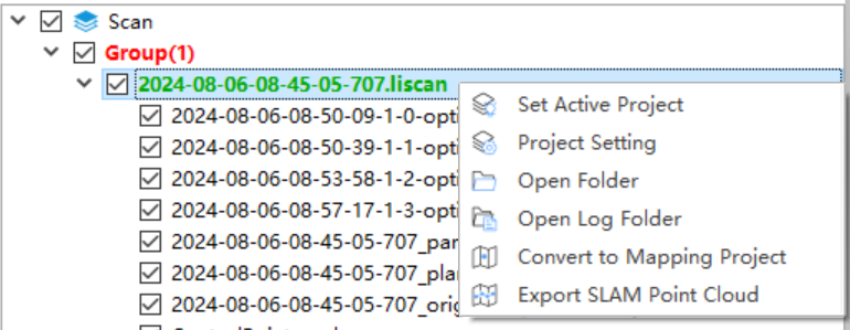
- Set Active Group: The active group is displayed in red, and only the active group can perform the Register operation.
- Ungroup.
- Register.
.liscan
.liscan</p></div>
Directory Tree-Group

Directory Tree-Ungruop\*.liscan
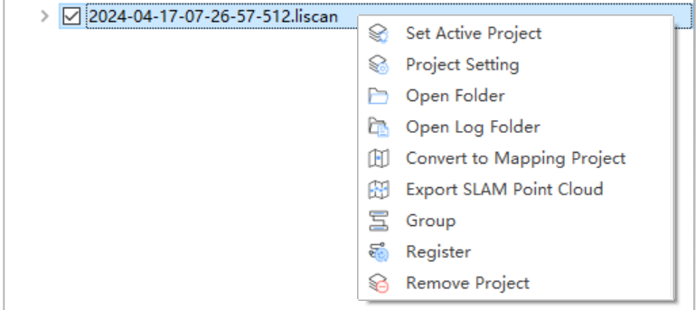
- Set Active Project: Used to control which project is displayed in the Settings window.
- Project Setting: Used to set project parameters, with functions consistent and linked to the Settings window.
- Open Folder: Open the folder where the current project is located.
- Open Log Folder:Open the folder containing the log files.
- Convert to Mapping Project.
- Group: Organize .liscan projects; after the *Strip Adust operation, the software will automatically group them.
- Register: The software will automatically group *.liscan projects and display the Register dialog box.
*.LiData

Directory Tree-\*.LiData
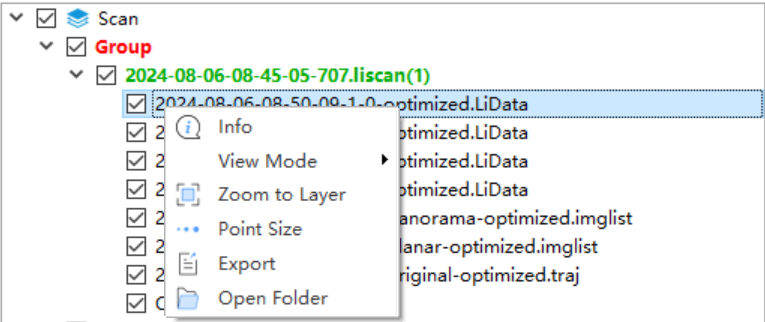
- Info: View basic information about the point cloud, including the data path, coordinate information, minimum and maximum X, Y, Z coordinates, the average and standard deviation of Z, minimum and maximum GPS time, minimum, maximum, average, and standard deviation of intensity, bounding box of the point cloud, total number of points, point cloud category statistics, and echo count statistics. Click the "Export" button to export the basic point cloud information as a .txt file.
- View Mode: Set the display mode for individual point cloud files, including the types shown in the figure.
- Zoom to Layer: Calculate the bounding box of the current point cloud data and globally display all open windows for this data within the bounding box range.
- Point Size: Set the symbol size for displaying the point cloud.
- Export: Export the point cloud as a *.laz or *.las format file.
- Open Folder: Open the folder where the current point cloud data is located.
*.imglist

Directory Tree-*.imglist
- Select Color:Set the color for exposure points.
- Open Folder: Open the folder where the current image data is located.
- Update:Update the *.imglist based on the trajectory.
- Update EXIF.
*.traj

Directory Tree-\*.traj
- Info: View basic trajectory information, including the data path, timestamps, latitude and longitude, elevation, rotation angles, projected coordinates, eastward velocity, northward velocity, upward velocity, and other details.
- Point Appearance: Set the display mode and size for individual trajectories.
- View Mode: Set the display mode for trajectories, including the types shown in the figure.
- Zoom to Layer: Center the view based on the current trajectory range.