Mobile Data Output Data
Steps
1.Control the data processing workflow by selecting the appropriate processing steps![]() . The software supports the following steps:
. The software supports the following steps:
- Filter: Smooth and continuous point cloud surfaces, reducing the influence of noise.
- Colorize: Point cloud coloring is based on point clouds and images, giving color information to point clouds. Panoramic cameras and single plane cameras are currently supported.
- Classify: Use deep learning methods to classify point cloud data.
Only after Georeference is checked, Filter,Colorize and Classify will be activated at the same time.
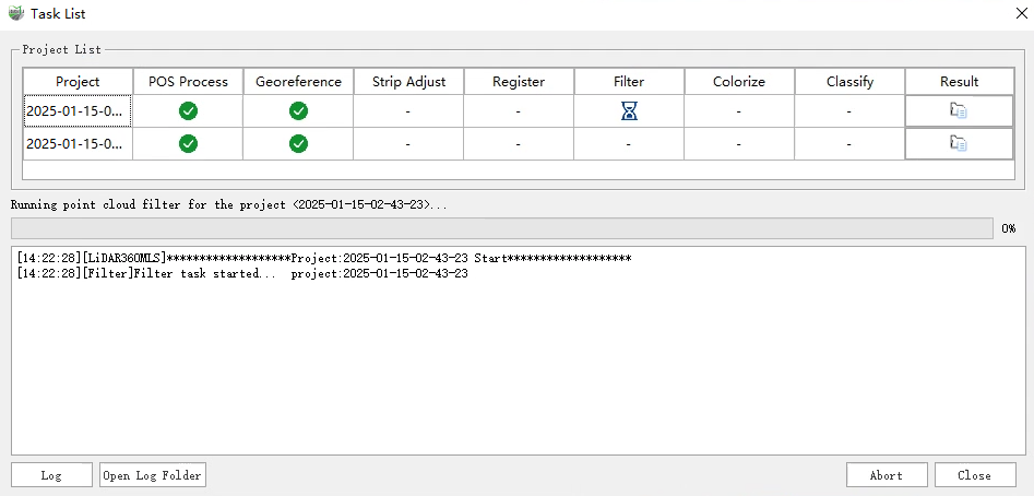
2.In the directory tree, select the .liscan project you want to process, and click the Start![]() button. The software interface will automatically open the *Batch Processing - Project List window and begin executing the selected processing steps.
button. The software interface will automatically open the *Batch Processing - Project List window and begin executing the selected processing steps.

Batch Processing - Project List Window
3.After the selected processing steps are successfully completed, click the Close button to close the Batch Processing - Project List window. The software's main interface will load and display the processed data.
If the user needs to stop the processing during execution, they can click the Abort button in the Batch Processing - Project List window. The currently executing step will then be marked as failed.