Based On Point Cloud
Note: If the point cloud has been categorized in advance, a DEM will be generated using only the category in which the ground is located, and a DSM will be generated using all point clouds.
Steps
1.Click Based on point cloud![]() button.
button.
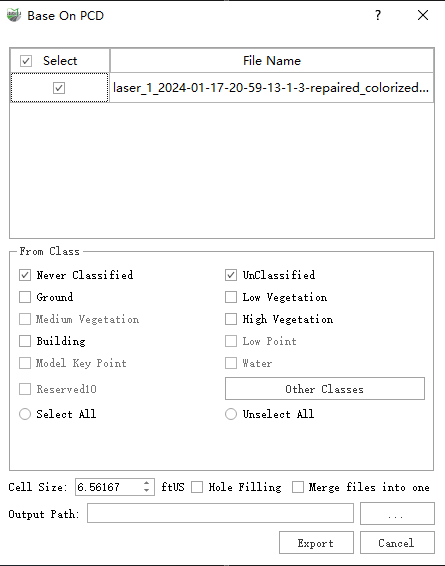
2.Pop-up Dialog box

Dialog box
Parameter description:
Pixel size: resolution of the image.
Hole Filling: point cloud in the scanning process, due to the impermeable surface of the feature, easy to produce internal voids, check this option will automatically fill small voids.
Merge into one file: if checked, all point clouds are generated into one DSM/DEM image, unchecked, one image is generated for each point cloud
Check the box carefully, if the point cloud range is too large, it may cause computer memory overload, which may lead to generation failure. Please check the box if you have a small number of point clouds and the range is within a reasonable range.
Output Path: where the image is saved.
Results: results files, including the image itself in .tif format, and the corresponding tfw coordinate files

Outcome document