Geo Module FAQ
Common error messages and solutions
1.[Analyze Images]Please generate the trajectory file first!
- Error reason: No *.traj file was generated in the project.
- Solution: The Thinning By Distance function when analyzing images and generating *.imglist files require trajectories, so the trajectories need to be processed before performing these operations.
2.[Analyze Image]Maybe something wrong with command line parameters for Ladybug.
- Error reason: *.pgr files do not exist or is damaged.
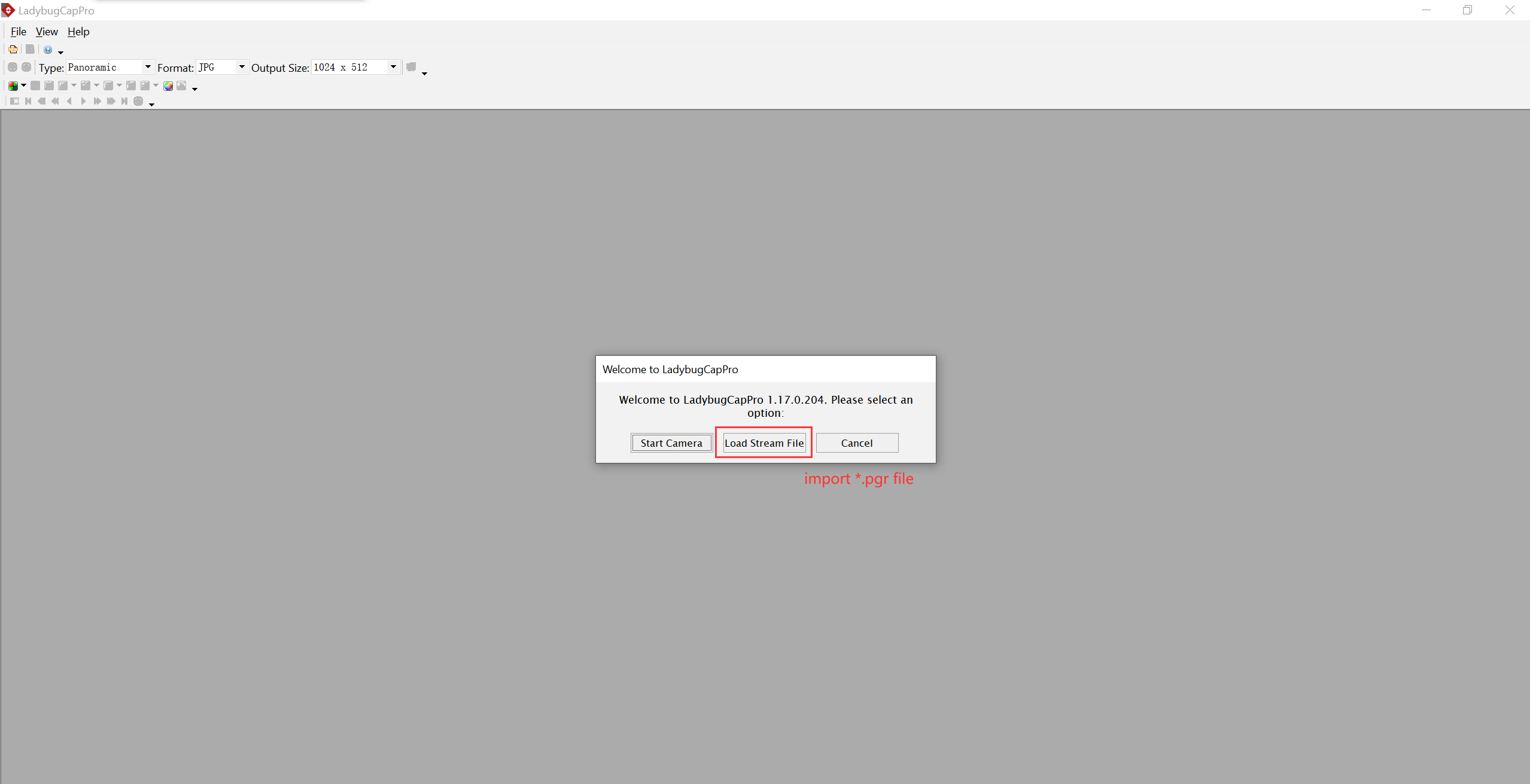
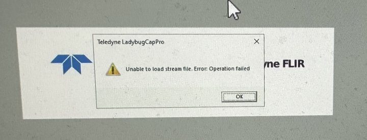
- Solution: Check if the .pgr files exists in the Cam folder. If the file exists, it is considered damaged. Users need to send the .pgr files to our technical support, and they will use ladybugCapPro software to view it. As shown in the figure, the data is damaged.
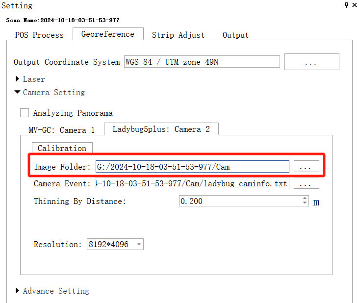
3.[Analyze Image]Folder doesn't exist *.pgr file! F:/Data/0625/2024-06-25-07-12-28/Result.
- Error reason:The panoramic Image Folder path is set incorrectly.
- Solution: Check the Image Folder path and whether there are *.pgr files under the path.
4.Error Num = -41, The quality of the satellite navigation processing is poor (Fix ratio is 0%), and the solution is terminated.
- Error reason: Data quality is poor, fix rate is 0.
- Solution: Check if the base station is too far away.
5.[Open Project] The project has been occupied.
- Error reason: The project file is open.
- Solution: Check whether multiple software interfaces are open and the project is open in other interfaces.
6.[LiDAR360MLS]Please switch to the mapping project to use this function.
- Error reason: This function can only be used in mapping projects.
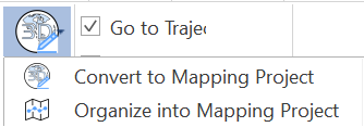
- Solution:Click the button to convert the project.
7.[LiDAR360MLS]The base station file 'R:/20240914/onig258l00,24o' does not exist.
- Error reason: The base station file is lost in the project.
- Solution: Check whether the base station file is lost. It is strongly recommended to put the base station file into the project to reduce the risk of data omission when copying data.
8.[IO]Failed to build G:/2023-06-21-07-26-10/laser_1_2023-06-21-06-36-37-1-optimized.LiData!
- Error reason: The LiData file is not completely generated or is damaged.
- Solution: Please check if the solution disk space is insufficient.
9.[IO] Load project file F:/1021_2024-10-21-05-09-40/2024-10-21-05-09-40.live failed!
- Error reason: There is an error in the live project file.
- Solution: Open the live file and check if it is normal.
10.[IO]Recover project data failed, please copy the original project data to current project directory!
- Error reason: The project folder is not copied completely.
- Solution: Compare and check whether the copied data is inconsistent with the original data.
11.[LiDAR360MLS]Failed to load project file path from F:/1021_2024-10-21-05-09-40/2024-10-21-05-09-40.liscan
- Error reason: liscan project file corruption and other JSON format issues.
- Solution: Check whether the liscan file is abnormal. If it is an empty file, try to create a new liscan project for solution. If it is not an empty file, it is recommended to contact our technical support for file repair.
12.[Strip Adiust] Initialization: Failed reading E:/2024-10-13-07-37-29-199/202410-13-07-37-29-199_original.traj
- Error reason: The trajectory file was moved, deleted, or the file format was incorrect, resulting in a failure in reading the trajectory file.
- Solution: Check the trajectory file under this path.
13.“E:/M2/1018_2024-10-18-01-25-25/LaserRaw/Hesai_1/Hesai_1_2024-10-18-01-35-13-0/Temp/pointCloudList.json” is not found.
- Error reason: Geo process task run failed.
- Solution: Try to update the software version or try to change the processing computer equipment.
14.No point cloud input for colorization
- Error reason: There is no LiData point cloud data in the liscan project.
- Solution: Coloring after processing the point cloud.
Point cloud process issues
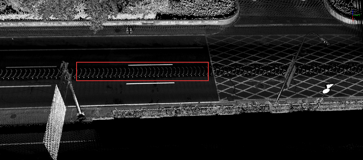
1.Why are there noise points along the trajectory after solution as shown in the figure?
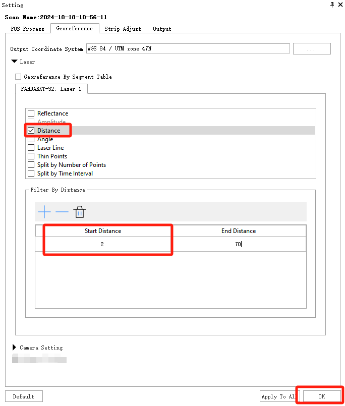
- The distance filter option is not set when processing the point cloud. Please note that you need to click the OK button after setting it so that the configuration takes effect.
2.How to solve the problem of point cloud stratification after solution?
- (1) Check whether the trajectory has jumps. If there are jumps, repair the trajectory jumps, re-solve the point cloud and check whether it is stratified.
- (2) Use the Strip Adjust function for automatic optimization.
- (3) In special scenarios, if the above methods cannot meet the requirements, you can further use the Register function to perform manual point cloud adjusting.
3.Why is the SLAM option in the advanced settings checked and the resulting point cloud quality is worse?
- Error reason: The accuracy of SLAM is greatly affected by environmental features, and in environments with sparse features or many dynamic targets, it is easy to encounter problems such as pose estimation drift or error accumulation
- Solution:Avoid selecting certain open scenarios (such as highways, elevated bridges, etc.) for calculation; If the entire process of engineering collection is open, it is recommended not to check the SLAM option, otherwise it may reduce the accuracy of point cloud solution.
Analysing Panorama and Colorize point cloud
1.How to analyze panoramic camera photos?
- (1) In the Georeference interface, the software defaults to the Analyzing Panorama option, and the user will analyze the panorama simultaneously when performing the point cloud Georeference step.
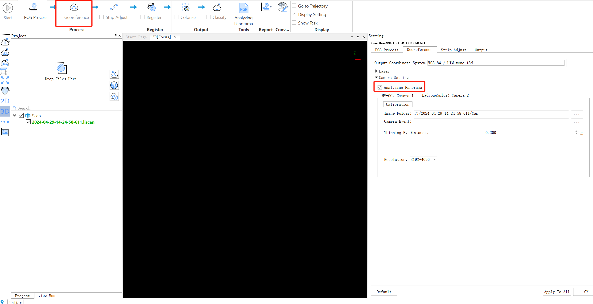
- (2) After processing the POS, the user can also click the Analyzing Panorama button to analyze the panoramic photo.

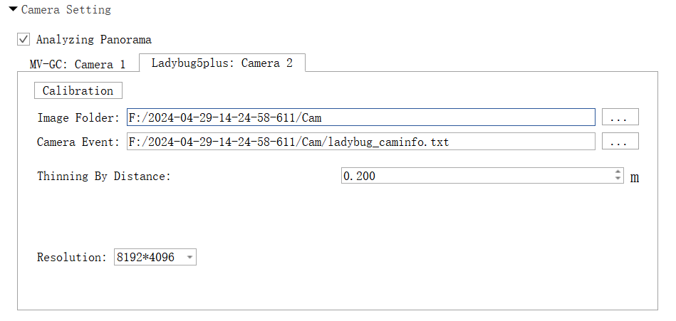
2.Is the panoramic camera setting interface normal as shown in the figure?
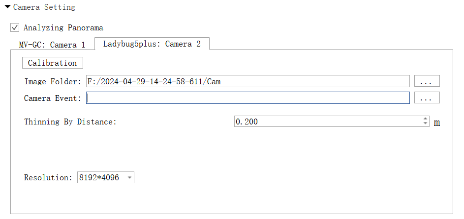
- The settings in the picture are correct. After analyzing panoramic, the software automatically generates the ladybug_caminfo.txt file and displays the path in the Camera Event.
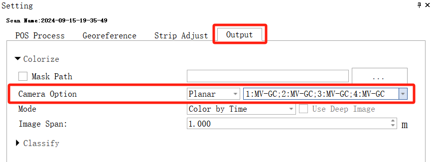
3.How to select the planar camera for coloring?
- Set it in the Output interface, and then run the Colorize steps.
4.How to make a mask file?
- The software has a built-in mask file. If the mask cannot fit the collected panoramic photos, the user can use the Make Mask function button under the Raster module in the mapping project to create a custom mask. The mask style of the panoramic camera is as follows.
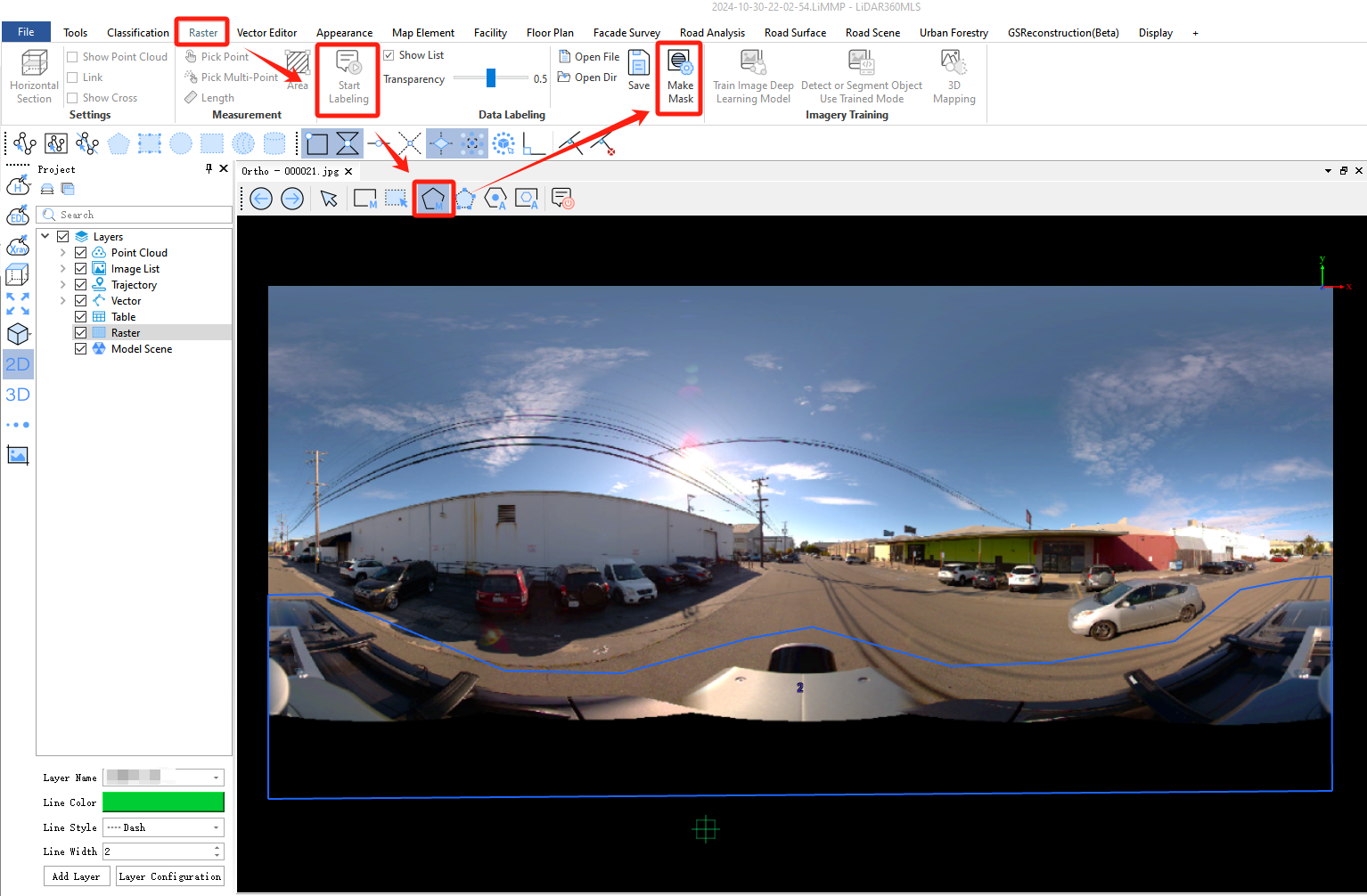

- To achieve better coloring effect and alleviate the jagged coloring of lane lines, please draw the mask as shown in the figure below to cover the lane line position as much as possible.

5.Can the LiMobile M2 planar camera be used for point cloud colorization?
- No, the angle of the planar camera is not suitable for point cloud colorization tasks.
Strip Adjust
1.After adding control points, the position of the point cloud is greatly offset. What is the reason?
- (1) Check whether the coordinate system of the point cloud solution is set correctly and consistent with the control points.
- (2) Check whether the X and Y coordinate columns are selected correctly when importing the GCP file
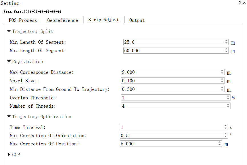
2.If the Strip Adjust effect is not ideal, how to further optimize the data?
This is a normal phenomenon. You can refer to the following steps for optimization:
- (1) Check the trajectory for any jumps. If jumps are present, repair jump first.
- (2) Try to change the Time Interval to 1 and try to run Strip Adjust task again.
- (3) Add control points.
- (4) Use the registration function to edit the Links according to the manual’s specifications. Ensure the Links are correct, and then re-optimize.
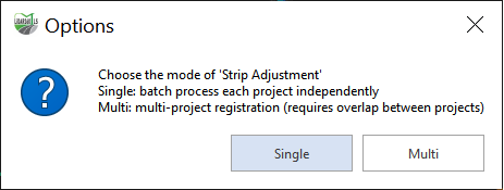
3.When running flight strip stitching, how to select the pop-up window option?
- (1) Single: Each liscan project performs internal strip adjusting operations separately.
- (2) Multi: Not only each liscan project performs internal strip adjusting operations separately, but also strip adjusting operations are performed between liscan projects.
Project Organization
1.Relationship between mscan project and liscan project
- Mscan project can contain multiple liscan projects, each of which corresponds to a set of raw data collected. mscan project can be compared to outer folders, and liscan project to inner folders. This project organization structure can facilitate batch processing.
2.How to convert to mapping project to complete other data post-processing operations?
- The software has a function button for converting mapping project with one click. They are Convert to Mapping Project button and Organize into Mapping Project button. The Convert to Mapping Project function can convert a single activated .liscan project into a mapping project, and the Organize into Mapping Project function can convert multiple liscan projects into mapping projects together.

3.Why can't I remove the project?
- This may be because the liscan project is grouped. You need to cancel the grouping before removing it.
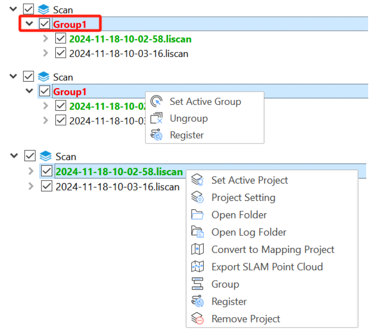
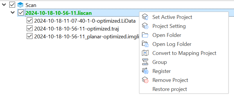
4.How to restore the project after the Strip Adujst are spliced?
- First ungroup the projects, then right-click the project name and click the Restore Project button.
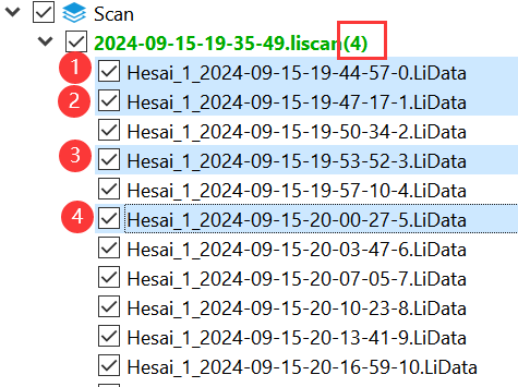
5.What do the brackets after the liscan project name represent?
- It represents the number of selected LiData files, and after the user selects, he can right-click to change the display mode and display settings of the selected point cloud.
