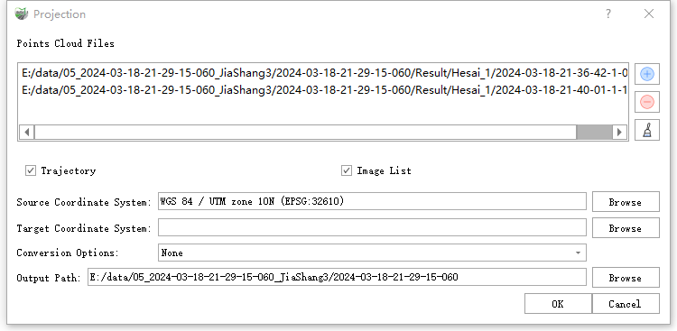
Projection
Function Description: This tool allows the user to project the coordinate system of the point cloud in the software.
Steps
1.Click the Projection![]() button to bring up the Projection pop-up box.
button to bring up the Projection pop-up box.

Description:
- Input Data: The input file can be a single point cloud data file or multiple data files. File Format:*.LiData.
- Trajectory: Whether the trajectory is converted or not.
- Image List: Whether the image is converted or not.
- Source Coordinate System: The software automatically reads the coordinate system of the point cloud and vector files and displays them in the output box. Users can also click the browse button to manually select.
- Target Coordinate System: Click the Browse button on the right to select the projection coordinate system to be exported.
- Conversion Options: Select the method of projection conversion.
- Output Path: Select the output path after the point cloud and vector are converted, and the software automatically defaults to the path where the current point cloud is located.