Update EXIF
Steps
1.Click the Update EXIF ![]() button to open the dialog box,The dialog box will display the coordinate system of the current project or point cloud:
button to open the dialog box,The dialog box will display the coordinate system of the current project or point cloud:

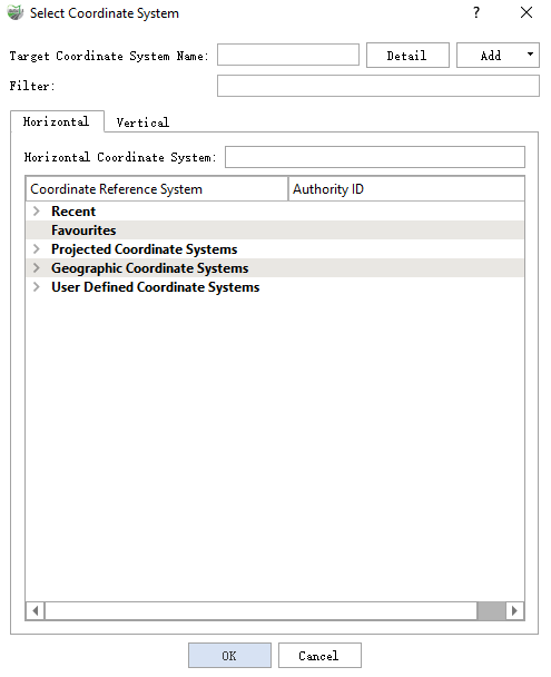
2.Click the button on the right  to open the coordinate system selection box. For detailed usage, see Define Projection:
3.Click OK to modify the current source coordinate system.

4.Click Export to calculate the latitude and longitude of the photos based on the source coordinate system. This will add latitude and longitude information to the images in the image list of the previous project.
Note: In step 4, the latitude and longitude coordinates of the photos are derived from the absolute coordinate projection in the image list file. If the coordinate system of the current project is undefined or defined incorrectly, it may lead to export failure or incorrect export results.