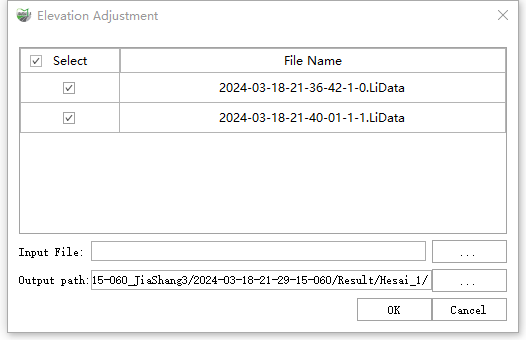
Elevation Adjustment
Feature Description: The elevation value of raw laser data is usually represented by ellipsoid height. Usually, these values need to be converted to local elevation systems or local elevation system values. For larger areas, the adjustment of elevation values cannot be defined as a mathematical formula. Therefore, it is necessary to define the elevation adjustment model by constructing a triangulation model from known control point data and using elevation outliers between height systems for local point interpolation correction. The adjusted data can be checked for elevation adjustment results using the [Adjust Elevation Report](AdjustElevationReport.md) tool. Suggest using control point data that includes the entire project area to adjust the model. Suggest using control point data that includes the entire project area to adjust the model, in order to provide more accurate elevation information for project boundaries.
Step
1.Click Elevation Adjustment ![]() button, Pop up dialog box interface.
button, Pop up dialog box interface.

Parameter Settings:
- Input Data: The input file can be a single point cloud data file or multiple data files.
- Input File: The user needs to input control points to adjust the model file,The Adjust Elevation Report tool can generate data for this file.
- Output Path: Output adjusted point cloud data.