Define Unit
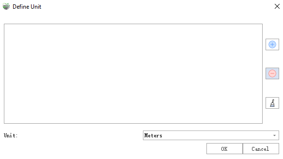
Function Description: Define the coordinate reference system for the point cloud data based on the unit. Supported units include meters, kilometers, miles, feet, US feet, and yards. This function only supports defining the projected coordinate system for point clouds.
Steps
1.Open the toolbox, Click on Data Management > Point Cloud Tools > Projection and Coordinate Transformation > Define Units button to open the Define Units Dialog Box.

2.You can add, delete, or clear point cloud files by clicking the buttons on the right side:![]()
![]()
![]() .
.
3.Select the target unit and click OK. The system will generate a recommended coordinate system based on the selected unit and modify the point cloud's coordinate system to the recommended one.
Description:
- Input point cloud data: Input one or more point cloud data files. File format: *.LiData.
- Unit: The name of the currently set unit.