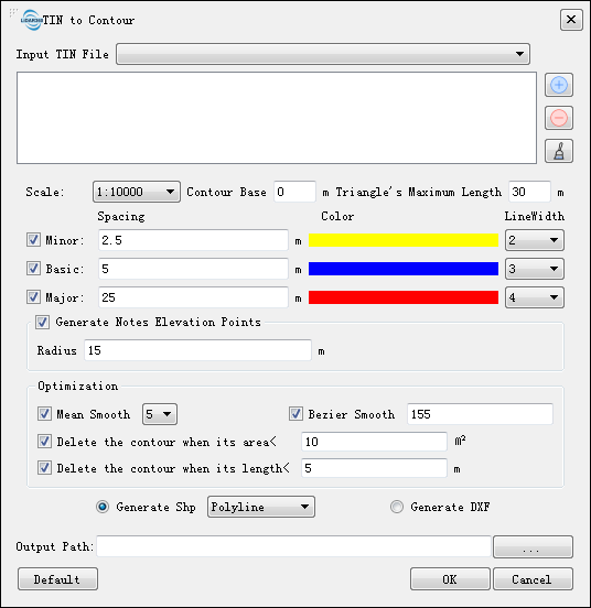
TIN to Contour
Summary
This function directly connects contour point positions of the same elevation on the TIN stored in the LiTin file to generate contour lines.
Usage
Click on the Terrain > TIN to Contour.

Settings
- Input TIN File:Input LiTin file(s). The drop-down box allows to select the LiTin data that has already been opened in the LiDAR360 software. User can also import LiTin data by clicking
. Or delete imported LiTin data by clicking
. Or clear all the imported data by clicking
.
Default Value: Click this button to restore all default parameters.
The other parameters settings of the interface are the same as Point Cloud to Contour.