Theory of Leaf Area Index
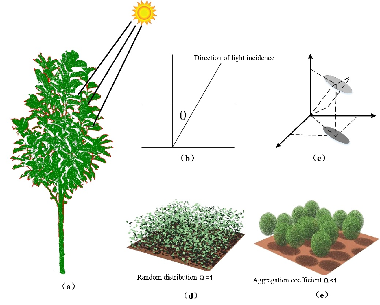
The Leaf Area Index (LAI) is one of the most basic parameters that characterizes the forest canopy structure. It is defined as half of the surface area of all leaves projected on the surface area of a unit (Chen et al., 1991), LAl can be calculated from the normalized LiDAR vegetation points.

Schematic diagram of LAI theory principle (a) Direction of light incidence, (b) the zenith angle refers to the angle between the incident ray and the vertical direction, (c) the projection of the leaf in the vertical direction, (d) describes the extinction coefficient, and (e) describes the aggregation coefficient.
Principle Description
LAI value is calculated using the following equation:
The average scan angle is calculated from LiDAR points using the following equation:
The Gap Fraction (GF) is calculated using the following equation:
    @inproceedings{
        author={Chen J M and Black T A},
        title={Measuring leaf area index of plant canopies with branch architecture},
        booktitle={Agricultural and Forest Meteorology,57(1-3): 1-12},
        year={1991}
    }
    @inproceedings{
        author={Richardson J J},
        title={Modeling approaches to estimate effective leaf area index from aerial discrete-return LiDAR},
        booktitle={Agricultural and Forest Meteorology, 149 (6): 1152-1160},
        year={2009}
    }