Flooding Analysis
Function Overview
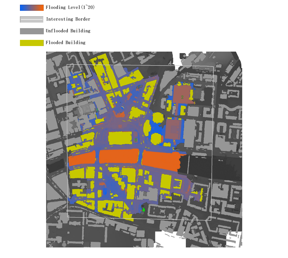
Flooding analysis is a common hydrological GIS application used to simulate and predict areas that may be affected by flooding events.

Usage
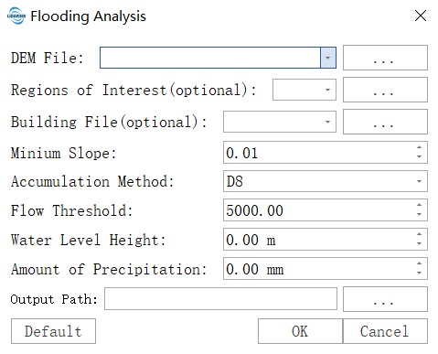
Click on Terrain > Flooding Analysis.

Parameter Settings
- Input DEM File: Input DEM file. For generation methods, refer to DEM Generation.
- Regions of Interest: Input vector file, can be empty. If an area of interest file is provided, the analysis will be confined to that area.
- Building File: Input vector file containing extracted building data, can be empty. If provided, the analysis will include the impact on buildings.
- Minimum Slope: Used for the depression filling process in DEM data.
- Accumulation Method: Used for flow accumulation, currently supports D8, D-Infinity, and MFD methods.
- Flow Threshold: Used for river network extraction. Only areas with values above this threshold will form rivers.
- Water Level Height: Specify the current water level. After extracting the river network and delineating watersheds, areas with raster values lower than the water level within each watershed will be considered flooded.
- Amount of Precipitation: Specify the precipitation amount in millimeters (mm). The precipitation will affect the water level in each watershed, ultimately influencing the flooded areas.
- Output Path: The algorithm will output the flooding analysis results and related reports.