Generate TIN
Summary
Generate irregular triangulation model based on point cloud, LiDAR360 adopts custom triangulation model file format*.LiTin。
Usage
ClickTerrain > Generate TIN。

Parameters Setting
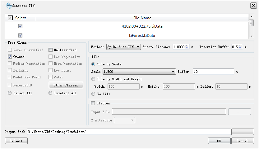
- Input data:The file can be a single point cloud data file or a point cloud data set; the data to be processed must be opened in the LiDAR360 software.
From Classes:Source class(es).
Method:Methods to generate TIN. Now there are two methods, Delaunay and Spike Free TIN.
- Delaunay:Use point-by-point insertion to generate Delaunay TIN.
- Trisngle's Maximum Length (default value is "30 meter"): Delete any triangle whose longest size is longer than this value.
- Spike Free TIN:Remove the points with abnormal elevation, in order to generate TIN without obvious spikes.
- Freeze Distance (default value is "1.0 meter") :The shortest distance in xy plane of each side of triangle in the triangulated network. When inserting a new point and its Z value lower Insertion Buffer, freeze all the triangles whose three sides are all less than Freeze Distance. The frozen triangles will no longer change. The larger this value is, the fewer points will be involved in creating the network, the more smooth the network will be and the less details will be included. Conversely, more points will be involved in creating the network, the more details will be included and the more possible spikes will appear in the network.
- Insertion Buffer (default value is "0.5 meter") :When trying to freeze a new triangle right after freezing another one, the difference in altitude value should be larger than this threshold. Decreasing this value will result in more triangles will be frozen too early, new point cannot be inserted, less spikes will appear, processing will be faster, and more details will be lost. Conversely, more details will be included, abd more spikes will be included in the network.
Tile:The results consist of three types of tiles: "Tile by Scale","Tile by Width and Height" and "No Tile".
- Tile by Scale(default):Generate TIN by a certain scale.
- Scale:Point cloud tile scale.
- 1:500(default):1:500 scale.
- 1:1000:1:1000 scale.
- 1:2000:1:2000 scale.
- 1:5000:1:5000 scale.
- Buffer(m) (default value is "10"):The buffer size of the overlap between two adjacent point cloud tiles.
- Scale:Point cloud tile scale.
- Tile by Width and Height:Tile by a certain width and height.
- Width(m)(default value is "100"):Width of point cloud tile.
- Height(m)(default value is "100"):Height of point cloud tile.
- Buffer(m)(default value is "10"):The buffer size of the overlap between two adjacent point cloud tiles.
- No Tile:The point cloud generates a TIN as a whole and no tile.
- Tile by Scale(default):Generate TIN by a certain scale.
Terrain feature objects (optional): Import terrain features (breaklines, simulated terrain points) component files, breaklines and simulated terrain points will participate in TIN generation.
- Output path:The path where the generated TIN file to be saved.
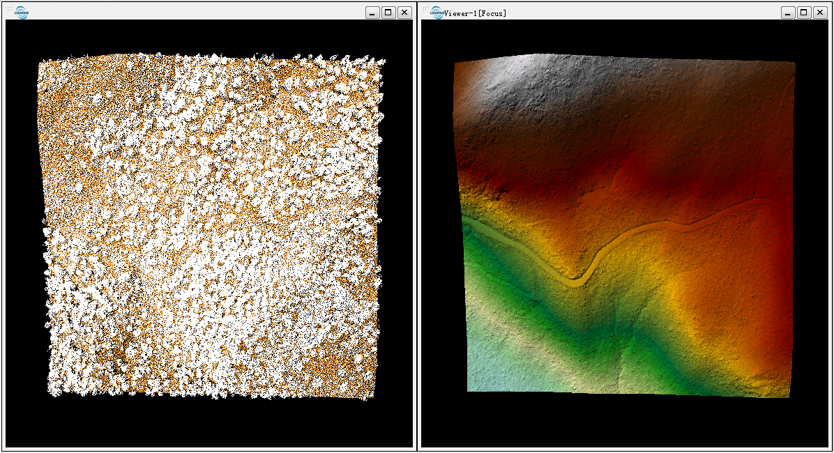
Point cloud data (left below) and TIN (right below).

    @inproceedings{
        author={ Khosravipour A, Skidmore A K, Isenburg M},
        title={Khosravipour A, Skidmore A K, Isenburg M. Generating spike-free digital surface models using LiDAR raw point clouds: A new approach for forestry applications},
        booktitle={ International journal of applied earth observation and geoinformation, 52: 104-114},
        year={2016}
    }