Vegetation Index
Functional Description
Vegetation index can reflect the background influences of plant canopy, such as soil, wet ground, snow, dead leaves, roughness, etc., and is related to vegetation cover.
Principle Description
Normalized difference vegetation index
The normalized difference vegetation index(NDVI) requires near-infrared (NIR) and red (R) attributes in point cloud data. The specific calculation method is as follows:
Visual band difference vegetation index
The visual band difference vegetation index requires that red (R), green (G) and blue (B) attributes exist in the point cloud data and are not all 0. The specific calculation method is as follows:
Usage
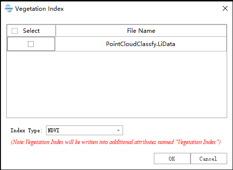
Click Data Management > Point cloud tool > Vegetation index, Set parameters click OK to generate Vegetation Index, vegetation index will be written into the point cloud additional attribute "Vegetation Index".

Parameters Settings
- Input data: The input file can be a single data file or a point cloud data set; the file(s) to be processed must be opened in the LiDAR360 software.
- Index Type:
- NDVI: The vegetation index is calculated from near - infrared (NIR) and red light (R) attributes.
- Visual band difference: The vegetation index is calculated according to the red (R), green (G) and blue (B) attributes.
Note: If the point cloud does not have RGB attribute or both are 0, the two planting indexes cannot be calculated. Normalized vegetation index cannot be calculated if the point cloud does not have Near Infrared attribute.