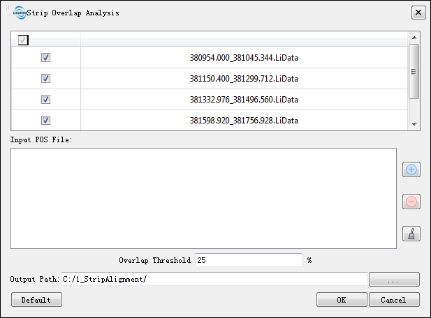
Strip Overlap Analysis
Summary
Strip Overlap Analysis tool analyzes the overlap between point clouds.
Usage
Click Strip Alignment > Strip Overlap Analysis
Settings
- Input Data: The input files should be 2 or more point cloud files. The data to be processed must be pre-opened in LiDAR360.
- Input POS File: Click
 to load the data. The supported formats of POS files include *.OUT and *.pos. Click
  to clear the loaded data. Click
  to clear the loaded POS file(s).
 - Overlap Threshold (%, default value is "25"): Set the threshold to define the overlap region between two adjacent strips.
- Output Path: The results of overlap quality inspection will be exported to the selected folder, which contains the results of each strip overlap quality inspection in SHP format and a comprehensive report in html format.