Raster to Contour
Functional Overview
The contour refers to the curve of the adjacent points with equal elevation on the topographic map. Raster to Contour is to connect the grid points that have the same elevation value, which can build the contour.
Usage
ClickTerrain > Raster to Contour.

Parameters Settings
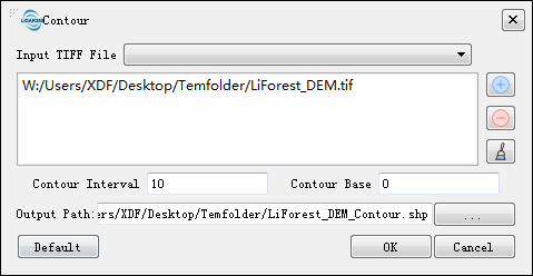
- Input TIff File: Input DEM file in Tiff format. The Drop-down box allows to select the Tiff data that has already been opened in the LiDAR360 software. User can also can click
to import Tiff data.Delete the imported Tiff data by clicking
.Clear all the imported data by clicking
.
- Contour Interval (m, default value is "10"): The elevation difference between adjacent contours.
- Contour Base (default is "0"): The elevation of the generated contour is calculated from the reference elevation, that is, the elevation which differs from the reference by interval multiples of the interval is the contour elevation.For example, the Contour Base is 0, Contour Interval is 10, then the elevation distribution of the contour is: 0, -10, -20, -30... 10, 20, 30... .
- Output path: The path where the generated contour file to be saved.
- Default Value: Click this tool option to restore all default parameters.
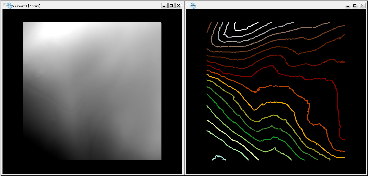
DEM (left below) and contour (right below)

Note: To smooth the contours, you can use the elevation smoothing tool in LiModel Editor.