Classify by Machine Learning
Summary
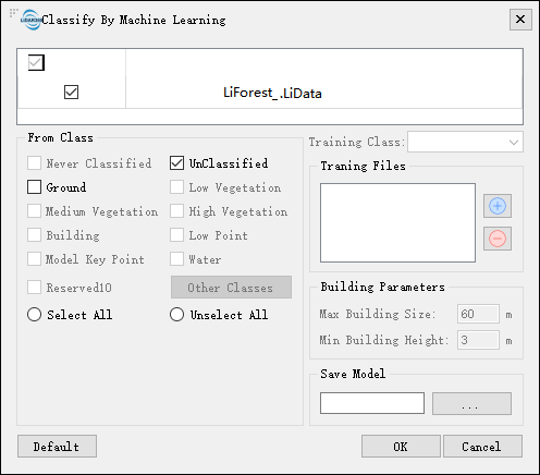
This feature uses random forests (machine learning) method to classify point cloud data. In the same batch of data, it is necessary to manually edit the categories of a small amount of data. After the model is trained, a large amount of data is processed in batches, and it is used to reduce the amount of labor. This feature supports two kinds of processes, one is through selecting training samples, generating training models, and classifying the data, the other is classifying the data directly using the existing models.
Usage
Click Classify > Classify by Machine Learning

Settings
- Input Data: The input file can be a single point cloud data or a point cloud dataset, which must be opened in the LiDAR360 software.
- From Class: Source class(es).
- Training Class: The classes that are of interest to the user are trained, which will also be included in the classification results. At least two types of training categories should be selected, of which one must be unclassified
- Training Files: Click
to load training data. Click
to remove the selected data. You can train multiple files. The categories in the training data are edited manually.
- Building Parameters: The parameters are set only when buildings are included in the training class, which were used to set the maximum building size and minimum building height, respectively.
- Max Building Size (m, default value is"60"): The largest building size in the data to be processed.
- Min Building Height (m, default value is"3"): The smallest building size in the data to be processed.
- Save Model: After training, save the model in the file path with the custom .vcm file format . This model file can be used as input data for Run Machine Learning Classification Model.
- DefaultValue: Click this button to set all parameter as default.
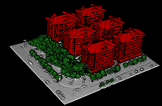
Training a small amount of manually edited data, including unclassified, vegetation, building, and all involved in training, as shown below:

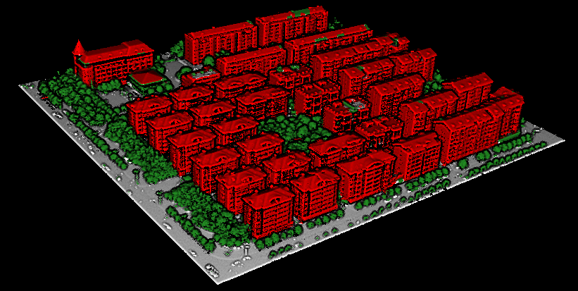
Handle a large number of data results, including unclassified, vegetation, building, as shown below:
