AEP Project
Functional Overview
The right-click menu for airborne LiDAR project data in the layer management tree mainly includes importing and removing airborne LiDAR project data, as well as operations such as displaying information, opening the containing folder, and removing individual airborne LiDAR project data.
Right-Click Menu for Data Types
Import Data: The supported formats of airborne LiDAR project data in LiDAR360 include *.liaep, *.ligeo, *.limap, *.p4d, *.prj. Among them,*.liaep,*.ligeo,* .limap are software-defined formats.
Remove All: Remove all airborne LiDAR project data from the software.
Right-Click Menu for Individual Airborne LiDAR Project Data
Information: View basic information about the airborne LiDAR project including image count, connection point count and coordinate system information.
Open Containing Folder: This function opens the directory where the file is located.
Zoom to Layer: Calculates the bounding box of the current data and scales all open windows displaying that data to fit within this bounding box.
Show Camera: Determines whether to draw the camera's viewing frustum in the 3D window.
Show Thumbnails: Determines whether to display the thumbnail of the image in the 3D window.
View Mode: Sets the display mode for the current data, including elevation-based display, color-coded connection points, or additional attributes.
Camera Projection Distance: Sets the size of the camera's viewing frustum.
Save: Saves the image project after making modifications.
Export Camera: Exports the image project to a third-party file. For specific functionality, see the Export Camera page.
Remove: Removes the selected aerial triangulation project data from the software.
Camera Group Right-Click Menu
- Info: View basic information about the specified camera group in the aerial triangulation project, including the number of images in the group, principal points, focal length, internal orientation elements, etc.
Image Right-Click Menu
- Remove: Removes the selected image from the image project.
Point cloud set information viewing is supported.
Info: View basic information about all points in the point cloud set.
Export: Export the point cloud set to another format.
Image Double-Click View
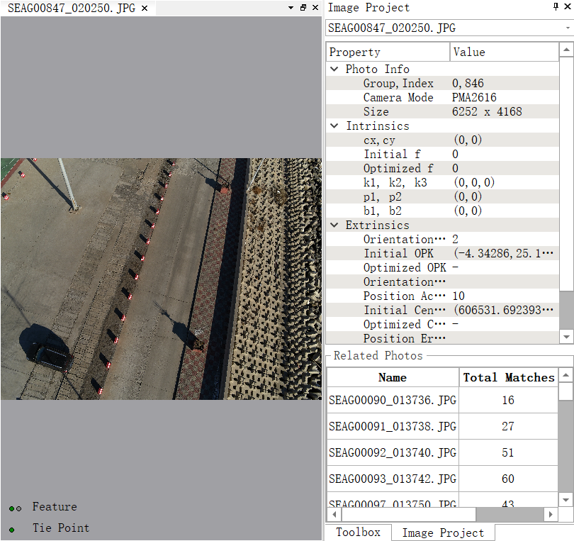
- Double-clicking a single image will open the image information window, displaying all details about that image, as shown below.
