The actually scanned LiDAR point density is much larger than the DEM point density requirement of the production. Can data be subsampled?
- If the actually scanned LiDAR point density is much greater than the production demand, you can use the Subsampling tool to subsample the point clouds. This function provides three types of subsampling methods: "Minimum Points Spacing", "Sampling Rate" and "Octree".
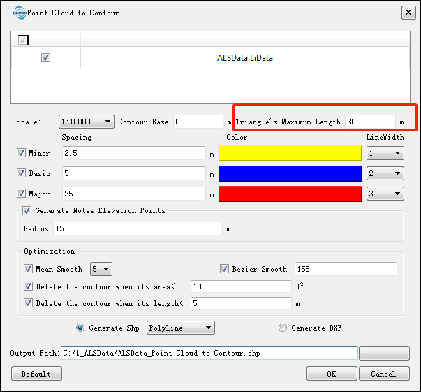
Some of the contour lines generated by the function "Point Cloud to Contour" are broken. Why?
The broken contour lines may be caused by the lack of ground points. The contours can be contiguous by increasing the parameter "Triangle's Maximum Length" on the interface. For example, set 30 meters up to 50 meters or an even larger value.

During DEM processing, the result of this process has .tiff format. Can I convert this into 3D data?
- You can convert your .tiff DEM into our custom 3D model format (LiModel). Go to Data Management > Conversion > Convert TIFF to LiModel(../ToolReference/DataManagement/Conversion/ConvertImagetoLiModel.md).
How to check and improve the quality of DEM generated by LiDAR360?
- You can view the DEM effect through Terrain->Section Editing->DEM Preview. For unqualified DEMs, you can optimize the DEM through terrain patching and inserting breaklines, regenerate the DEM, and check the accuracy of the generated DEM through Terrain->DEM Accuracy Check. Check and output report.
How do you generate a smoother contour for a DEM?
- Perform a smoothing operation using smooth height tool. Save the data. Then Convert the LiModel back to .tiff format, Data Management > Conversion > Convert LiModel to TIFF(../ToolReference/DataManagement/Conversion/ConvertLiModeltoImage.md). From here perform a contour operation Terrain > Raster to Contour(../ToolReference/Terrain/RastertoContour.md).
How to choose the interpolation method for generating DSM?
- It is recommended to choose IDW interpolation for forestry area, and TIN interpolation (Spike Free TIN) for urban area.
    @inproceedings{
        author={Zhao X Q, Guo Q H, Su Y J and Xue B L},
        title={Improved progressive TIN densification filtering algorithm for airborne LiDAR data in forested areas},
        booktitle={ISPRS Journal of Photogrammetry and Remote Sensing,117:79-91},
        year={2016}
    }
Can LiDAR360 achieve specific area classification, such as lake, river area?
- You can go through Classification -> Section Editing -> Start Editing -> Generate TIN -> Add Breaklines -> Leveling Areas (Lakes)/Double Breaklines (Rivers) -> Set Initial Category, Target Category, such as Water Body -> Add, complete lake area classification
Can LiDAR360 achieve uniform assignment of elevations for point clouds within a given vector range?
- You can select the area to be unified elevation through Classification->Section Editing->Start Editing->Generate TIN->Add Breakline->Closed Area Breakline->Polygon, you can specify the elevation, or you can pick the triangle mesh patch with the mouse point uniform elevation
Sparse Ground Points in LiDAR360?
Situation 1: Sufficiently dense ground points have been extracted, but they appear sparse when displayed.
You can use the "Extract Point Cloud by Class" function to export and visualize the ground points separately. This sparse appearance may occur because only ground points are displayed from the original data, which might contain points from other categories. The tree structure of the point cloud can also cause some ground points not to load and display when viewed from a distance.
Situation 2: The extracted ground points are indeed sparse. Here are three methods to address this.
- When using the "Classify Ground Points" function, uncheck the option "Stop building triangles when side length < x".
- For non-urban areas, you can choose the "Deep Learning Ground Point Classification" function.
- If the accuracy requirement is not high, you can select "CSF Ground Filter" to extract ground points.