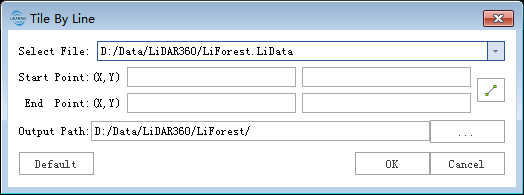
Tile by Draw Line
Summary
Draw a straight line on the Viewer and divide the point cloud data into two pieces by using this line as the boundary.
Usage
ClickData Management > Point Cloud Tools > Tile by Line

Settings
- Input Data:The input file should be a single point cloud data file. File Format: *.LiData.
- Initial Point(X,Y):The XY of initial point.
- Termination Point(X,Y):The XY of termination point.
- Out Path:Path of the output folder,After the function is executed, the divided point cloud file and the shp file of the block boundary are generated. The block boundary stored in the shp file does not include the size of the buffer.