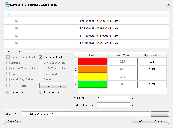
Elevation Difference Inspection
Summary
Elevation Difference Inspection tool analyzes the elevation difference between point clouds.
Usage
Click Strip Alignment > Elevation Difference Inspection

Settings
- Input Data: Input files can be single point cloud file or point cloud dataset. The data to be processed must be opened in the LiDAR360.
- From Class: The point cloud classes used in the elevation difference quality inspection.
- Grid Size (m, default value is "2"): The grid size in the point cloud gridding.
- Cut off Value (m, default value is "0.5"): The data will be ignored if the height difference is greater than this threshold. Considering the moving vehicles in the scanning area which can be scanned at different time, it is necessary to set the cut off value for height difference.
- Output Path: The results of elevation difference quality inspection will be exported to the selected folder, which contains the result of each strip density quality inspection and integral report in HTML format.