Hillshade
Summary
The Hillshade tool obtains the assumed illumination of the surface by determining the illumination for each image element in the grid. The assumed illumination can be obtained by setting the position of the light source and calculating the illumination value of each image element related to the adjacent pixels. In the analysis or graphic display, the Hillshade tool can greatly enhance the surface visualization especially when using transparency.
Usage
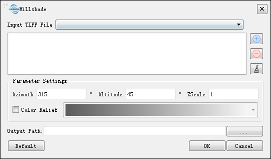
Click on the Terrain > Hillshade.

Settings
- Input Tiff File: Input DEM file format in Tiff. The drop-down box allows to select the Tiff data that has already been opened in the LiDAR360 software. Users can also import Tiff data by clicking
.OR delete imported Tiff data by clicking
.Or clear all the imported data by clicking
.
- Azimuth (°)(default value is "315"): Using North as the benchmark, the degree range is 0~360 clockwise and the default is set to 315 degree(NW).
- Altitude(°)(default value is "45"): The angle between the incident direction of the light source and the ground plane, which ranges from 0 to 90 degrees and uses 45 degree as default.
- ZScale(default value is "1"): The stretch scale of the Z value.
- Color Relief: Color rendering of hillshade.
- Yes: There are 11 types of optional color bar.
- No(default): Black and white color bar.
- Output path: The path where the generated hillshade map file will be saved.
- Default Value: Click this button to restore all default parameters.
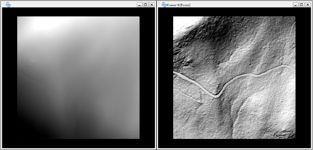
DEM (left below) and Hillshade map (right below).
