Tile by Polygon
Summary
Read the polygon information in the vector data by the polygon block function, extract the points inside the polygon, the points outside the polygon or the points between the polygons to generate a new point cloud file.
For Polygon objects in vector data, a new file is generated for the points within each polygon, and a point cloud file is generated for the points that are not in any polygon.
For MultiPolygon objects in vector data, the point cloud file of the inner polygon will be generated as point cloud data, the set of points between the inner polygon and the outer polygon will be generated as point cloud data, and all points outside the Polygon will be generated as point cloud files.
Usage
ClickData Management > Point Cloud Tools > Tile by Polygon

Settings
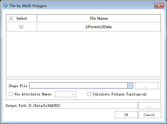
- Input Point Cloud Data:The input file can be a single point cloud data file or multiple data files. File Format:*.LiData.
- Vector File: User can select the Vector File loaded into LiDAR360 software from the drop-down menu, or select
 button to load an external vector data file.
 - Named With The Attribute Name of The shp File:Select the attribute field of Polygon and name the newly generated block data.
- Calculate the topological relationship of polygons: For the Polygon object in the vector data, calculate the topological relationship between polygons. If checked, the topological relationship between polygons will be calculated; if not checked, all points in the Polygon will be generated into a new file.
- Output Path:Path of the output folder, the point cloud file after the function is executed will be output under this file path.