ASCII Data Reprojection
Function Overview
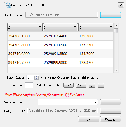
Reproject the X, Y, Z coordinate data in the ASCII file from the current coordinate system to the target coordinate system while keeping other data unchanged.
Usage
Click Data Management > Projections and Transformations > ASCII Data Reprojection
Parameter Settings
- Input File: Input an ASCII data file. File formats: .txt, .csv, .treedb.
- Current Coordinate System: Select the coordinate system information of the current ASCII data.
- Target Coordinate System: Select the target coordinate system information.
- Use Seven Parameters: Select the Use Seven Parameters option and click the Create button to create a seven-parameter transformation relationship. Refer to Create Transformations for more information.
- Output Path: Output the reprojected ASCII file to the specified path.