Classify Close by Points
Summary
This function is used to classify those points close to the certain class(es) of points. For each points in the source class, find the points in its specified 2D or 3D neighborhood area, and determine whether these points meet certain conditions (i.e., belong to a specified class). Those points meet the requirement will be classified as the target class.

Usage
Click Classify > Classify Closeby Points.

Settings
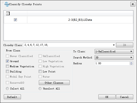
- Input Data: The input data could be one point cloud file or a set of point cloud files. The data to be processed must be opened in LiDAR360 software.
- Closeby Class: The points of this class which is close to the source points will be classified.
- From Class: The points close to this class will be classified.
- To Class: Target class of the classification.
- Search Method: The method for searching in the neighborhood. Support 2D or 3D neighborhood.
- Radius: Neighborhood search radius.