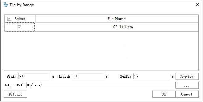
Tile by Range
Overview
Tile by Range divides the point cloud into a series of small data files based on the user-defined width ,length and buffer size of the small data file. This process begins from the lower-left corner of the input file's bounding box,the result includes the point cloud blocks data(including buffer) and the blocks boundary stored in the shp file(not including buffer). The output of this function is similar to Tile by Point Number.
Usage
Click Data Management > Point Cloud Tools > Tile by Range

After completing the parameter settings, click the Preview button to check the subdivision grid for each point cloud. The white solid lines indicate the block boundaries, while the red dashed lines represent the buffer zone.
Settings
- Input Data: The input file can be a single point cloud data file or multiple data files. File Format: *.LiData.
- Width (m)(default value is "500"): The width of the data block size, which is the length in the X-axis direction.
- Height (m)(default value is "500"): The length of the data block size, which is the length in the Y-axis direction.
- Buffer (m)(default value is "0"): The extend size of every block in all directions.
- Merge:Whether to merge multiple point clouds within a block into a single point cloud file.
- Preview:Preview the range of the tiles.
- Output path: Path of the output folder. After the function being executed, new files will be generated which include the point cloud blocks data(including buffer) and the blocks boundary stored in the shp file(not including buffer).