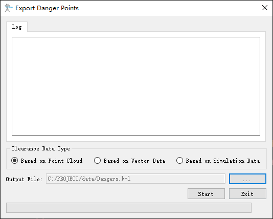
Export Danger Points
Summary
Export the clearance danger points into kml file, which can be viewed in Google Earth.
Usage
Click Toolbox > Result Finishing > Export Danger Points

Settings
- Clearance Data Type: Select the data type to be processed. The data type includes point cloud based data, vector based data, and data based on working conditions simulation. The software can record the user's current settings and automatically restore the settings when opened again.
- Based on Point Cloud: Extract the power line data from the original point cloud data.
- Based on Vector Data: Extract the power line data from the vector file, and other classes objects from original point cloud data.
- Based on Simulation Data: Extract the power line data from the simulation file, and other classes objects from original point cloud data.
- Output File: The output path of the kml file.