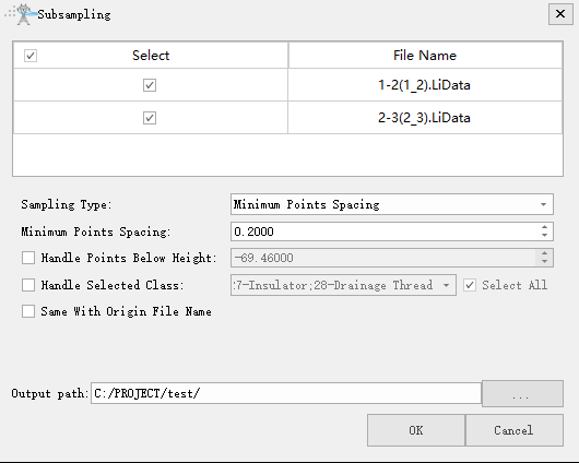
Subsampling
Brief
Subsampling point clouds, namely, reducing the number of point clouds, LiPowerline offers three methods for resampling: minimum point spacing, sampling rate, and octree.
Usage
Click Data Management > Point Cloud Tools > Subsampling

Settings
- Input Data: The input file can be a single point cloud data file or multiple data files. File Format: *.LiData.
- Sampling Type: This parameter defines the resampling method.
- Minimum Points Spacing (default, default value is "0.2000"): Users need to set a minimum point spacing between two points so that the minimum three-dimensional distance between any two points in the sampled point cloud will not be less than this value. The larger the value is set, the fewer points will be kept.
- Handle Points Below Height: If this item is checked, only points below that elevation are processed.
- Handle Selected Class: If this item is checked, only the points of the target category are processed.
Same With Origin File Name: Whether to use the same file name of origin file name.
Output path: Path of the output file. New file will be generated after the algorithm being executed.