Pick Point
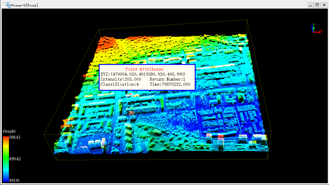
Brief: This tool is applicable to point cloud data, raster data and model data. For point cloud data, the attributes that can be queried contain position, intensity, return number, classification and GPS time. For raster data, the attributes that can be queried contain position, stretched RGB value and pixel value.
Usage
Click Point Cloud > Measurement > Point
Steps
Click a valid point in the scene and a label that displays the point attributes will pop up. If the point belongs to point cloud data, then the label will show the position, intensity, return number, classification and GPS time, as is shown below. If the point belongs to raster data, then the label will show the position, stretched RGB value and pixel value.

Click the right mouse button, two context menus will pop up. The menu "Clear Measure" is used to clear the selection result. The menu "Quit Measure" is used to exit the pick point function.
Note: This tool only works with point cloud data, raster data and model data. It's available in the profile window too.