Add Data
Brief: One of the most useful features of LiPowerline is its ability to interface with data in many file formats. You can import point clouds (LAS/LAZ, TXT, PLY, ASC, NEU, XYZ, PTS, CSV etc.), tables, images (JPG, TIF), models (OSG, LiModel, LiTin) or vectors into LiPowerline. It allows you to visualize, animate and edit your point cloud as well. Point cloud data will be converted into LiData file at the first time being added. LiData file is the LiPowerline native file format for point cloud and optimized for viewing.
Import LAS/LAZ File
The LAS file is intended to contain LiDAR point data records. The data will generally be put into this format from software (e.g. provided by LiDAR hardware vendors) which combines GPS, IMU, and laser pulse range data to produce X, Y, and Z point data. The intention of the data format is to provide an open format that allows different LiDAR hardware and software tools to output data in a common format.
Click File > Data > Add Data to view the Open Data window.
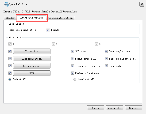
Choose the LAS file you want to import and click Open for the Open LAS File window where you can do some initial settings as shown in the figures below:
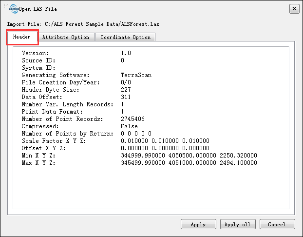
Click tab Header to check general LAS file header information such as Version, Source ID, System ID, Generating Software, File Creation Day/Year, Header Byte Size, Data Offset, Number of Point Records etc.
Click tab Attribute Option to set Crop Option and decide which point attributes you want to import for each point record. LiPowerline imports all the point attributes by default.
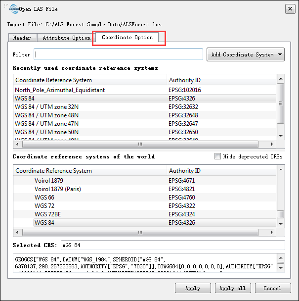
Click tab Coordinate Option to set the coordinate system for your point records.
You can search the coordinate system much more quickly by using regular expressions. For example, the WGS 84 coordinate system will be displayed instantly when you input EPSG code of WGS 84 system as shown in the figure below:
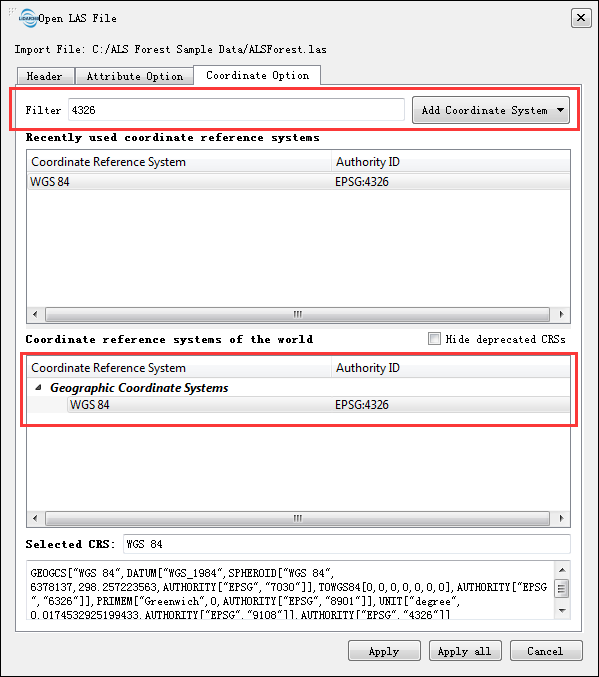
You can also import coordinate system form WKT or PRJ by clicking drop-down menu Add Coordinate System. Recently used coordinate reference systems holds a history list.
Click Apply or Apply All when you finish your configuration. Apply implies that you want this configuration for current point cloud data only. Apply All means all the point cloud data share the same configuration during the LiPowerline's running and it won't show this configuration window again even you add new data.
Import TXT File
A point cloud is a set of vertices in a three-dimensional coordinate system usually defined by X, Y, and Z coordinates and other attributes such as color and normal. These attributes can be simply arranged in one line for each point record and one single TXT file for one-point set.
Click File > Data > Add Data to view the Open Data window.
Choose the TXT file you want to import and click Open for the Open Ascii File window where you can do some initial settings as shown in the figure below:
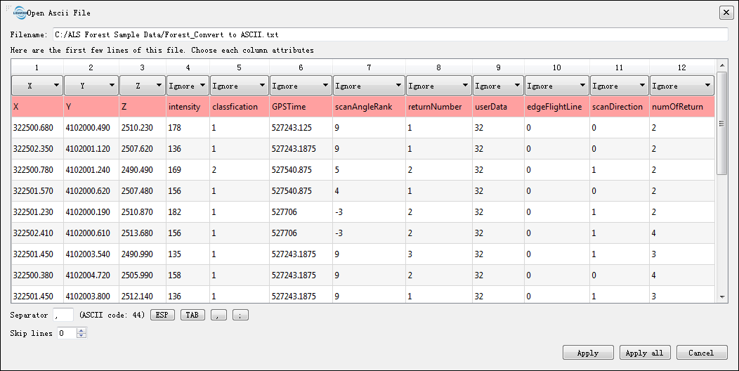
LiPowerline can automatically detect the delimiters but you can also specify delimiter manually.
There are indeed cells that are colored red in the import window if TXT file has a header. Just skip them by setting Skip line value to 1.
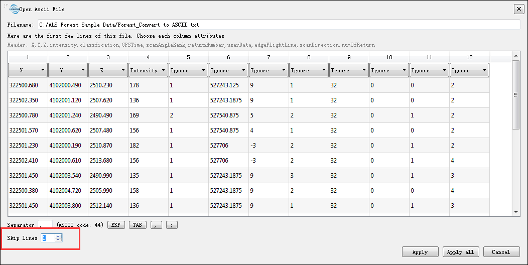
Use the drop-downs to give the proper form of your point records.
Import CSV File
The so-called CSV (Comma Separated Values) format is the most common import and export format for spreadsheets and databases. CSV format was used for many years prior to attempts to describe the format in a standardized way in RFC 4180. The lack of a well-defined standard means that subtle differences often exist in the data produced and consumed by different applications. These differences can make it troublesome to process CSV files from multiple sources. Still, while the delimiters and quoting characters vary, the overall format is similar enough that it is possible to write a single module which can efficiently manipulate such data.
Click File > Data > Add Data to view the Open Data window.
Choose the CSV file you want to import and click Open for the Open ASCII File window where you can do some initial settings as shown in the figures below:
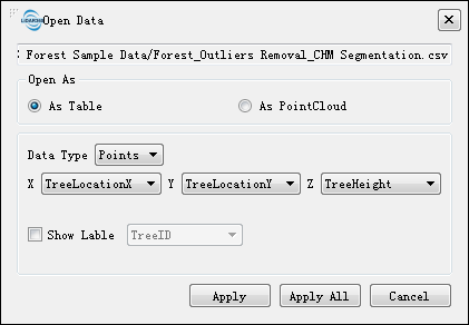
CSV file can be opened as table or point cloud.
Open as Table is recommended if the CSV file is the resultant product of the Segmentation function. The CSV table contains the ID of each tree, the x, y coordinate locations, the tree height, the crown diameter, and the crown area properties. The data type could be Point or Circle. If Point type was selected, you should specify the X,Y,Z columns additionally.
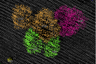
If Circle type was selected, you should specify the center and radius.
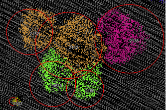
Click Show Label radio button to show/hide label for each point or circle.
The Import TXT File section has more detailed descriptions if you Open as Point Cloud.
Import PLY File
The polygon (PLY) file format, also known as the Stanford triangle format stores three-dimensional data from 3-D scanners. It is a format for storing graphical objects that are described as a collection of polygons. A PLY file consists of a header, followed by a list of vertices and then, a list of polygons. The header specifies how many vertices and polygons are in the file. It also states what properties are associated with each vertex, such as (x, y, z) coordinates, normals, and color. The file format has two sub-formats: an ASCII representation and a binary version for compact storage and for rapid saving and loading. The header of both ASCII and binary files is ASCII text.
Click File > Data > Add Data to view the Open Data window.
Choose the PLY file you want to import and click Open for the Open PLY File window where you can do some initial settings as shown in the figure below:
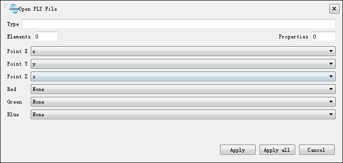
Specify properties that associated with each vertex's coordinates(x,y,z).
Specify properties that associated with each vertex's color (r,g,b) if they have any. Otherwise, simply choose None.
Click Apply when you complete your configuration.
Import Raster File
A raster data structure is based on a (usually rectangular, square-based) tessellation of the 2D plane into cells. In its simplest form, a raster consists of a matrix of cells (pixels) organized into rows and columns (grid) where each cell contains a value representing information. The geographic location of each cell is implied by its position in the cell matrix. Accordingly, other than an origin point, e.g. bottom left corner, no geographic coordinates are stored. Due to the nature of the data storage technique data analysis is usually easy to program and quick to perform.
Click File > Data > Add Data to view the Open Data window.
Choose the Raster file and click Open.
Import Vector File
Vector data can be represented at its original resolution and form without generalization. Graphic output is usually more aesthetically pleasing (traditional cartographic representation). Since most data is in vector form and no data conversion is required. Accurate geographic location of data is maintained.
Click File > Data > Add Data to view the Open Data window.
Choose the Vector file and click Open.
Import Model File
LiModel file is the native file format where LiPowerline stores triangulated regular network models generated by DEM or DSM. LiTin file is generated by the irregular 2.5D triangulation model based on the point cloud.
Click File > Data > Add Data to view the Open Data window.
Choose the Model file and click Open.
Note: You can drag file(s) into LiPowerline directly. If you can't, click here for more help.