Subscribe

Solar Energy - Intelligent Inspection Project Using LiDAR and Point Cloud Data

-- 26 Aug 2021 --

1.     Background


Known as solar power plants, solar farms, solar parks, and photovoltaic power stations or plants, photovoltaic systems (PV systems) have become larger and more significant, increasing in construction and scale during the past decade. Although, Photovoltaic power operations and maintenance challenges have become more prominent and frequent. Traditional manual inspection can encounter many problems, such as inefficiencies, non-standard data collection, and a poor operating environment.


Faced with these difficulties, using an intelligent inspection system, UAV-based LiDAR has become one of the most effective solutions.
 11.png


2.     Project Outline


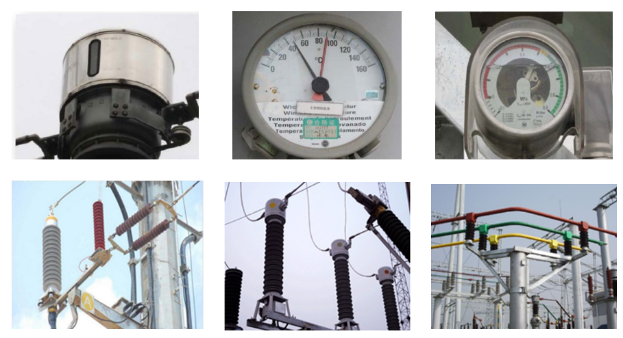
The project mainly focused on inspecting 110kV boost stations and solar stations (field area) using LiDAR technology. By adopting lidar technology, point cloud data collects and creates 3D spatial structures of a solar power facility and is conducted through high-precision route planning. Through UAVs are equipped with different sensors, details from each solar panel and other power generation equipment can be taken from all directions after one flyover. The data obtained is analyzed by an AI image processing system (AI Image Intelligent Analysis System), and a report is generated.


3.     LiDAR Scanning and Modeling


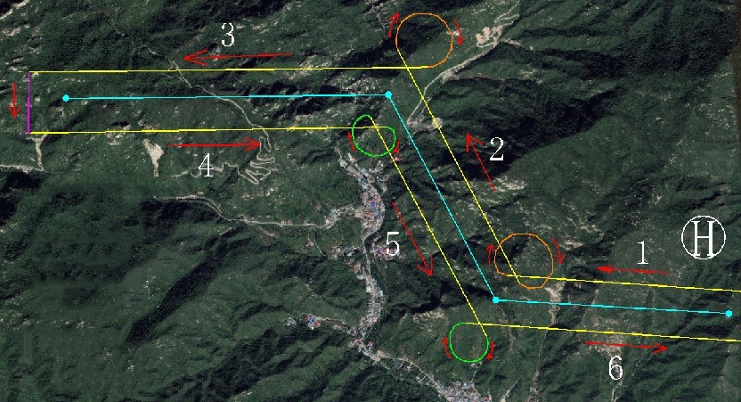
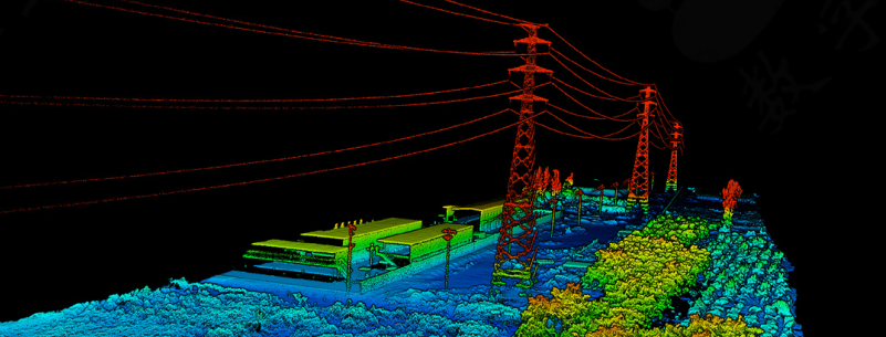
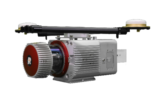
Preliminary route planning for the survey area, the UAV-Based LiDAR System LiHawk collects point clouds of the photovoltaic power station (solar farm), transmission lines, transformers, and other equipment. LiAcquire solution software uses raw data to calculate high-precision trajectories, providing the user with route planning information (point cloud data).


The collected data points will be used as the basis for future planning and inspection routes.


  Parameters
 12.png


UAV   Platform

Diagonal   Distance

160cm

Weight   (Include battery)

16.5kg

Payload

8kg

Hovering   Time

120minNo   payload

40minPayload

Hovering   Accuracy

P-GPS

Vertical+/-0.1   mVisual   orientation);+/-0.5 m

Horizontal+/-0.3   mVisual   orientation);+/-1.5m

Max   Wind Resistance

10m/s

LiDAR

Laser   Product Classification

Class 1Eye   safety

Measuring   Range

0.3-1350m

Field   of View

330°

Measurement   Rate

750,000 pts / sec

AccuracyElevation

10cm200AGL

Echoes

Unlimited   times

Attitude   Accuracy

0.005°

Weight

4.35kgInclude   camera


Route Planning


 13.jpg

Data Acquisition


 14.png15.png

4.     Inspection Equipment


UAV

16.png

17.png  

Model

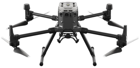
DJI Matrice 300

DJI Mavic 2

Size

810*670*430mm

322*242*84mm

Weight

6.3kg (Inc. Battery)

0.9kg (Inc. Battery)

Max Payload

2.7kg

0.2kg

Duration

55min

31min

Wind Resistance

15m/s

10m/s

Transmitting Distance

8km

6km


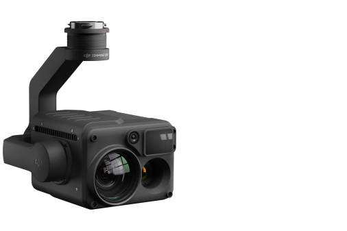
H20T-Quad-Sensor   Solution

18.png

Supported Aircraft

Matrice 300 RTK

Zoom Camera

Sensor

1/1.7" CMOS, 20 MP

Photo Size

5184*3888

Wide Camera

Sensor

1/2.3" CMOS, 12 MP

Photo Size

4056 x 3040

Thermal Camera

Sensor

Uncooled Vox Microbolometer

Digital Zoom

1x, 2x, 4x, 8x

Image Resolution

640×512

Scene Range

-40 °C to 150 °C

Laser Rangefinder

Measurement range

3-1200 m


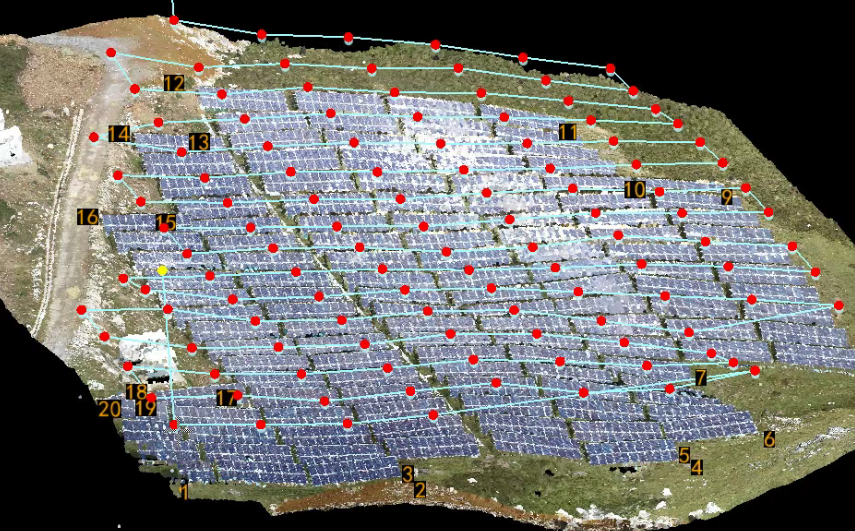
5.     Inspection Route Planning - Examples


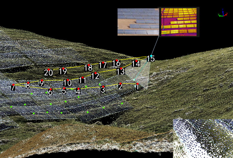
l  Inspection Route of the Solar Power Station (PV System)
19.png


l  Inspection Route of Solar Panels

20.png


l  Inspection Route of Booster Stations

21.png


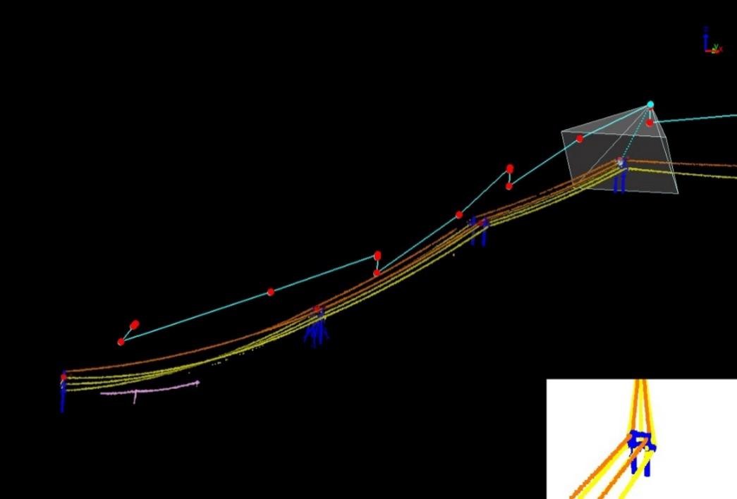
l  Inspection Route of Power Lines


22.jpg


6.     Sample Inspection Results


33.png

24.png


7.     Computer Vision - Intelligent Analysis System


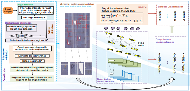
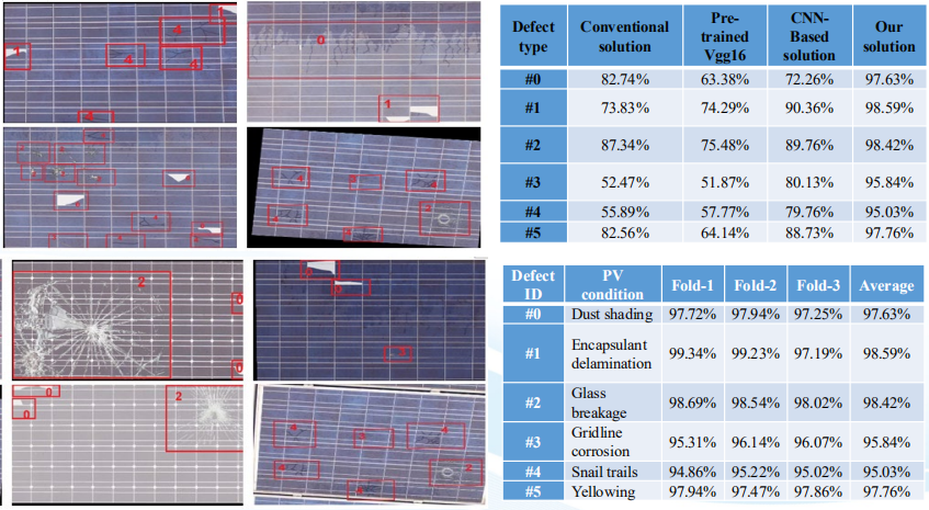
Based on multi-source (visible/infrared) data, the system combines expert knowledge with artificial intelligence to accurately analyze the visual and infrared data. The system determines the type of flaws found and their impact on power generation efficiency. It provides a supporting reference point for the operation and maintenance at the power station.   


1Multi-Defect Detection of PV System Modules Based On Visible Light


Using a visual recognition algorithm, the visible light images are analyzed and identified. Defects are found in time, the problem locations are logged, and a diagnosis report is automatically generated. The report is sent to the operation and maintenance personnel within the photovoltaic power station.
25.png

26.png


2Defect Detection Based on Infrared


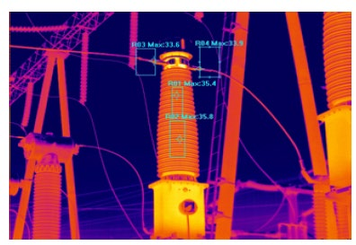
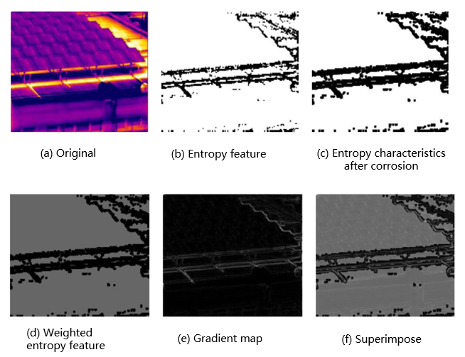
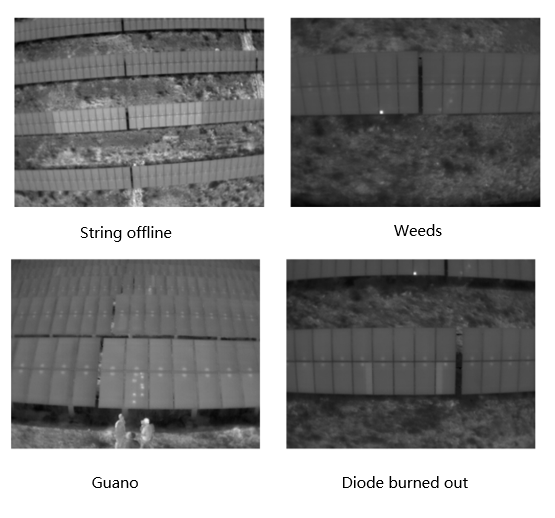
Using infrared cameras, the deep learning model identifies hot spots and foreign object occlusion in diodes, generating a comprehensive analysis report.
27.png

28.png


1.     Background


Known as solar power plants, solar farms, solar parks, and photovoltaic power stations or plants, photovoltaic systems (PV systems) have become larger and more significant, increasing in construction and scale during the past decade. Although, Photovoltaic power operations and maintenance challenges have become more prominent and frequent. Traditional manual inspection can encounter many problems, such as inefficiencies, non-standard data collection, and a poor operating environment.


Faced with these difficulties, using an intelligent inspection system, UAV-based LiDAR has become one of the most effective solutions.

 11.png


2.     Project Outline


The project mainly focused on inspecting 110kV boost stations and solar stations (field area) using LiDAR technology. By adopting lidar technology, point cloud data collects and creates 3D spatial structures of a solar power facility and is conducted through high-precision route planning. Through UAVs are equipped with different sensors, details from each solar panel and other power generation equipment can be taken from all directions after one flyover. The data obtained is analyzed by an AI image processing system (AI Image Intelligent Analysis System), and a report is generated.


3.     LiDAR Scanning and Modeling


Preliminary route planning for the survey area, the UAV-Based LiDAR System LiHawk collects point clouds of the photovoltaic power station (solar farm), transmission lines, transformers, and other equipment. LiAcquire solution software uses raw data to calculate high-precision trajectories, providing the user with route planning information (point cloud data).


The collected data points will be used as the basis for future planning and inspection routes.


  Parameters

 12.png


UAV   Platform

Diagonal   Distance

160cm

Weight   (Include battery)

16.5kg

Payload

8kg

Hovering   Time

120minNo   payload

40minPayload

Hovering   Accuracy

P-GPS

Vertical+/-0.1   mVisual   orientation);+/-0.5 m

Horizontal+/-0.3   mVisual   orientation);+/-1.5m

Max   Wind Resistance

10m/s

LiDAR

Laser   Product Classification

Class 1Eye   safety

Measuring   Range

0.3-1350m

Field   of View

330°

Measurement   Rate

750,000 pts / sec

AccuracyElevation

10cm200AGL

Echoes

Unlimited   times

Attitude   Accuracy

0.005°

Weight

4.35kgInclude   camera


Route Planning


 13.jpg

Data Acquisition


 14.png15.png

4.     Inspection Equipment


UAV

16.png

17.png  

Model

DJI Matrice 300

DJI Mavic 2

Size

810*670*430mm

322*242*84mm

Weight

6.3kg (Inc. Battery)

0.9kg (Inc. Battery)

Max Payload

2.7kg

0.2kg

Duration

55min

31min

Wind Resistance

15m/s

10m/s

Transmitting Distance

8km

6km


H20T-Quad-Sensor   Solution

18.png

Supported Aircraft

Matrice 300 RTK

Zoom Camera

Sensor

1/1.7" CMOS, 20 MP

Photo Size

5184*3888

Wide Camera

Sensor

1/2.3" CMOS, 12 MP

Photo Size

4056 x 3040

Thermal Camera

Sensor

Uncooled Vox Microbolometer

Digital Zoom

1x, 2x, 4x, 8x

Image Resolution

640×512

Scene Range

-40 °C to 150 °C

Laser Rangefinder

Measurement range

3-1200 m


5.     Inspection Route Planning - Examples


l  Inspection Route of the Solar Power Station (PV System)

19.png


l  Inspection Route of Solar Panels

20.png


l  Inspection Route of Booster Stations

21.png


l  Inspection Route of Power Lines


22.jpg


6.     Sample Inspection Results


33.png

24.png


7.     Computer Vision - Intelligent Analysis System


Based on multi-source (visible/infrared) data, the system combines expert knowledge with artificial intelligence to accurately analyze the visual and infrared data. The system determines the type of flaws found and their impact on power generation efficiency. It provides a supporting reference point for the operation and maintenance at the power station.   


1Multi-Defect Detection of PV System Modules Based On Visible Light


Using a visual recognition algorithm, the visible light images are analyzed and identified. Defects are found in time, the problem locations are logged, and a diagnosis report is automatically generated. The report is sent to the operation and maintenance personnel within the photovoltaic power station.

25.png

26.png


2Defect Detection Based on Infrared


Using infrared cameras, the deep learning model identifies hot spots and foreign object occlusion in diodes, generating a comprehensive analysis report.

27.png

28.png


Recommended Articles

HOW CAN WE HELP YOU?
Message us your questions and contact information.
We’ll get back to you right away!