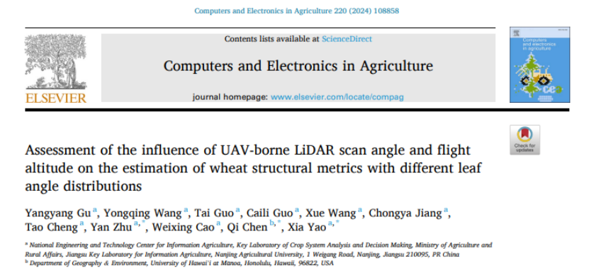
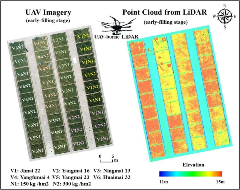
Recently, the Nanjing Agricultural University's Smart Agriculture Team published an article in the Chinese Academy of Sciences' top journal, "Computers and Electronics in Agriculture." The paper primarily discusses how flight altitude and scanning angles influence the estimation accuracy of effective plant area index (ePAI) and vertical ePAI distribution in wheat crops.

The study revealed that smaller scanning angles improve the estimation accuracy of ePAI and better capture the vertical ePAI distribution. Additionally, higher flight altitudes within a certain range (0-50 meters) can reduce estimation errors and decrease both flight and data processing time, ultimately lowering overall costs.
Furthermore, considering the differences in leaf angle distributions among various wheat varieties can significantly enhance the estimation accuracy of ePAI. This finding is essential for precise crop growth evaluation and high-throughput crop screening, serving as a significant tool in modern smart agriculture and crop breeding research.

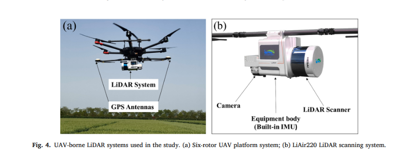
Drone Airborne Lidar from GreenValley International


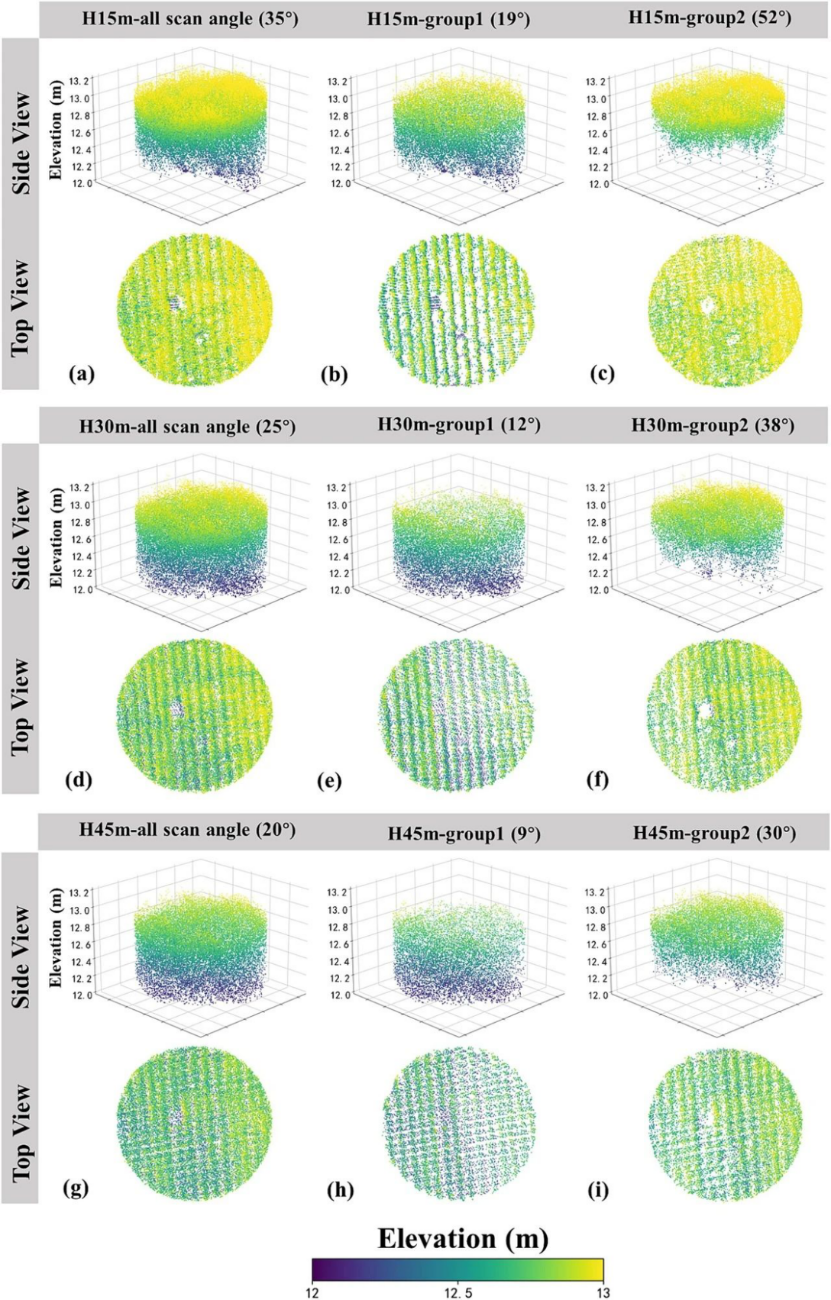
Spatial distribution of point clouds obtained by UAV-borne lidar at different flight heights and scanning angles in the same field of view
GVI's integrated turnkey solutions are helping scientific research teams to better produce scientific research results. Many scientific research results have been published in scientific journals.
Currently, the surveying and mapping geographic information industry faces global challenges in the era of intelligence and spatio-temporal big data. A new paradigm characterized by data-intensive computing and artificial intelligence as the primary technical means provides transformative theories, methods, and technologies for the industry to address these challenges.
Through significant changes in big data thinking, analyzing and mining spatiotemporal big data, and the widespread application of artificial intelligence, innovative models, knowledge, and laws can be developed. As a result, intelligence will become the core driving force for the development of the surveying and mapping geographic information industry.
In the future, GreenValley International will continue to explore the fusion and innovation of "AI + Geographic Information," contributing to sustainable development for humanity and the environment.
Read the full article
Recently, the Nanjing Agricultural University's Smart Agriculture Team published an article in the Chinese Academy of Sciences' top journal, "Computers and Electronics in Agriculture." The paper primarily discusses how flight altitude and scanning angles influence the estimation accuracy of effective plant area index (ePAI) and vertical ePAI distribution in wheat crops.

The study revealed that smaller scanning angles improve the estimation accuracy of ePAI and better capture the vertical ePAI distribution. Additionally, higher flight altitudes within a certain range (0-50 meters) can reduce estimation errors and decrease both flight and data processing time, ultimately lowering overall costs.
Furthermore, considering the differences in leaf angle distributions among various wheat varieties can significantly enhance the estimation accuracy of ePAI. This finding is essential for precise crop growth evaluation and high-throughput crop screening, serving as a significant tool in modern smart agriculture and crop breeding research.

Drone Airborne Lidar from GreenValley International


Spatial distribution of point clouds obtained by UAV-borne lidar at different flight heights and scanning angles in the same field of view
GVI's integrated turnkey solutions are helping scientific research teams to better produce scientific research results. Many scientific research results have been published in scientific journals.
Currently, the surveying and mapping geographic information industry faces global challenges in the era of intelligence and spatio-temporal big data. A new paradigm characterized by data-intensive computing and artificial intelligence as the primary technical means provides transformative theories, methods, and technologies for the industry to address these challenges.
Through significant changes in big data thinking, analyzing and mining spatiotemporal big data, and the widespread application of artificial intelligence, innovative models, knowledge, and laws can be developed. As a result, intelligence will become the core driving force for the development of the surveying and mapping geographic information industry.
In the future, GreenValley International will continue to explore the fusion and innovation of "AI + Geographic Information," contributing to sustainable development for humanity and the environment.
Read the full article


