Subscribe

LiDAR Helps with HD Map Production

-- 18 Jan 2024 --

Background

With the continuous development of urban planning, intelligent transportation, and autonomous driving, the demand for high-precision maps is increasing. Traditional map-making methods are no longer able to meet the accuracy and efficiency requirements of modern society. Therefore, more advanced technologies are needed to improve the accuracy and efficiency of map production. LiDAR360 MLS provides an innovative solution to address this problem.


HD Map Production

image.png


1. Data Acquisition


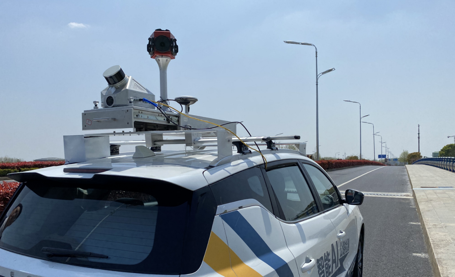
For this data acquisition, the LiMobile vehicle-mounted mobile surveying system is used. This product uses a 45-degree tilted laser placement, which can collect good ground data and information about objects on either side of the road. It is also equipped with a high-resolution video camera to obtain detailed information about objects. The system is integrated into a vehicle-mounting bracket that can be adapted to various SUV models, making it user-friendly. With upgradeable features, it allows for multiple interfaces, including panoramic cameras, wheel encoders, horizontal lasers, and other sensors, which can be selected based on specific needs.
图片1.png

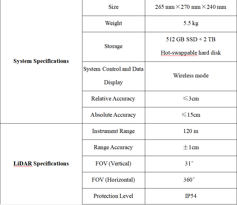
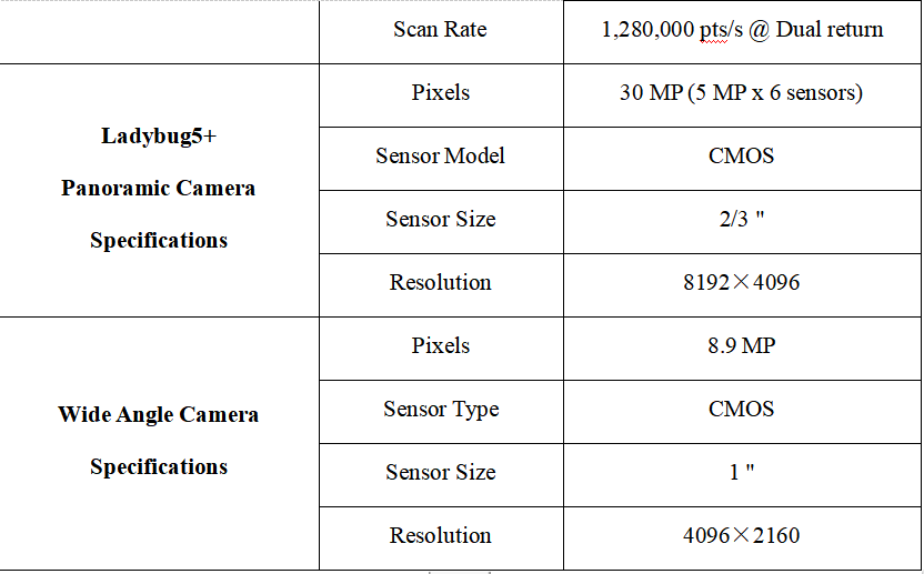
LiMobile M1 System Specifications


1705593722246.jpg1705593722253.jpg


2. Data Processing

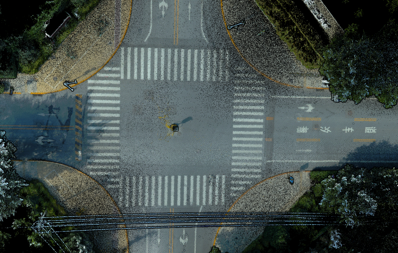
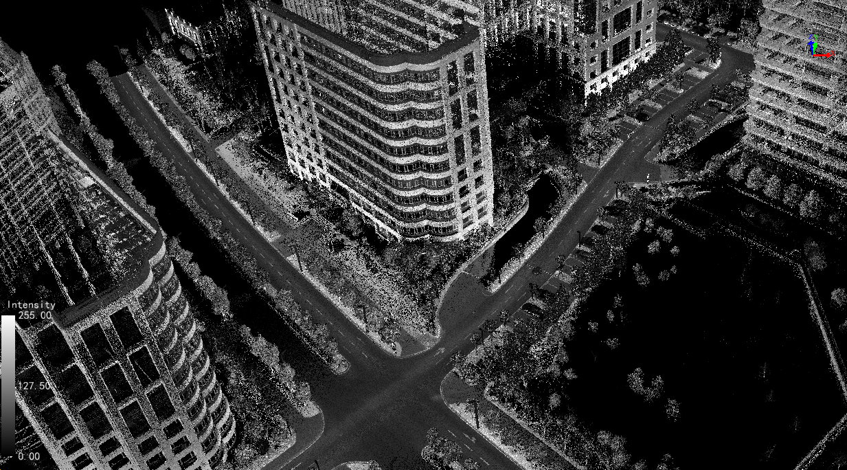
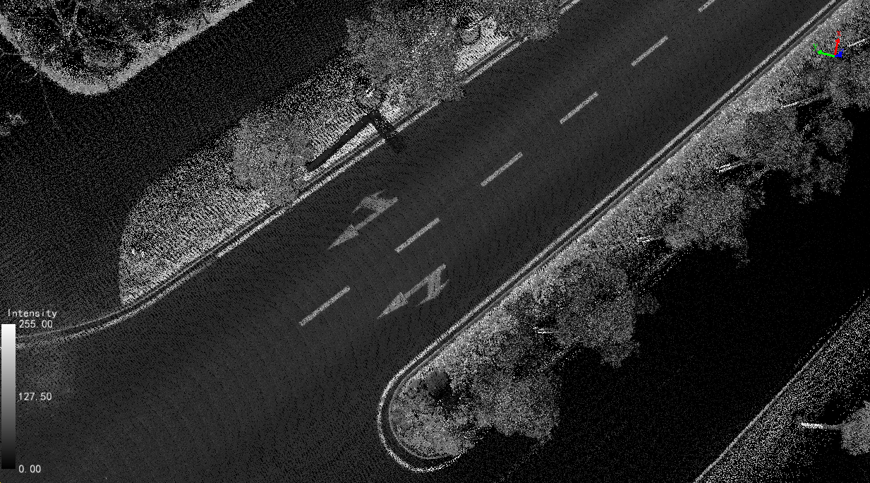
After completing the data acquisition, the LiGeoreference software can calculate the collected data with a single click, quickly obtaining high-precision point cloud data.
图片2.png

图片3.png
图片4.png
图片5.pngRoad point cloud data


3. HD Map Production

The HD map drawing uses the LiDAR360 MLS software developed by GVI for intelligent extraction and analysis of 3D features. It can flexibly integrate the point cloud and image data collected by various types of mobile measurement devices, such as vehicle-mounted, backpack, or handheld devices available on the market. The software is based on efficient indexing structures for massive point cloud data and artificial intelligence algorithms. It performs point cloud data editing, extraction, analysis, and three-dimensional vectorization of road features, providing features such as "full functionality, fast operation, intelligent efficiency, and user-friendly interaction." It has formed a complete production chain for vehicle-mounted point cloud data processing, high-precision mapping, road component survey, and maintenance. The output data from the software can be seamlessly integrated with various GIS, CAD, and simulation platforms, widely applied in high-precision map production, facade measurement, road survey, and maintenance fields. LiDAR360MLS utilizes intelligence to assist in information extraction and digitally depicts the vast world. The specific drawing process is as follows:

(1)Load the data and select an appropriate display mode.

The software supports loading point clouds, trajectories, and image data, and allows overlaying and browsing multiple data sources for measurement. Depending on the analysis requirements, you can select the best display mode to better reflect the data characteristics and check the data quality more intuitively.

图片6.png


(2)Layer settings and attribute configuration

The software supports customizing project-specific layers and attribute fields, meeting the diverse requirements of different industry standards and various types of applications. It also allows configuring layer styles and predefining field content information for convenient attribute editing and data entry.

图片7.png


(3)Road shape drawing

This step is primarily used to generate vectorized results related to road shape features. The vectorization result generation supports both semi-automatic and manual methods.

① Automatic detection of road edges

By clicking the left mouse button to select two points, the starting point and direction point are obtained. Along the selected direction, automatic detection of road edges can be performed starting from the initial point.

图片8.png


② Semi-automatic lane detection

This includes solid or dashed lane lines. By clicking the left mouse button to select two points, the starting point and direction point are obtained. Along the selected direction, automatic lane detection can be performed starting from the initial point.

图片9.png


③ Quick generation of lane centerline

Based on the lane lines on the left and right sides of the same lane, a one-click operation can generate the lane centerline. You can choose between solid or dashed lane markings.

图片10.png


(4)Road surface drawing

This step is primarily used for the vectorization production of various ground markings, including road arrows, pedestrian crossings, speed reduction signs, no-parking lines, and other types of ground signage.

①Fully automatic extraction of road surface markings

Automated extraction of ground markings using deep learning techniques, processing large volumes of point cloud data.

图片11.png


②Template matching

The software comes with built-in arrow templates according to Chinese national standards, as well as pedestrian crossing warnings, speed reduction signs, no U-turn signs, and other ground markings in accordance with Chinese national standards. By using three key points to select point cloud data, automatic template matching can be performed, directly obtaining vectorized results that fit the point clouds.

图片12.png


③Pedestrian crossings

Using three key points, pedestrian crossings can be vectorized and created.

图片13.png


④Arrows

Clicking on the start and end points of the arrow determines the position and direction of the road surface markings.

图片14.png


⑤Pedestrian crossing warning

Selecting two key points allows for the vectorization and creation of pedestrian crossing warnings.

图片15.png


⑥Other road surface drawings

LiDAR360 MLS supports the drawing of directional arrows, lateral markings, and pavement graphic symbols for road surfaces.

图片16.png


(5)Road facility drawing

①One-click detection of road facilities

Using panoramic images as assistance, the software can automatically recognize traffic signs, manhole covers, surveillance cameras, bus stops, traffic lights, garbage bins, streetlights, and underwater grates for road facilities.

图片17.png


②Streetlight detection

Streetlights can be automatically detected by using single points, two points, polygons, or grabbing methods. This allows for the automatic extraction and drawing of pole-like objects such as lamp posts.

图片18.png


③Adding traffic signs

Select the desired shape to draw, and the drawing preview will be displayed in real-time at the mouse cursor. Use the right mouse button to bring up a dialog box to adjust the size and double-click to confirm the current traffic sign.

图片19.png


4. Exporting the results

图片20.png

图片21.png

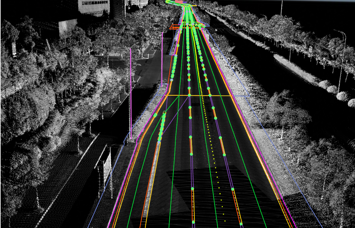
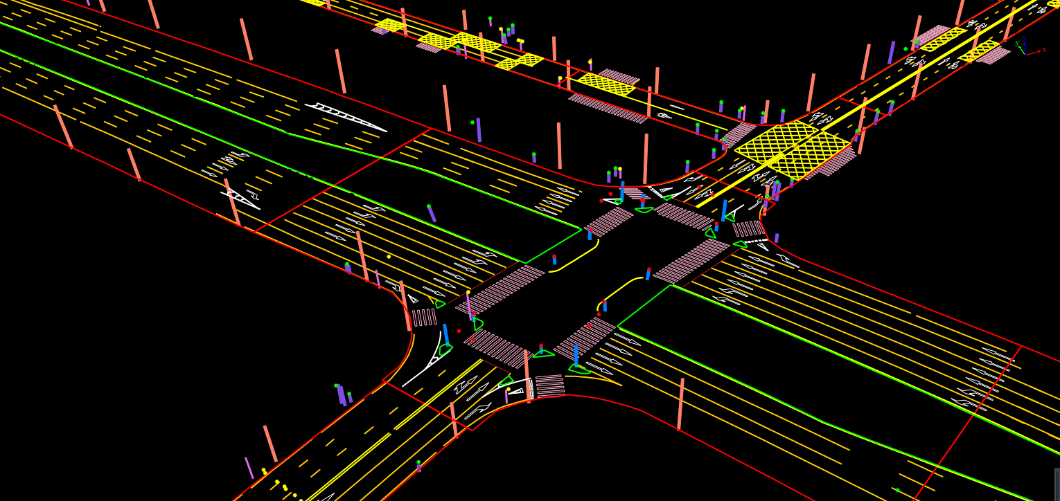
HD map based on LiDAR360MLS 

Conclusion

LiDAR360 MLS has significant advantages in HD map production. Through the LiMobile vehicle-mounted mobile mapping system, it is possible to efficiently obtain HD map data, providing new possibilities for map creation and updates. This system can be applied not only in urban planning and land surveying but also provides crucial support for the development of emerging technologies such as intelligent transportation and autonomous driving. With its high precision and efficiency, LiDAR360 MLS opens up new opportunities for the application of geographic information and spatial data fields.


Background

With the continuous development of urban planning, intelligent transportation, and autonomous driving, the demand for high-precision maps is increasing. Traditional map-making methods are no longer able to meet the accuracy and efficiency requirements of modern society. Therefore, more advanced technologies are needed to improve the accuracy and efficiency of map production. LiDAR360 MLS provides an innovative solution to address this problem.


HD Map Production

image.png


1. Data Acquisition


For this data acquisition, the LiMobile vehicle-mounted mobile surveying system is used. This product uses a 45-degree tilted laser placement, which can collect good ground data and information about objects on either side of the road. It is also equipped with a high-resolution video camera to obtain detailed information about objects. The system is integrated into a vehicle-mounting bracket that can be adapted to various SUV models, making it user-friendly. With upgradeable features, it allows for multiple interfaces, including panoramic cameras, wheel encoders, horizontal lasers, and other sensors, which can be selected based on specific needs.

图片1.png

LiMobile M1 System Specifications


1705593722246.jpg1705593722253.jpg


2. Data Processing

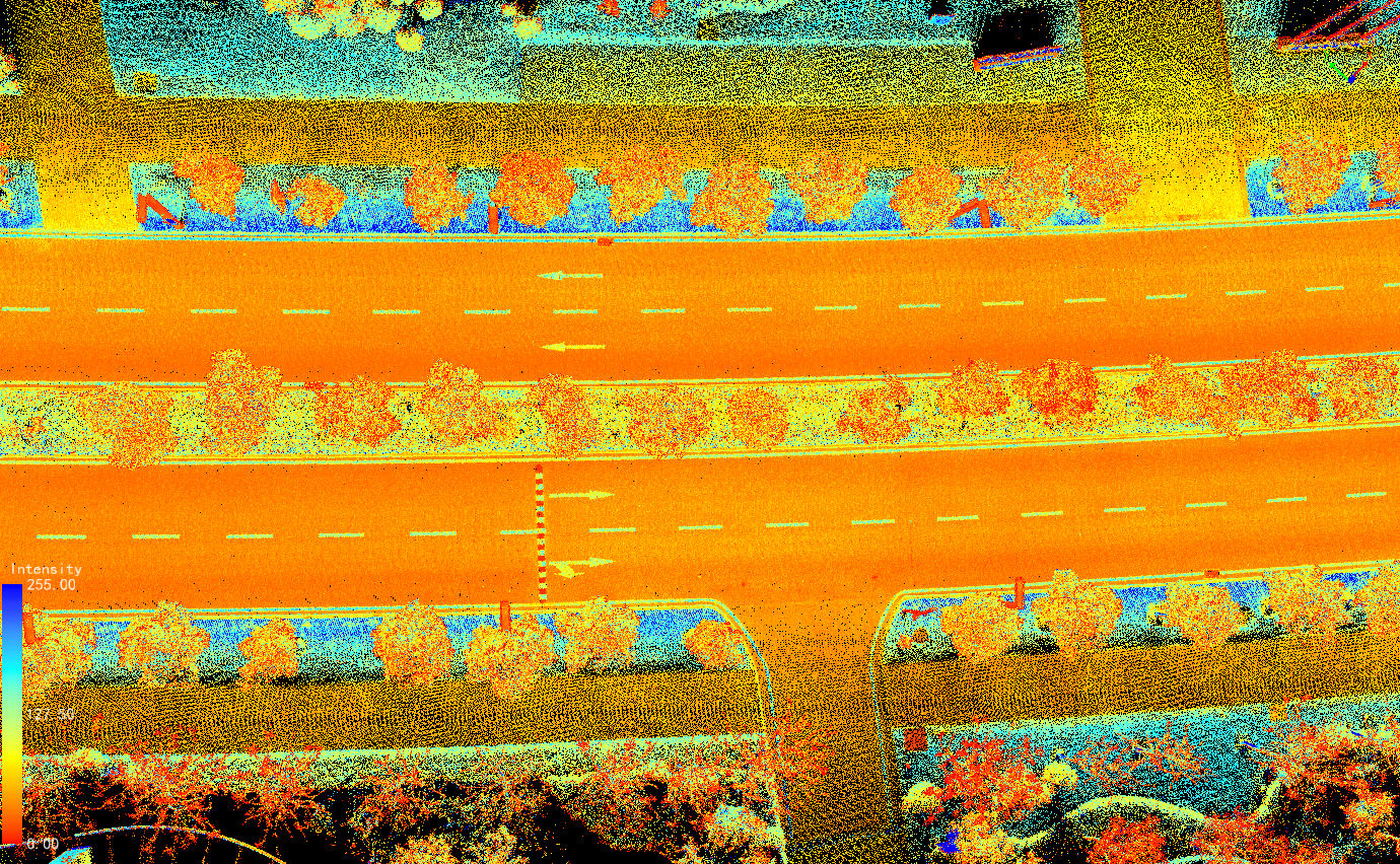
After completing the data acquisition, the LiGeoreference software can calculate the collected data with a single click, quickly obtaining high-precision point cloud data.
图片2.png

图片3.png
图片4.png
图片5.pngRoad point cloud data


3. HD Map Production

The HD map drawing uses the LiDAR360 MLS software developed by GVI for intelligent extraction and analysis of 3D features. It can flexibly integrate the point cloud and image data collected by various types of mobile measurement devices, such as vehicle-mounted, backpack, or handheld devices available on the market. The software is based on efficient indexing structures for massive point cloud data and artificial intelligence algorithms. It performs point cloud data editing, extraction, analysis, and three-dimensional vectorization of road features, providing features such as "full functionality, fast operation, intelligent efficiency, and user-friendly interaction." It has formed a complete production chain for vehicle-mounted point cloud data processing, high-precision mapping, road component survey, and maintenance. The output data from the software can be seamlessly integrated with various GIS, CAD, and simulation platforms, widely applied in high-precision map production, facade measurement, road survey, and maintenance fields. LiDAR360MLS utilizes intelligence to assist in information extraction and digitally depicts the vast world. The specific drawing process is as follows:

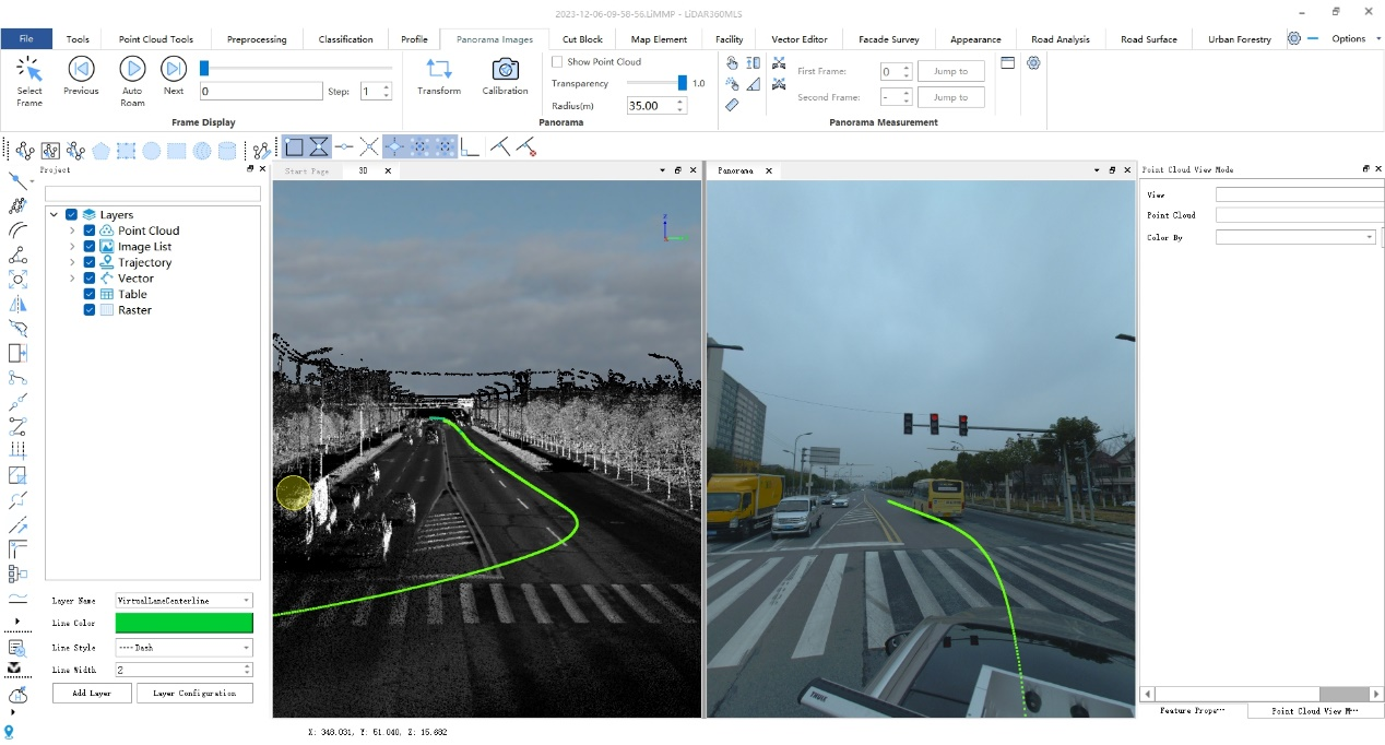
(1)Load the data and select an appropriate display mode.

The software supports loading point clouds, trajectories, and image data, and allows overlaying and browsing multiple data sources for measurement. Depending on the analysis requirements, you can select the best display mode to better reflect the data characteristics and check the data quality more intuitively.
图片6.png


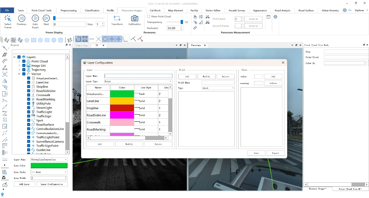
(2)Layer settings and attribute configuration

The software supports customizing project-specific layers and attribute fields, meeting the diverse requirements of different industry standards and various types of applications. It also allows configuring layer styles and predefining field content information for convenient attribute editing and data entry.
图片7.png


(3)Road shape drawing

This step is primarily used to generate vectorized results related to road shape features. The vectorization result generation supports both semi-automatic and manual methods.

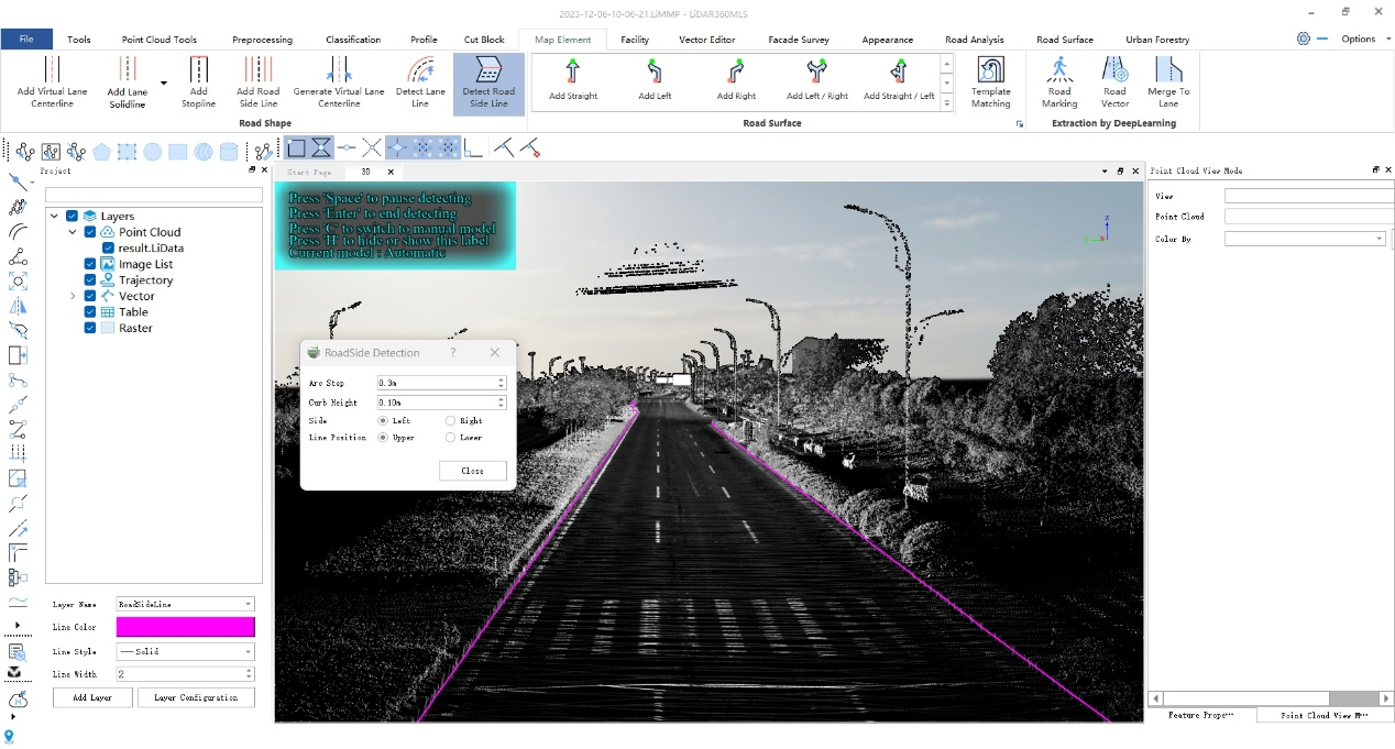
① Automatic detection of road edges

By clicking the left mouse button to select two points, the starting point and direction point are obtained. Along the selected direction, automatic detection of road edges can be performed starting from the initial point.
图片8.png


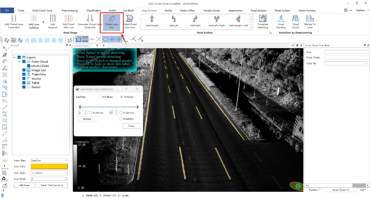
② Semi-automatic lane detection

This includes solid or dashed lane lines. By clicking the left mouse button to select two points, the starting point and direction point are obtained. Along the selected direction, automatic lane detection can be performed starting from the initial point.
图片9.png


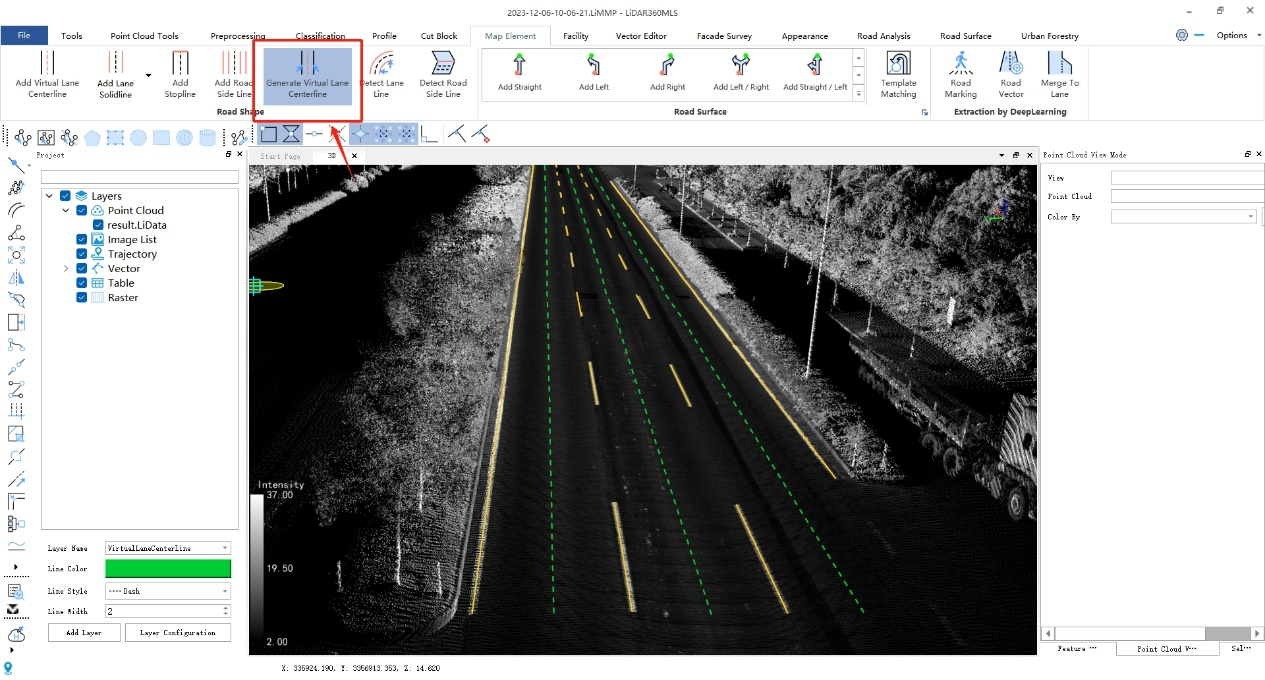
③ Quick generation of lane centerline

Based on the lane lines on the left and right sides of the same lane, a one-click operation can generate the lane centerline. You can choose between solid or dashed lane markings.
图片10.png


(4)Road surface drawing

This step is primarily used for the vectorization production of various ground markings, including road arrows, pedestrian crossings, speed reduction signs, no-parking lines, and other types of ground signage.

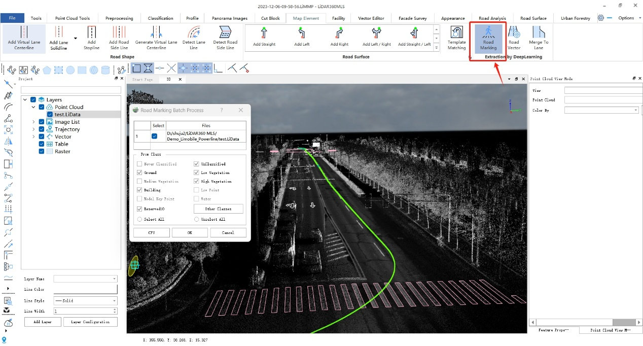
①Fully automatic extraction of road surface markings

Automated extraction of ground markings using deep learning techniques, processing large volumes of point cloud data.
图片11.png


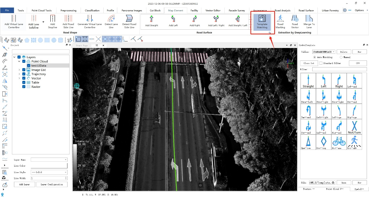
②Template matching

The software comes with built-in arrow templates according to Chinese national standards, as well as pedestrian crossing warnings, speed reduction signs, no U-turn signs, and other ground markings in accordance with Chinese national standards. By using three key points to select point cloud data, automatic template matching can be performed, directly obtaining vectorized results that fit the point clouds.
图片12.png


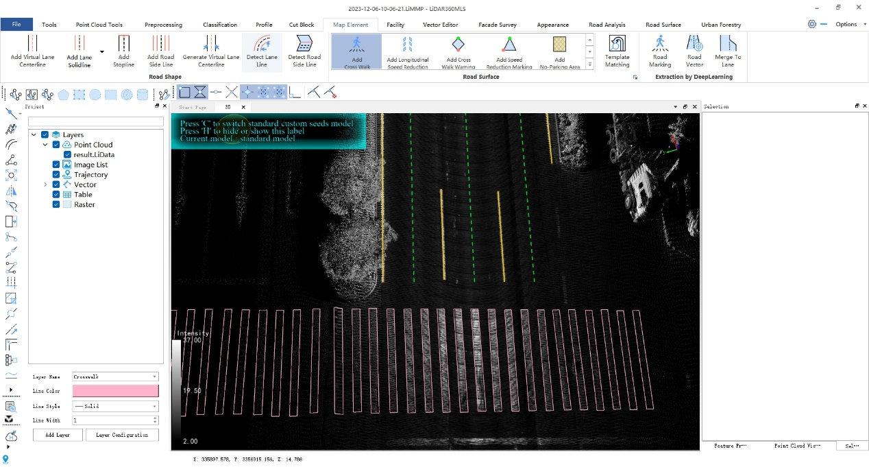
③Pedestrian crossings

Using three key points, pedestrian crossings can be vectorized and created.
图片13.png


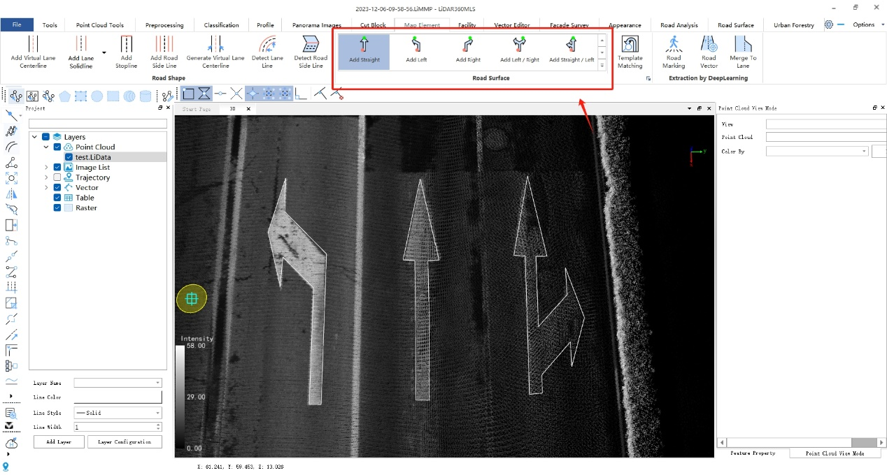
④Arrows

Clicking on the start and end points of the arrow determines the position and direction of the road surface markings.
图片14.png


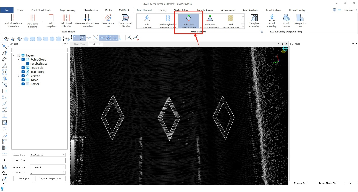
⑤Pedestrian crossing warning

Selecting two key points allows for the vectorization and creation of pedestrian crossing warnings.
图片15.png


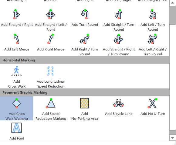
⑥Other road surface drawings

LiDAR360 MLS supports the drawing of directional arrows, lateral markings, and pavement graphic symbols for road surfaces.
图片16.png


(5)Road facility drawing

①One-click detection of road facilities

Using panoramic images as assistance, the software can automatically recognize traffic signs, manhole covers, surveillance cameras, bus stops, traffic lights, garbage bins, streetlights, and underwater grates for road facilities.
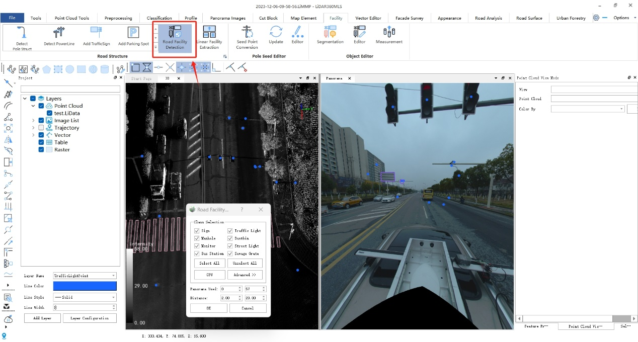
图片17.png


②Streetlight detection

Streetlights can be automatically detected by using single points, two points, polygons, or grabbing methods. This allows for the automatic extraction and drawing of pole-like objects such as lamp posts.
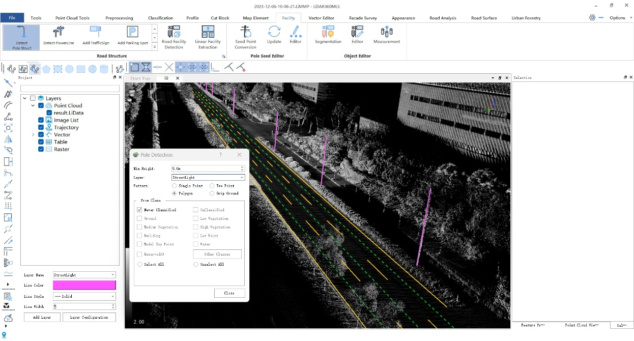
图片18.png


③Adding traffic signs

Select the desired shape to draw, and the drawing preview will be displayed in real-time at the mouse cursor. Use the right mouse button to bring up a dialog box to adjust the size and double-click to confirm the current traffic sign.
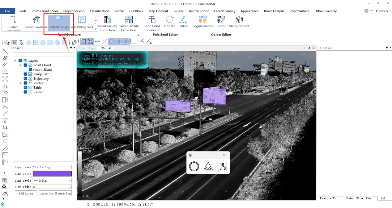
图片19.png


4. Exporting the results

图片20.png

图片21.png

HD map based on LiDAR360MLS 

Conclusion

LiDAR360 MLS has significant advantages in HD map production. Through the LiMobile vehicle-mounted mobile mapping system, it is possible to efficiently obtain HD map data, providing new possibilities for map creation and updates. This system can be applied not only in urban planning and land surveying but also provides crucial support for the development of emerging technologies such as intelligent transportation and autonomous driving. With its high precision and efficiency, LiDAR360 MLS opens up new opportunities for the application of geographic information and spatial data fields.


Recommended Articles

HOW CAN WE HELP YOU?
Message us your questions and contact information.
We’ll get back to you right away!