Subscribe

Introducing Floor Plan Mapping Solution: Extract 10,000 sqm Vector Lines in Just 40 Seconds!

-- 23 May 2024 --

Traditional Floor Plan Mapping

  • Relies on Manual Labor

  • Low Efficiency

  • Challenges in meeting large-scale, high-accuracy measurement demands


With the rapid development of cities and the increasing demands for housing quality, building quality inspection technology has garnered significant attention.

However, during the inspection process, it is common to encounter the issue of missing architectural drawings, especially for older buildings or those whose functions have changed. As a result, it becomes necessary to remap the buildings.

Currently, the surveying of architectural floor plans still requires a substantial amount of manual labor. Typically, steel tape measures and laser rangefinders are used on-site to measure the distances along the axes to determine the planar positions of walls and openings for doors and windows. However, these traditional methods are labor-intensive and rely heavily on the surveyor's engineering experience, which presents certain limitations.


LiDAR technology offers several advantages in building floor plan surveying, including high precision, high speed, non-contact measurement, comprehensive coverage, diverse data acquisition, and automated processing. It can quickly obtain point cloud data of the building's surface without the need for direct contact with the structure. Moreover, it can cover complex indoor and outdoor spaces, providing accurate and comprehensive data support for surveying. With the aid of automated processing techniques, LiDAR data can be swiftly transformed into architectural floor plans, significantly enhancing the efficiency and accuracy of the surveying process.


LiDAR360MLS and LiGrip: A Seamless Solution for Floor Plan Mapping


LiDAR360MLS V7.2 has just launched an automatic vectorization feature for floor plans, paired with the LiGrip series of hardware, offering a turnkey solution for architectural mapping.


image.png
LiGrip O1 Lite

image.png

LiGrip H300


20 Minutes to Classify 94.21 Million Points

LiDAR360MLS provides indoor (like shopping malls, offices) and garage point cloud classification models that can separate common categories such as ground points, moving objects, walls, pillars, and vehicles. It's adaptable to point cloud data from various platforms, with a classification accuracy reaching up to 80%.
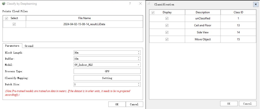
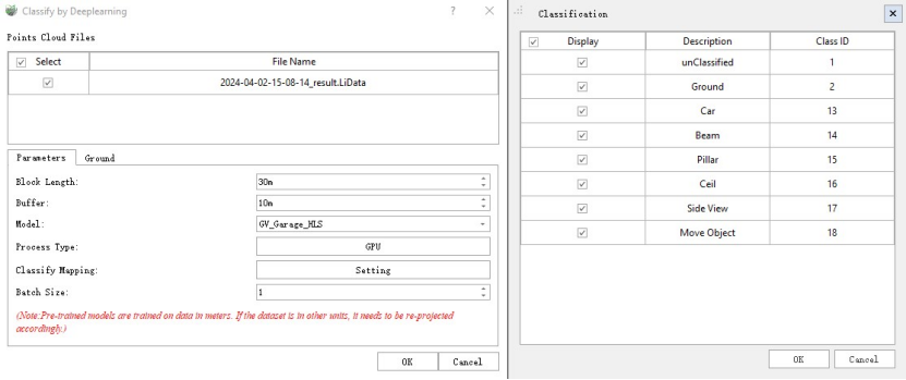
image.png

image.png


This sample data covers an area of approximately 10,000 square meters with 94.21 million points, using the "underground garage" scenario, processed with GPU mode on an NVIDIA GeForce RTX 3050 computer with 8GB of video memory, and can be classified in just 25 minutes!


40 Seconds to Extract Vector Lines for Floor Plans


With a one-click operation based on classified point cloud data, the software extracts the most complete part of the wall point cloud after slicing, completing the automatic extraction of vector lines for a 10,000 square meter area in just 40 seconds, with an extraction completeness of about 80%.


LiDAR360MLS comes with a variety of vector editing tools, such as break, merge, intersect, close, and move, as well as precise editing of vector nodes, to assist in the quick modification and optimization of floor plans, boosting productivity.


Attribute Editing Made Easy


LiDAR360MLS features an attribute table with a field calculator that can quickly calculate and fill in basic attributes like length and type of geometric features.


Exporting Your Results


Geometric results are exportable in DXF format, seamlessly integrating with CAD software, and also support the export of orthographic images.
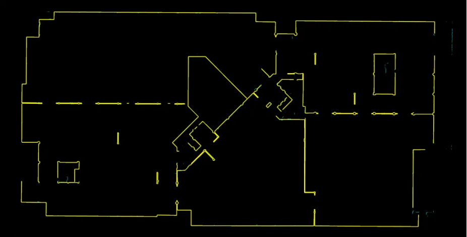
image.png

Underground Garage Floor Plan


Showcasing the Capabilities
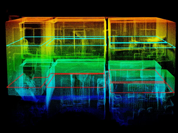

image.png

Multi-layer Data Stacking Point Cloud Effects
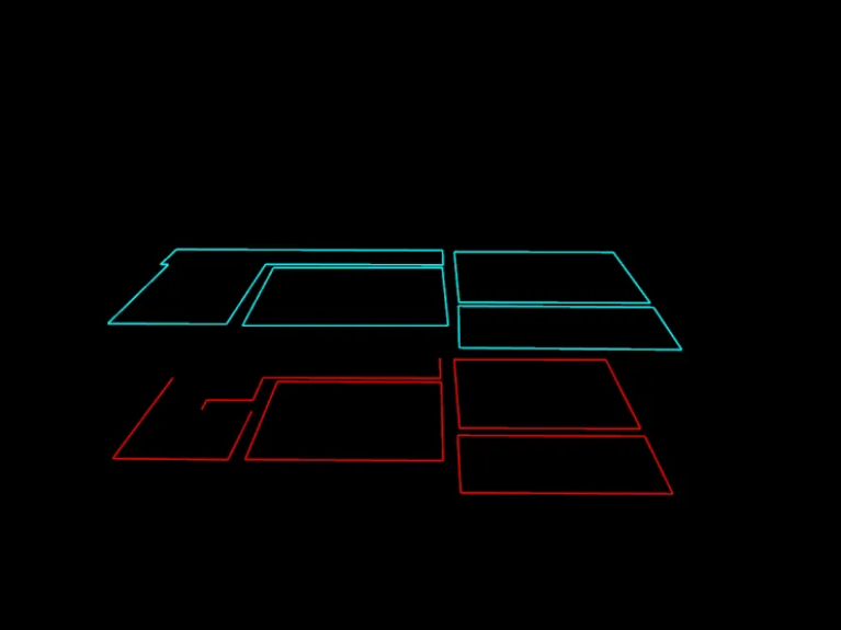

image.png

Multi-layer Data MLS Geometric Results
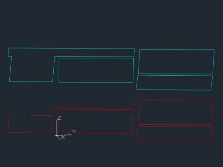

image.png

  Multi-layer Data Exported to DXF and Displayed in CAD


Note: The classification accuracy and vector line extraction completeness are based on existing test data statistics. There may be variations depending on the indoor scene and the type of objects.


Recommended Articles

HOW CAN WE HELP YOU?
Message us your questions and contact information.
We’ll get back to you right away!