A 3D point cloud is a map built by accumulating laser frame data collected at different locations and at different times. Since the state of the surrounding environment at the moment of acquisition is quickly captured during data collection, they often contain dynamic objects that may not always be observed.
Dynamic objects in the point cloud will reduce the readability of the data and affect the subsequent use of the point cloud, so it is important to remove dynamic objects from the point cloud.
The removal of moving targets by traditional algorithms requires parameter adjustment based on data conditions. The same set of parameters cannot even satisfy similar scenarios collected by different devices.
LiDAR360 MLS uses intelligent means to convert the problem of removing dynamic objects from point clouds into intelligent classification of point clouds without adjusting parameters. It can not only remove moving objects with one click, but also obtain data with category information, killing two birds with one stone!
[Example ONE]
Equipment: LiGrip H120
Scene: Urban Streets
Result: 34.339 million point cloud points after solution
Processing Time: 4 minutes
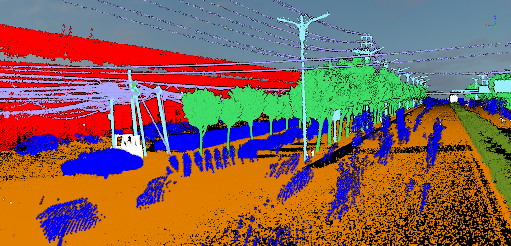
Before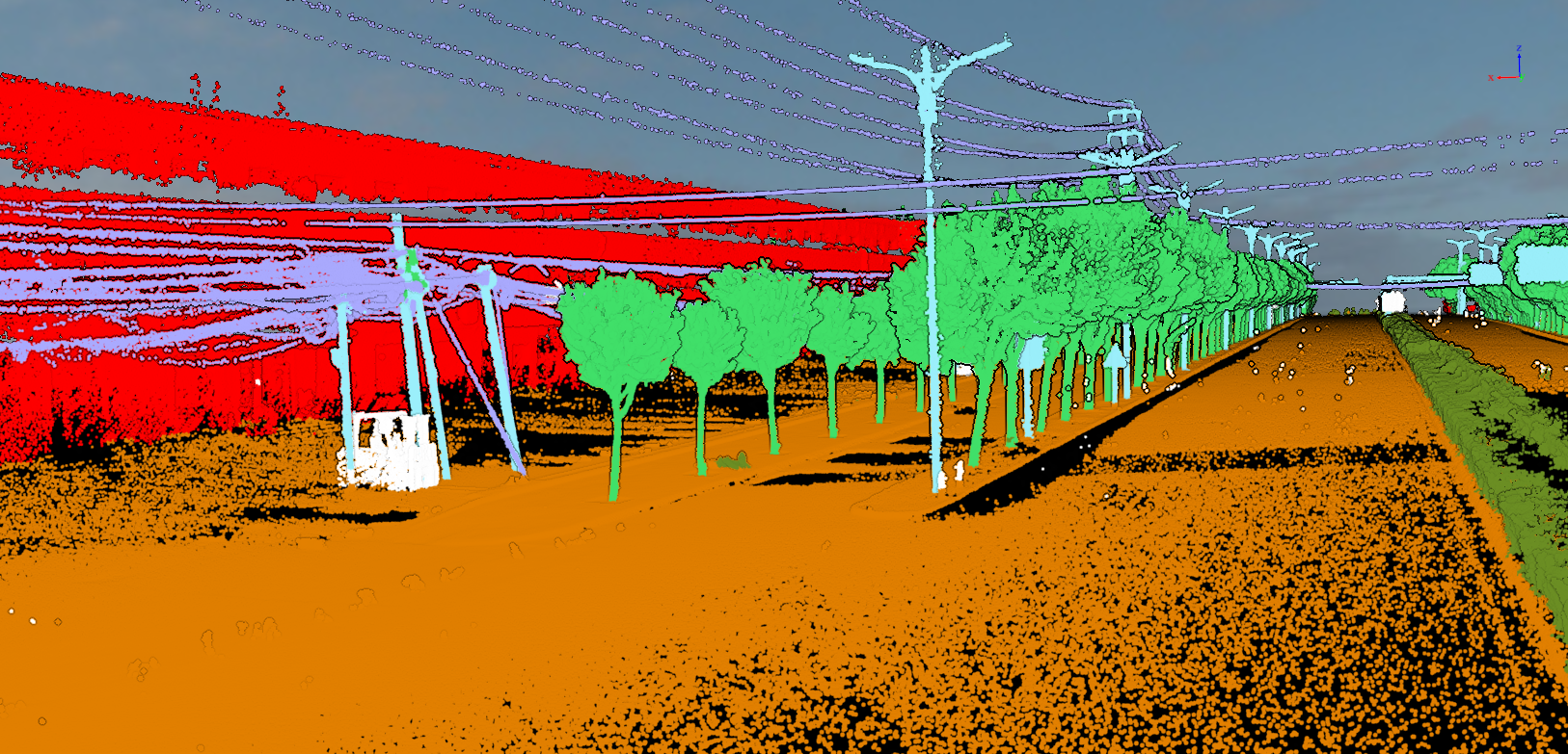 、
、
After
[Example TWO]
Equipment: Handheld LiGrip H300
Scene: Underground Garage
Result: 20.7991 million point cloud after solution
Processing Time: 3 minutes
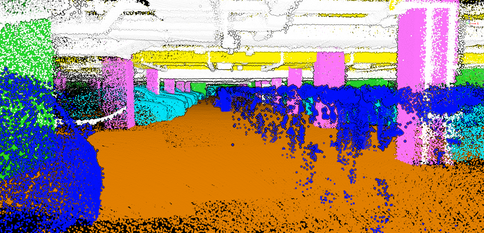
Before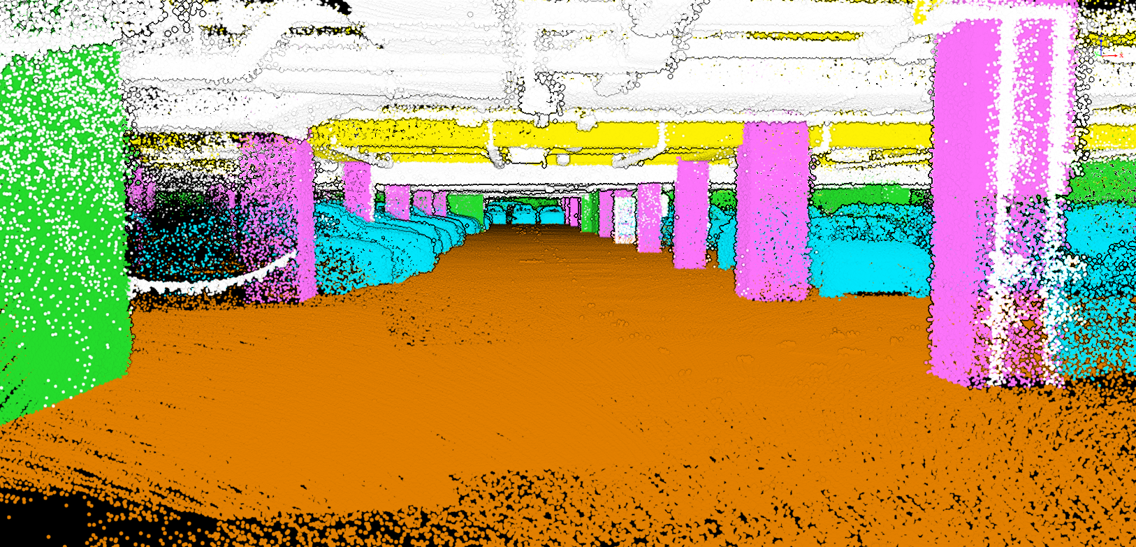
After
[Example Three]
Equipment: Handheld LiGrip H120
Scene: Wanda Mall
Result: 60.9142 million point cloud points after solution
Processing Time: 10 minutes
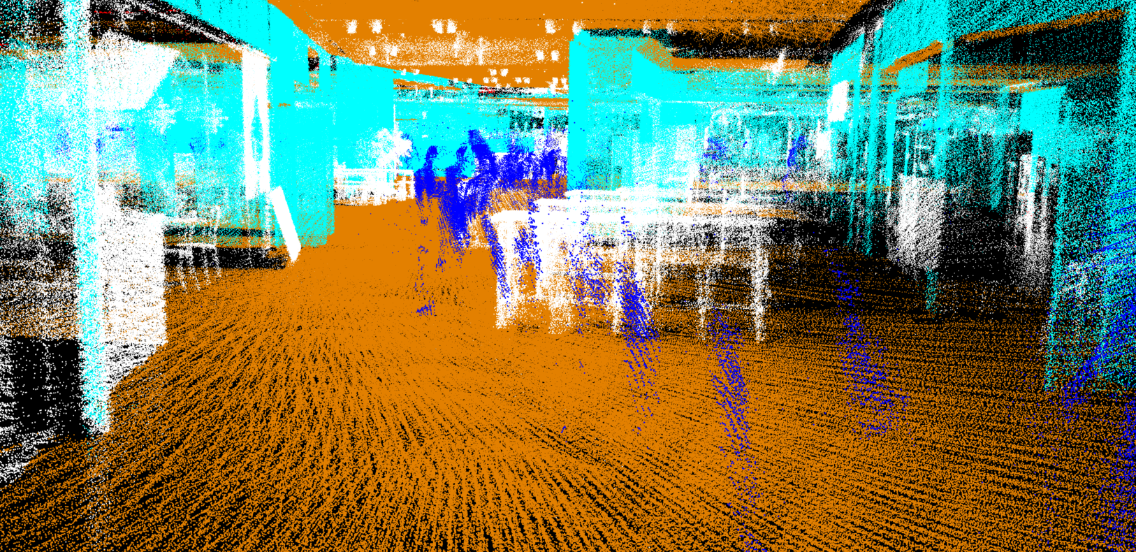
Before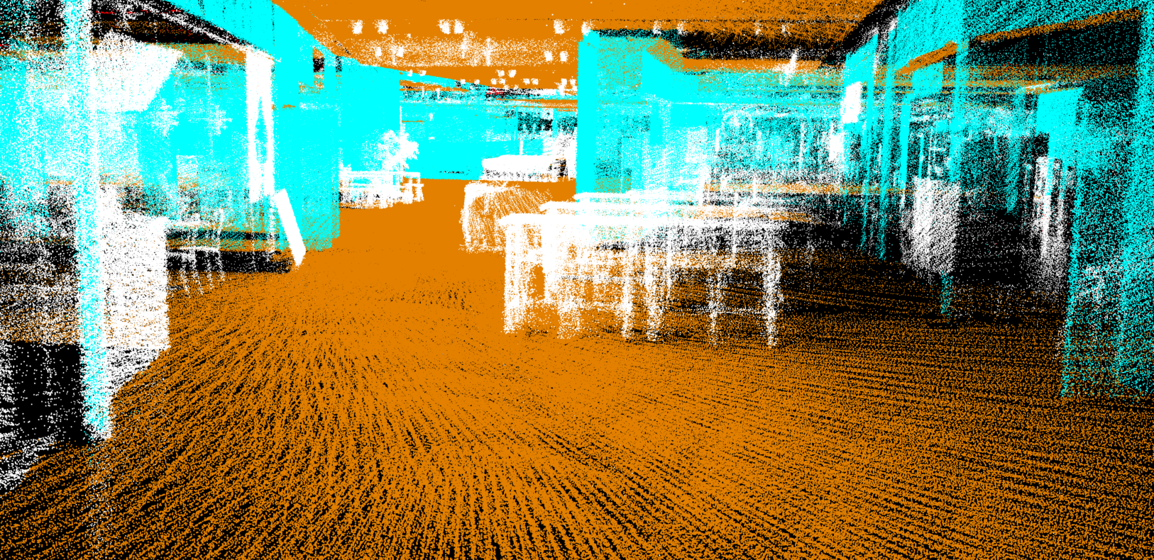
After
[Example Four]
Equipment: Handheld LiGrip H120
Scene: Enjiang Ancient City
Result: 108.3978 million point cloud after solution
Processing Time: 10 minutes
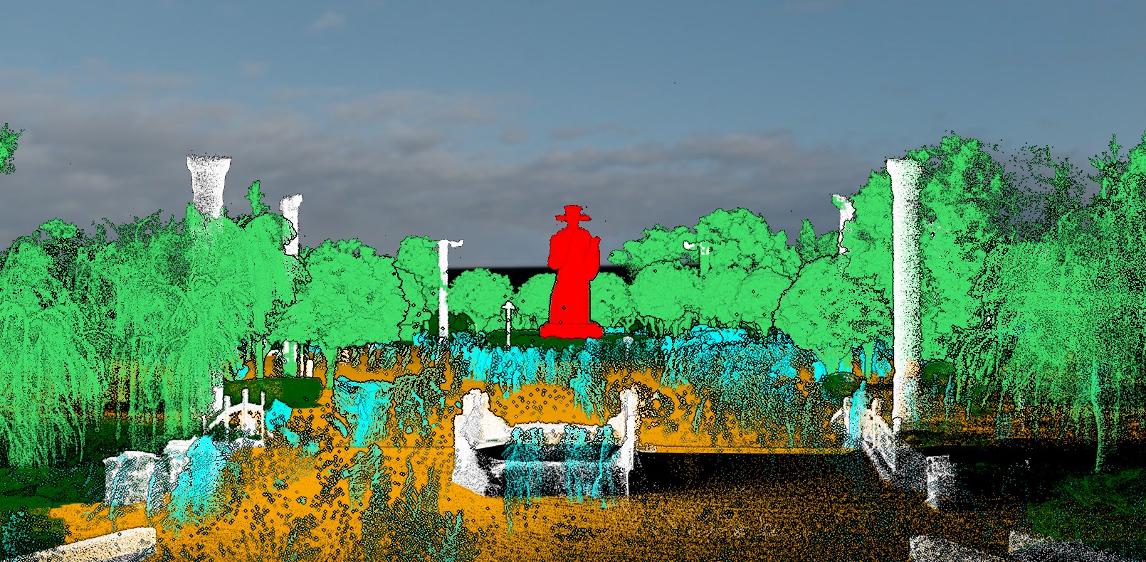
Before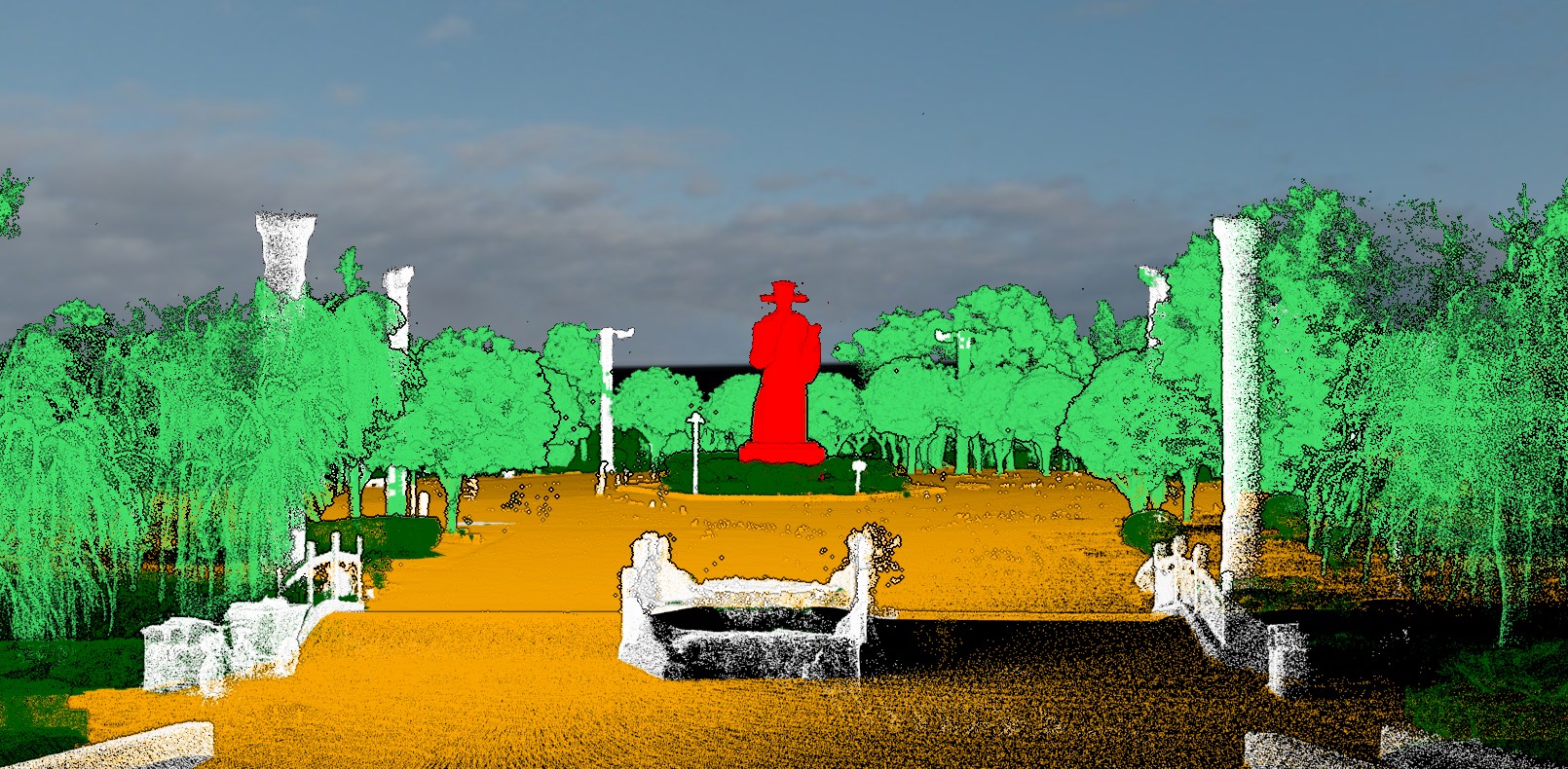
After
[Example Five]
Equipment: Handheld LiGrip H120 Backpack Mode
Scene: Mountain forest
Result: 27.8015 million point cloud points after solution
Processing Time: 3 minutes
Of course, the LiDAR360MLS software also provides customized deep learning classification. Based on actual operating scenarios and classification requirements, it can independently label target samples and train its own point cloud classification model.
Moreover, the software is easy to operate. Even if you are not an expert in deep learning, you can quickly get started and experience the charm of deep learning.
The customer used the deep learning classification function of LiDAR360MLS to conduct precise point cloud classification of the entire city and forest area data.
LiDAR360 MLS provides an intelligent one-click solution for the classification task of massive point cloud data, provides accurate identification of any responsible scene and target, simultaneously removes moving targets during the data collection process, and solves the first problem of point cloud data processing. , creating strong conditions for subsequent efficient data operations.
All the above times are measured based on NVIDIA GeForce RTX 3050 8G video memory graphics card. Different hardware performance points cloud classification time is different. The higher the performance of the graphics card, the shorter the classification time. Therefore, it is recommended that the video card memory is not less than 8G.
