Subscribe

LiDAR360MLS V8.1 Introduces the Gaussian Reconstruction Module

-- 16 Dec 2024 --

What is 3D Gaussian Splatting?

Gaussian Splatting is a technique for representing 3D scenes and rendering new perspectives, first introduced in the paper “3D Gaussian Splatting for Real-Time Radiance Field Rendering.” This method projects points (or "splats") from point clouds into 3D space and uses Gaussian functions for each splat to create high-fidelity, realistic 3D scenes. It supports complex view-dependent visual effects and generates dynamic and vivid visualizations, surpassing traditional point cloud rendering techniques.

With the release of LiDAR360MLS V8.1, the Gaussian Reconstruction Module is officially launched. Powered by proprietary LiDAR SLAM and AI reconstruction technology, it enables realistic 3D modeling of any scene.


Fully Automatic Gaussian Reconstruction

One-Click Reconstruction: Seamlessly integrates with LiGrip O1 Lite and LiGrip H300 devices for end-to-end processing, from pre-processing and calculation to post-processing and reconstruction.


Supports reconstruction of large-scale or indoor-outdoor integrated scenes, with smooth navigation of large-scale data

Overcomes technical challenges in modeling large spaces and complex environments, providing solutions for seamless indoor-outdoor scene integration and large-scale scene modeling, with smooth navigation of large-scale data.


Multi-Source Data Interactive Visualization

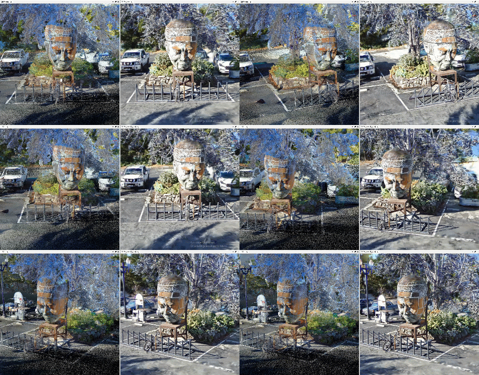
Supports interactive browsing and viewing between:

Gaussian models and point cloud data.

Gaussian models and panoramic images.
3.gif

4.gif


3D Measurement Capabilities

Measures points, multiple points, lengths, heights, areas, and angles in 3D.

WPS图片(1).jpeg

Left: Height measurement from point cloud.       Right: Height measurement from Gaussian model.


Flexible Model Editing and Format Conversion

Offers versatile selection and cropping features for internal/external cropping, hiding, or displaying cropped content, with results exportable.

Supports importing and exporting in PLY universal format and LiSplat proprietary format.

5.gif


3D Mapping and Annotation

Combines advanced 3D mapping capabilities with centimeter-level precision models for annotating and drawing any features on Gaussian data.
Fills the gap in missing information from single data sources, meeting mapping needs across multiple industries.


6.gif


Supports customizable roaming perspectives and navigation along the collection trajectory.

12月15日(1) 00_00_00-00_00_30~4.gif


Reconstructed Model Size Compression

With proprietary data compression technology, LiDAR360MLS reduces the size of Gaussian models by nearly 7 times compared to the original algorithm results.


3.jpeg


What is 3D Gaussian Splatting?

Gaussian Splatting is a technique for representing 3D scenes and rendering new perspectives, first introduced in the paper “3D Gaussian Splatting for Real-Time Radiance Field Rendering.” This method projects points (or "splats") from point clouds into 3D space and uses Gaussian functions for each splat to create high-fidelity, realistic 3D scenes. It supports complex view-dependent visual effects and generates dynamic and vivid visualizations, surpassing traditional point cloud rendering techniques.

With the release of LiDAR360MLS V8.1, the Gaussian Reconstruction Module is officially launched. Powered by proprietary LiDAR SLAM and AI reconstruction technology, it enables realistic 3D modeling of any scene.


Fully Automatic Gaussian Reconstruction

One-Click Reconstruction: Seamlessly integrates with LiGrip O1 Lite and LiGrip H300 devices for end-to-end processing, from pre-processing and calculation to post-processing and reconstruction.


Supports reconstruction of large-scale or indoor-outdoor integrated scenes, with smooth navigation of large-scale data

Overcomes technical challenges in modeling large spaces and complex environments, providing solutions for seamless indoor-outdoor scene integration and large-scale scene modeling, with smooth navigation of large-scale data.


Multi-Source Data Interactive Visualization

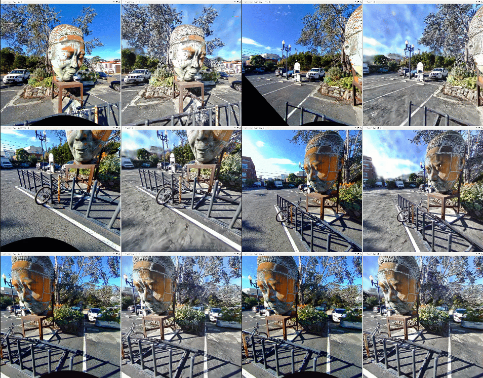
Supports interactive browsing and viewing between:

Gaussian models and point cloud data.

Gaussian models and panoramic images.
3.gif

4.gif


3D Measurement Capabilities

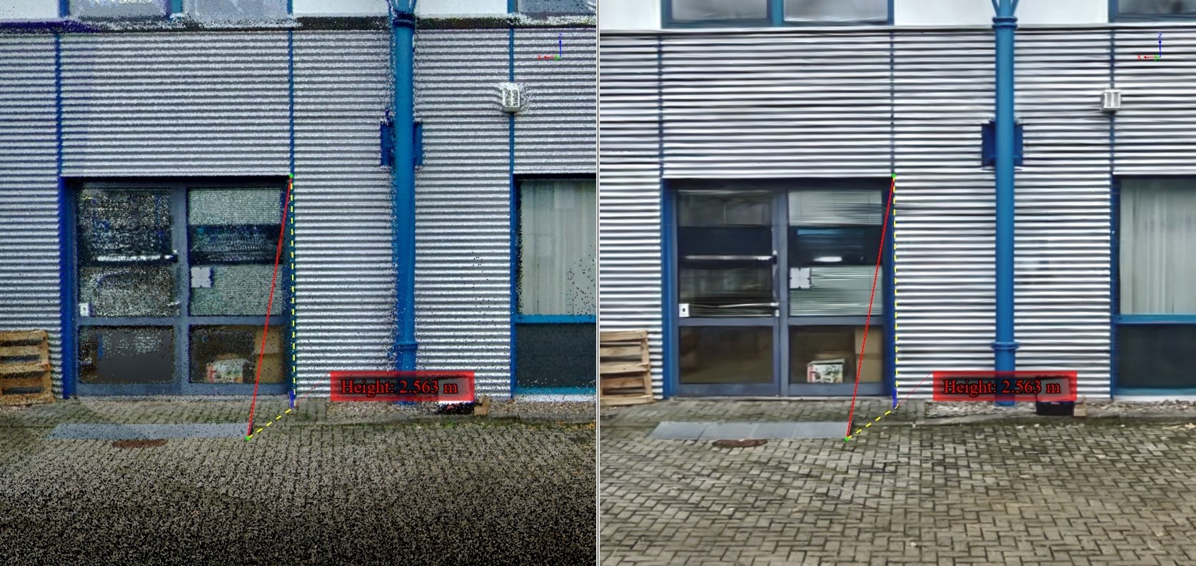
Measures points, multiple points, lengths, heights, areas, and angles in 3D.
WPS图片(1).jpeg

Left: Height measurement from point cloud.       Right: Height measurement from Gaussian model.


Flexible Model Editing and Format Conversion

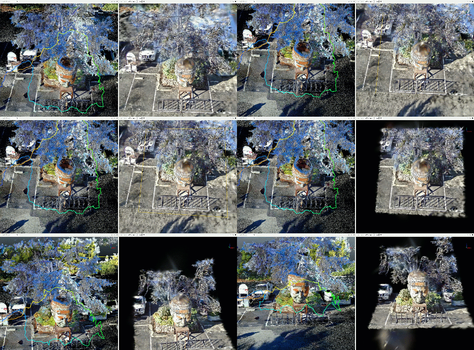
Offers versatile selection and cropping features for internal/external cropping, hiding, or displaying cropped content, with results exportable.

Supports importing and exporting in PLY universal format and LiSplat proprietary format.
5.gif


3D Mapping and Annotation

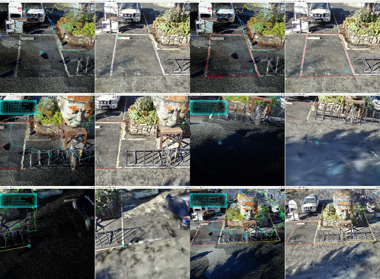
Combines advanced 3D mapping capabilities with centimeter-level precision models for annotating and drawing any features on Gaussian data.
Fills the gap in missing information from single data sources, meeting mapping needs across multiple industries.

6.gif


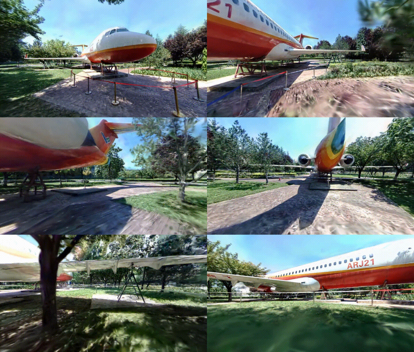
Supports customizable roaming perspectives and navigation along the collection trajectory.
12月15日(1) 00_00_00-00_00_30~4.gif


Reconstructed Model Size Compression

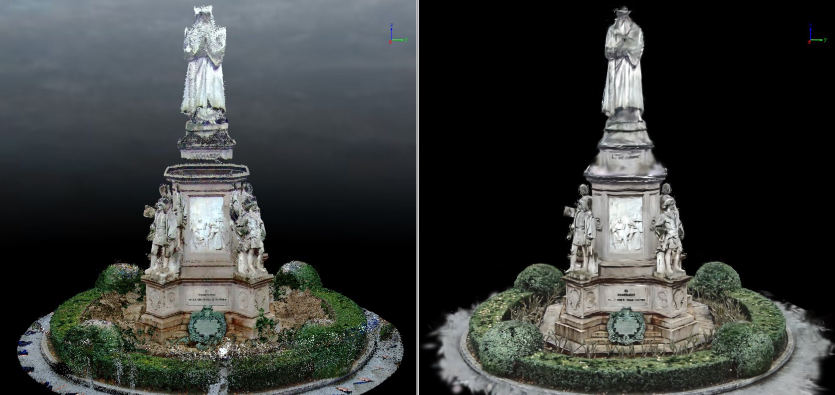
With proprietary data compression technology, LiDAR360MLS reduces the size of Gaussian models by nearly 7 times compared to the original algorithm results.

3.jpeg


Recommended Articles

HOW CAN WE HELP YOU?
Message us your questions and contact information.
We’ll get back to you right away!