Subscribe

AI-Driven Digital Twin Foundation: LiDAR360MLS Opens the Era of 3D Data Intelligence Processing 2.0

-- 25 Sep 2024 --

LiDAR360 MLS feature intelligent extraction and analysis software officially releases the brand new version of V8. The new version deeply integrates the pre-processing solution to post-processing application of handheld, backpack, and vehicle-mounted data, expands 500+ functions, and extends the application of AI to a variety of businesses such as extraction and analysis, realizing the complete processing chain from point cloud data processing to the delivery of industry results such as GIS asset survey, architectural drawings, 3D vector mapping, road condition assessment, railway inspection, urban forestry inventory, digital twin, high definition map. It can drive new changes in intelligent data processing.

New Georeference module, new data processing flow

1. BP Module

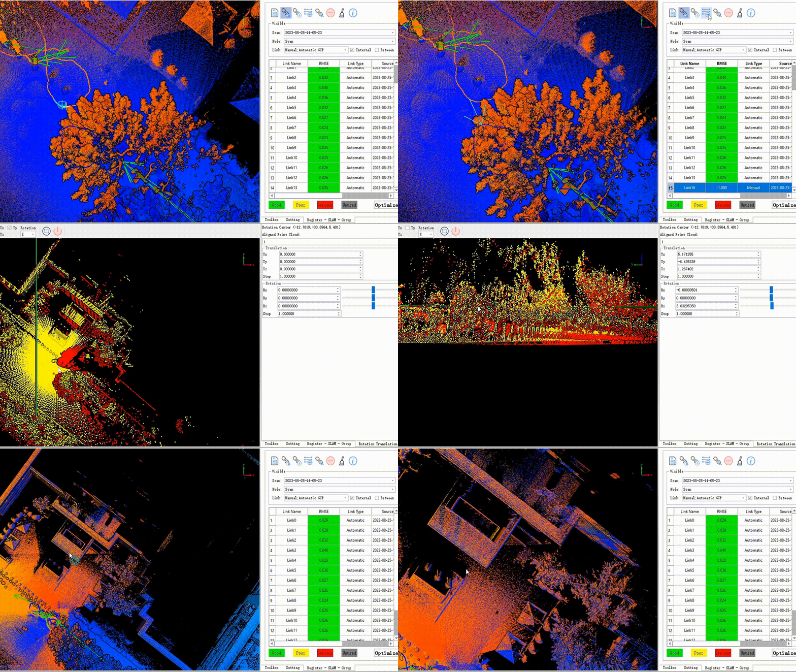
image.png 

SLAM solving process

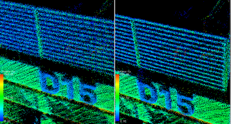
    • Point cloud structure is clearer


image.png 

Left: V7.2 effect; Right: V8.0 effect

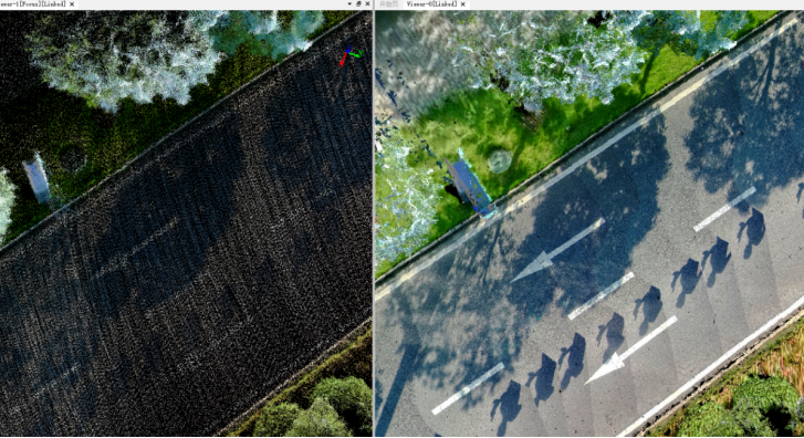
    • Live point cloud output


image.png 

O1-Lite Before encryption (left) After encryption (right)

    • SLAM closed-loop editing


SLAM闭环编辑 00_00_00-00_00_30.gif


2. Geo module

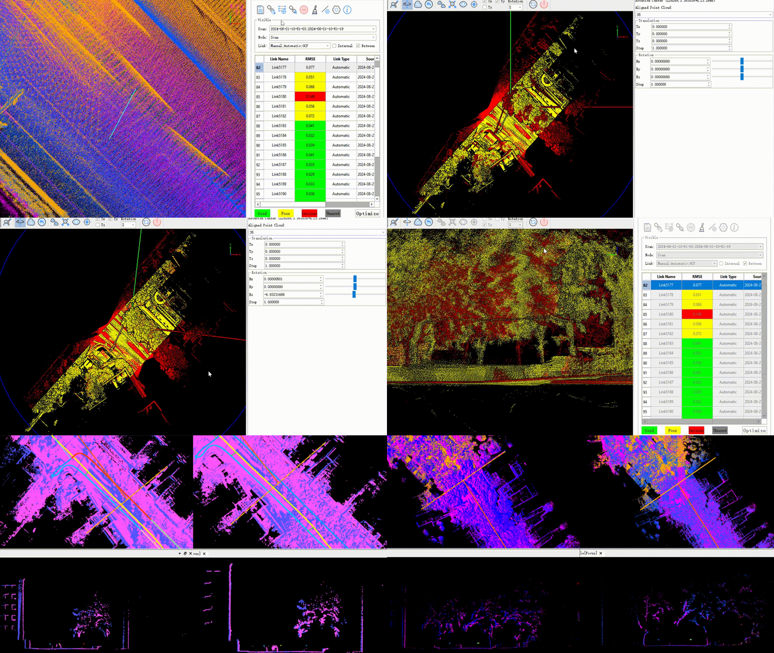
image.png 

Mobile solving process

    • Strip Adjust Editor


      航带拼接编辑 00_00_00-00_00_30.gif


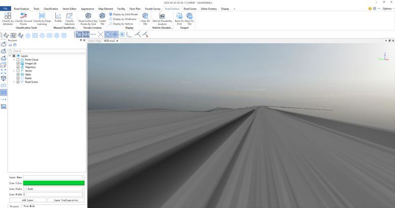
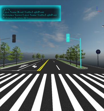
New Road Scene module, One click generate component-level 3D Real Scene
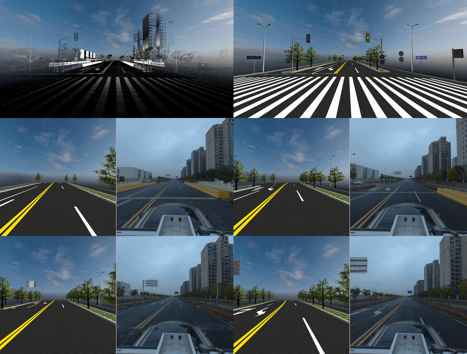
一键生成道路部件级三维模型 00_00_00-00_00_30.gif


The model library is easily extensible, enhancing modeling capabilities
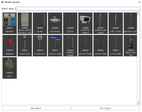
image.png 

Built-in library of monomer symbol models
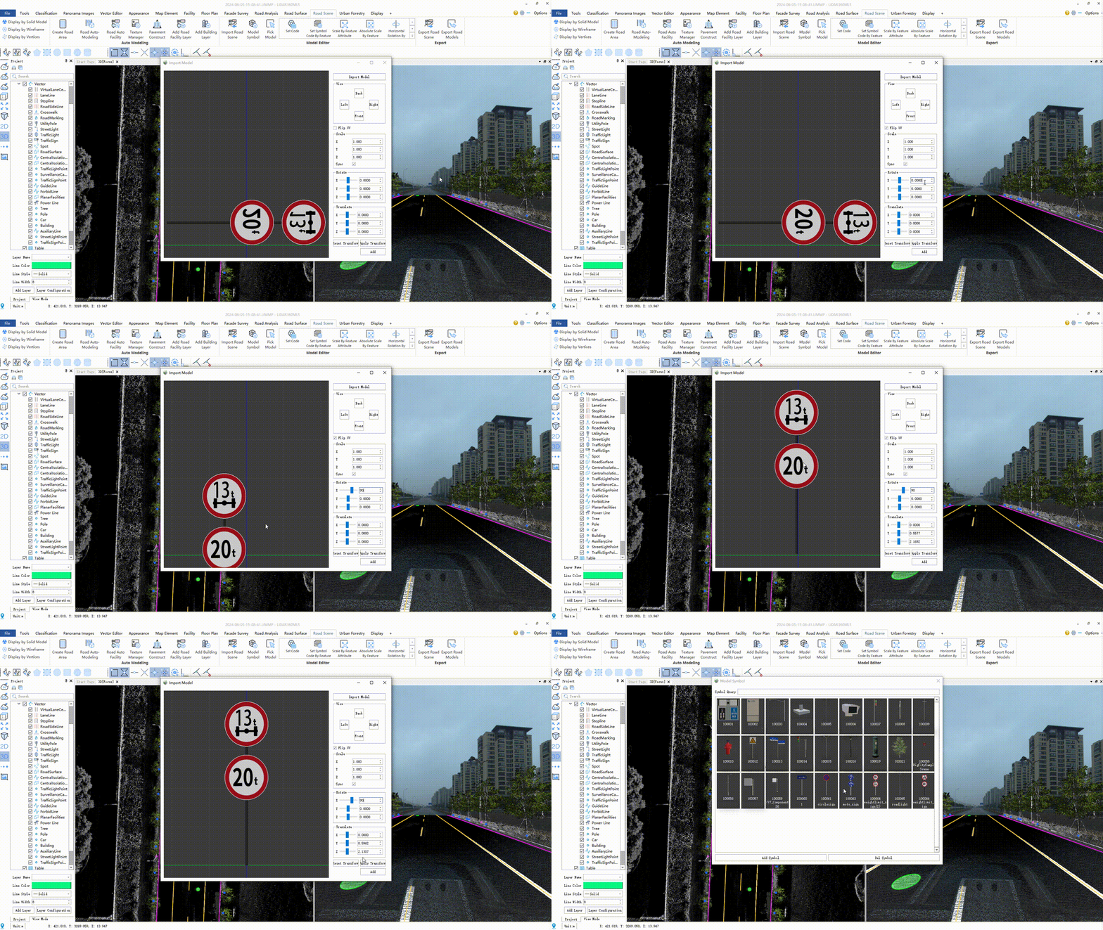
单体符号模型导入 00_00_00-00_00_30.gif


Support for model library expansion and customized configuration of model textures
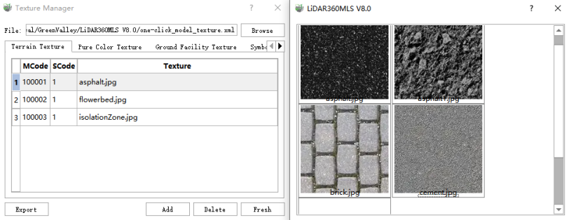
 

image.png


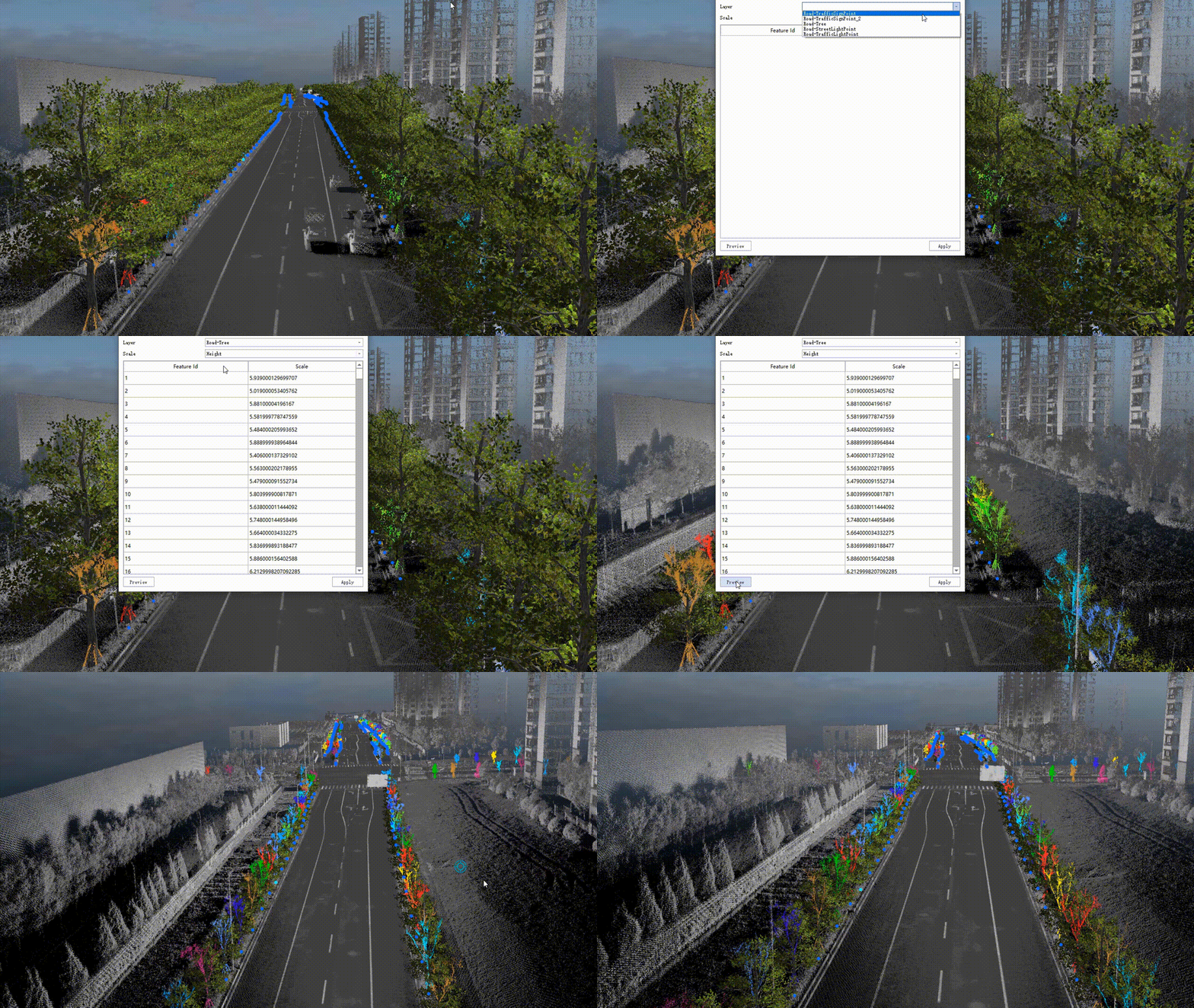
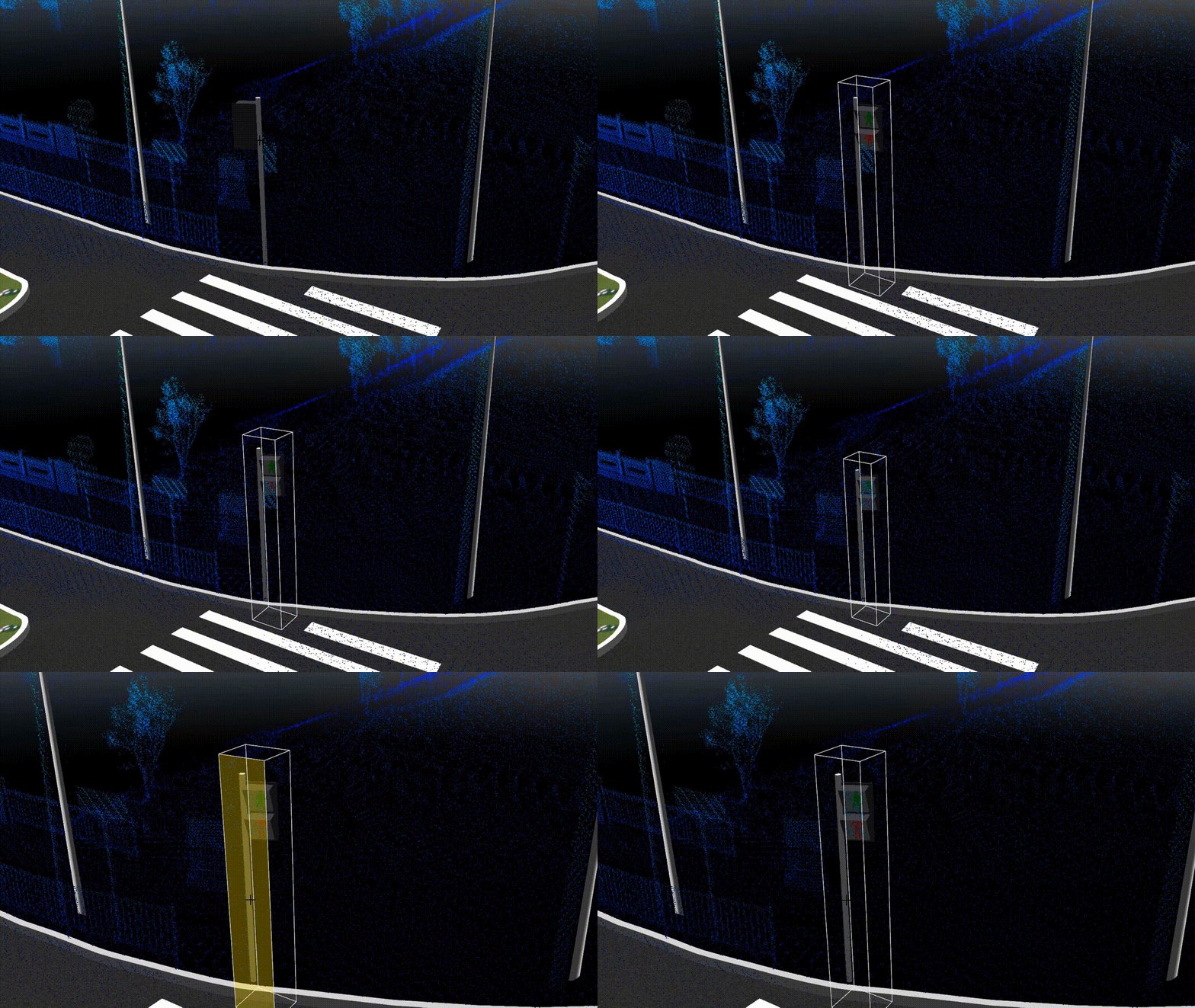
Support model query, with a variety of model editing tools, to achieve model refinement processing

image.png 

按要素属性绝对缩放 00_00_00-00_00_30.gif

模型移动 00_00_00-00_00_30.gif

相对旋转 00_00_00-00_00_30.gif


Intelligent Extraction Adds Image Customization AI Plus


Point Cloud & Image + AI = Unlimited scenarios, Boundless data, Unrestricted tasks

Complete AI pipeline for point cloud and image data from annotation, training to inference.
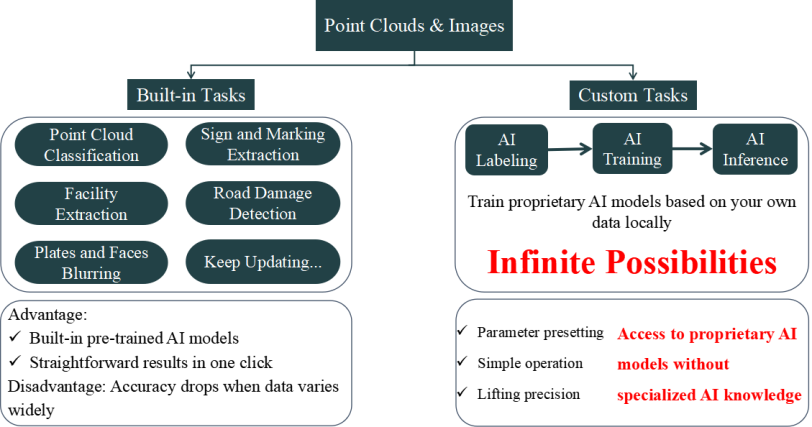

image.png 


Image AI support:

(1) AI labeling

Manual labeling

Auxiliary labeling based on SAM model
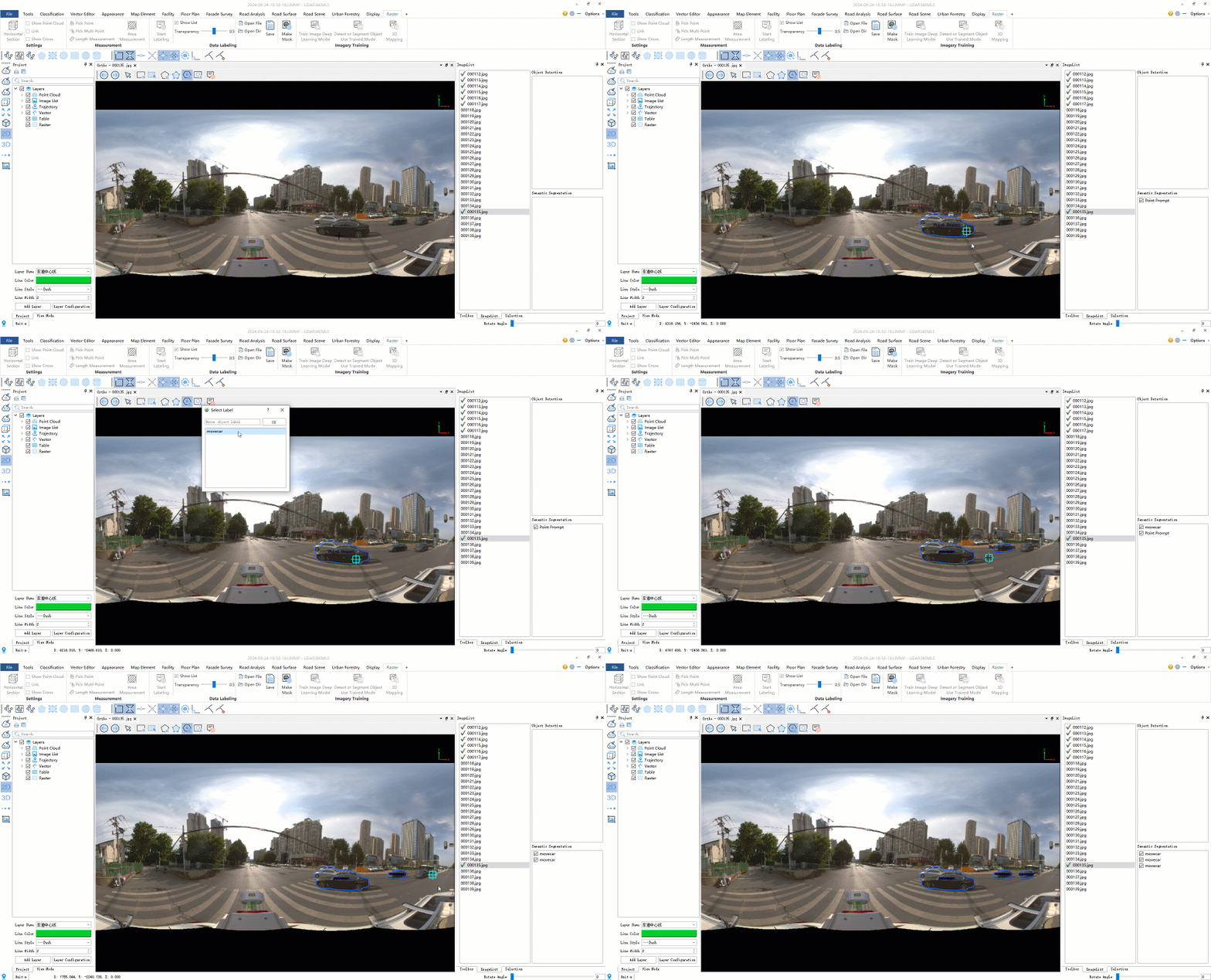
AI标注.gif


(2) Custom model training

Object detection

Semantic segmentation

Road sign extraction
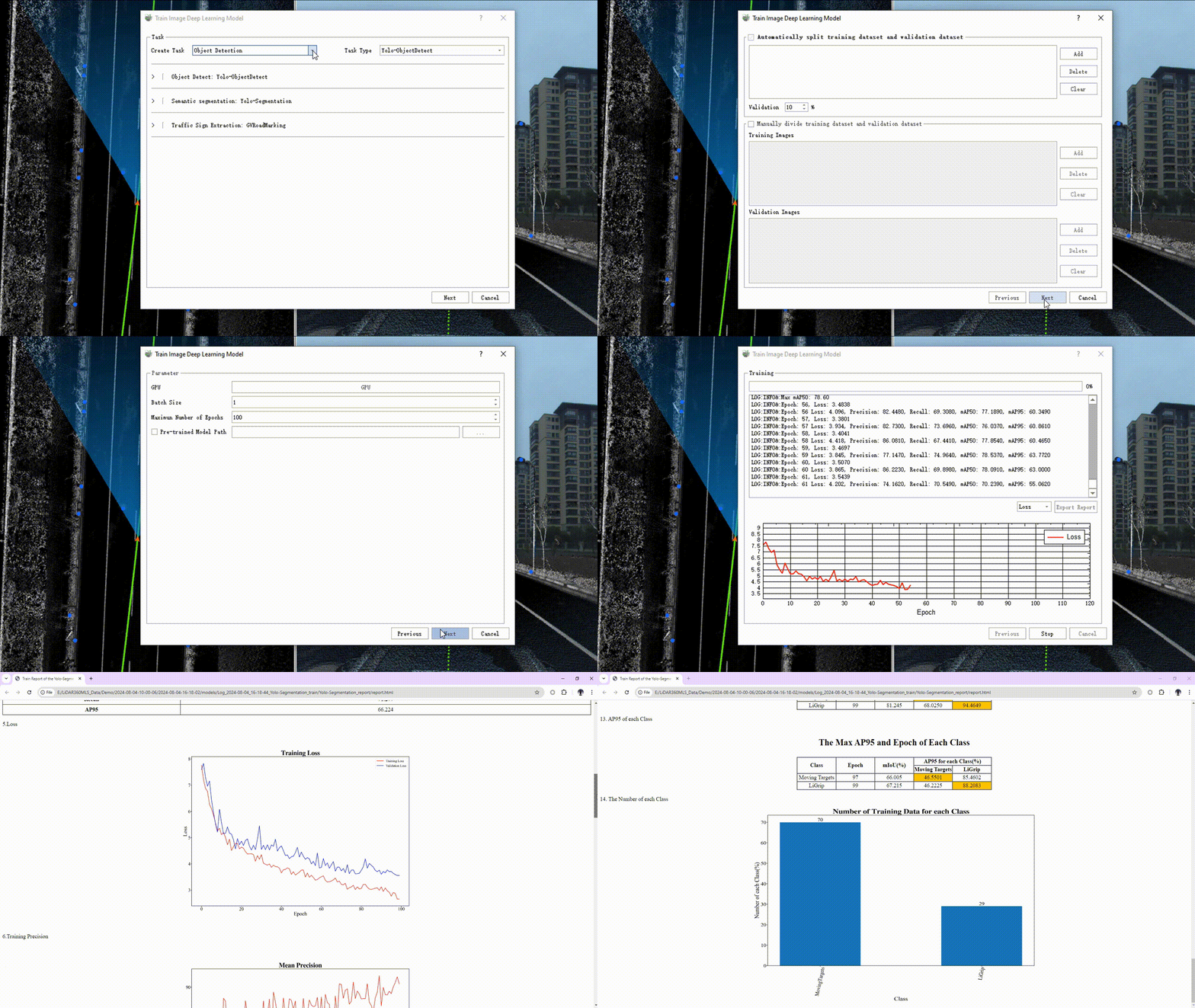
AI训练 00_00_00-00_00_30.gif


(3) Detect/Segment images using trained models

(4) Results are mapped in 3D back-projection
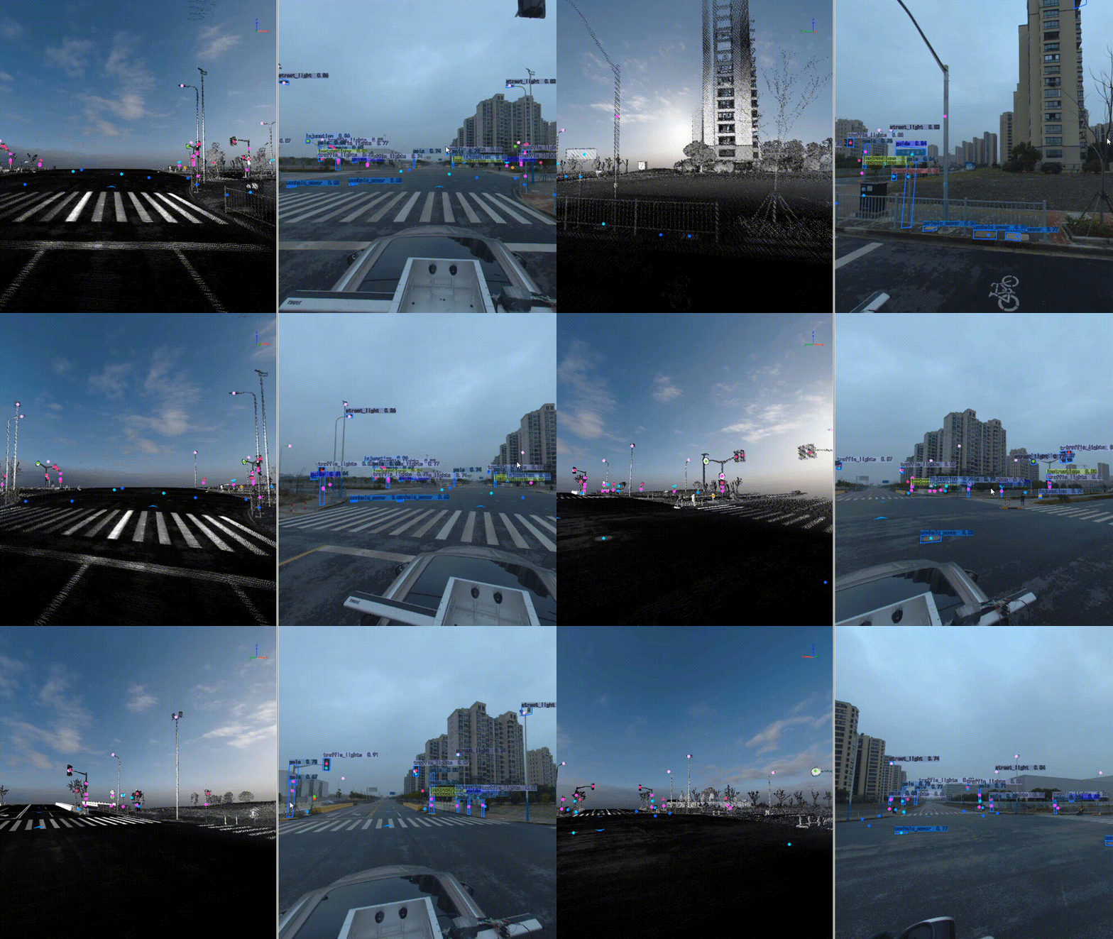
AI推理及反投影 00_00_00-00_00_30.gif 

Asset census

New automatic extraction model for North American road markings
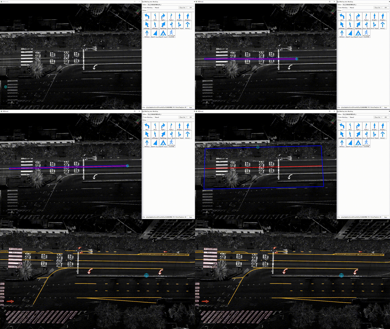
北美道路标线自动提取 00_00_00-00_00_30.gif


Support a small amount of labeling according to the vector or point cloud data of the marking line symbol library in any country or region, and directly carry out custom model training.
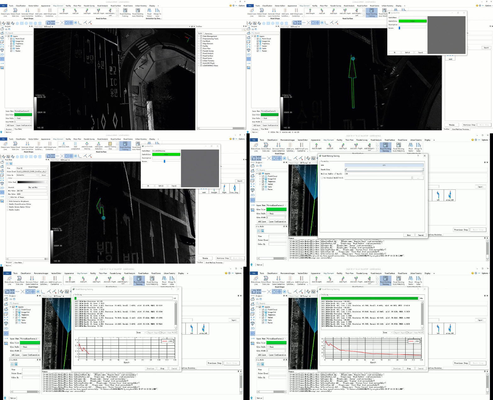
合成样本方式的标线模型.gif 


Intelligent Extraction of Road Facilities by Point Cloud and Images with Customization Modes

Road analysis

New AI-based pavement damage detection
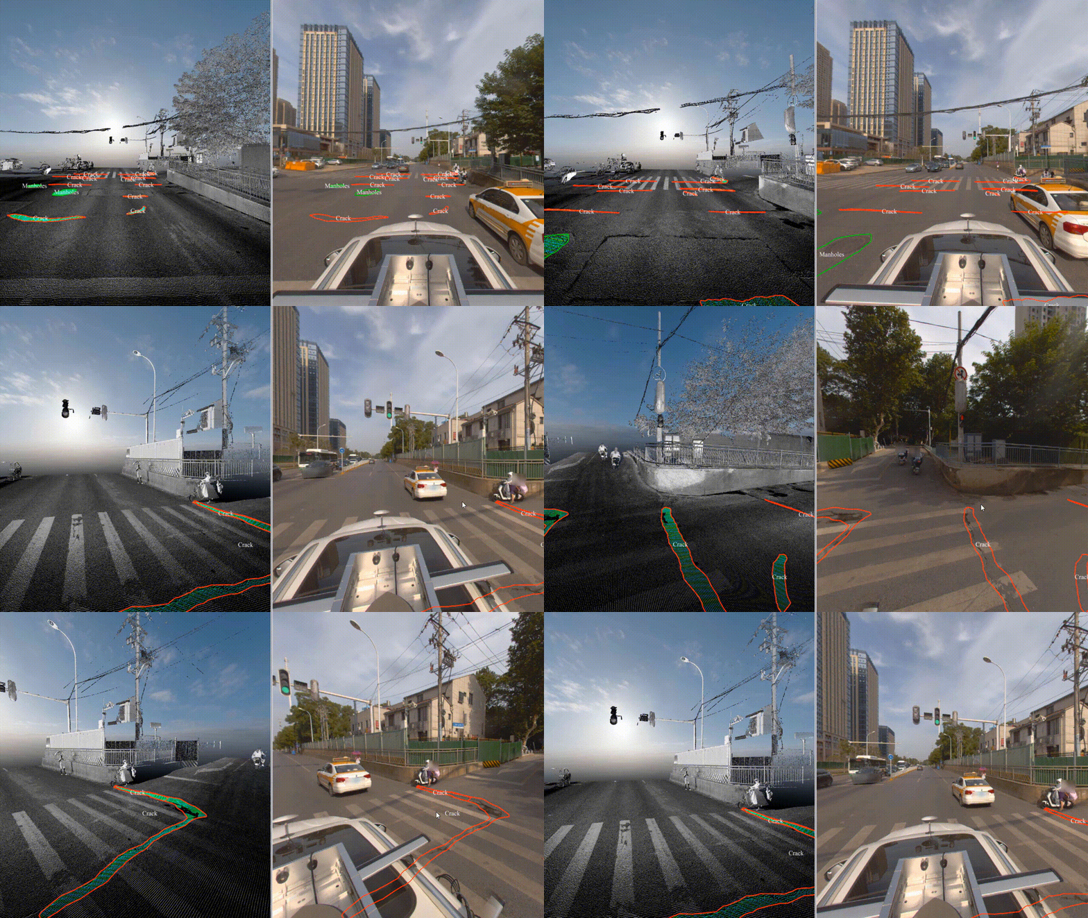
点云+影像的智能化道路破损检测 00_00_00-00_00_30.gif

High-precision terrain generation based on cross-sectional key points
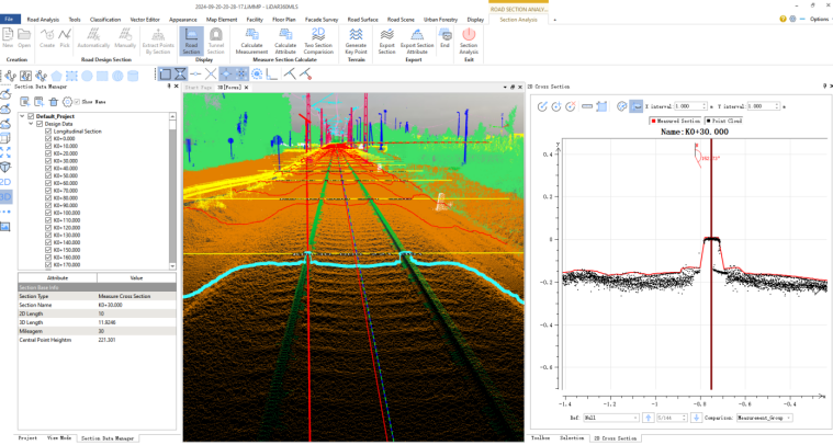
 image.png

Sections and key points

image.png 

Highly accurate terrain based on key points


Point cloud or TIN based roadway DEM and DSM generation
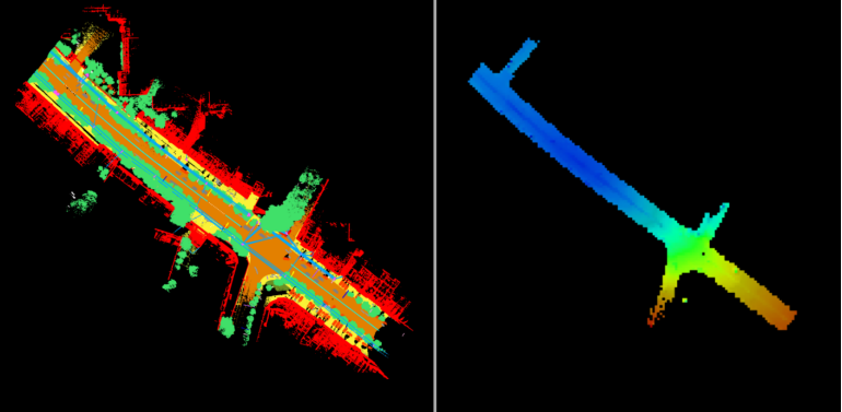
image.png

Left:Point Cloud, RightDEM

CAD plugins


New CAD plug-ins, no additional configuration, one-click installation, geometry, attributes, Annotation, styles, seamless integration of CAD
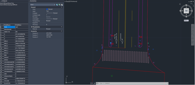
image.png 


Platform


1. All functions support units such as feet.
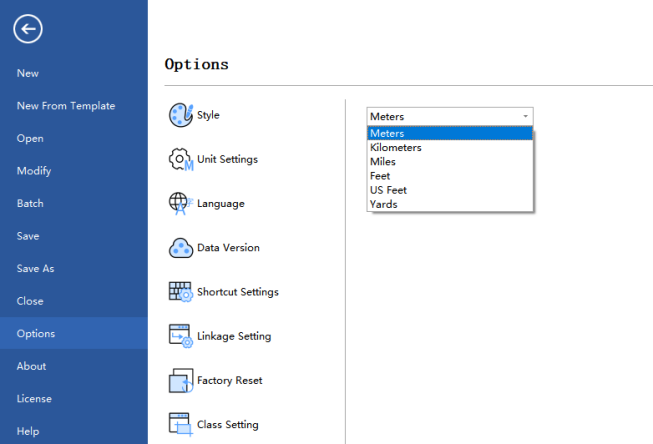
image.png


2. New toolbox, support full-featured search and collection of commonly used functions, point cloud processing tools have been expanded to 60+, vector processing tools have been expanded to 100+, raster processing tools have been expanded to 20+.
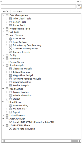
image.png 

3. The field calculator includes over 300 built-in functions and provides a Python scripting tool.
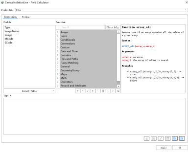
image.pngimage.png 

4. New publish tool, supporting upload of point cloud, imagery, and vector, with functions for display, browsing, and editing.


image.png 


LiDAR360 MLS feature intelligent extraction and analysis software officially releases the brand new version of V8. The new version deeply integrates the pre-processing solution to post-processing application of handheld, backpack, and vehicle-mounted data, expands 500+ functions, and extends the application of AI to a variety of businesses such as extraction and analysis, realizing the complete processing chain from point cloud data processing to the delivery of industry results such as GIS asset survey, architectural drawings, 3D vector mapping, road condition assessment, railway inspection, urban forestry inventory, digital twin, high definition map. It can drive new changes in intelligent data processing.

New Georeference module, new data processing flow

1. BP Module

image.png 

SLAM solving process

    • Point cloud structure is clearer


image.png 

Left: V7.2 effect; Right: V8.0 effect

    • Live point cloud output


image.png 

O1-Lite Before encryption (left) After encryption (right)

    • SLAM closed-loop editing


SLAM闭环编辑 00_00_00-00_00_30.gif


2. Geo module

image.png 

Mobile solving process

    • Strip Adjust Editor


      航带拼接编辑 00_00_00-00_00_30.gif


New Road Scene module, One click generate component-level 3D Real Scene

一键生成道路部件级三维模型 00_00_00-00_00_30.gif


The model library is easily extensible, enhancing modeling capabilities

image.png 

Built-in library of monomer symbol models

单体符号模型导入 00_00_00-00_00_30.gif


Support for model library expansion and customized configuration of model textures


image.png


Support model query, with a variety of model editing tools, to achieve model refinement processing

image.png 

按要素属性绝对缩放 00_00_00-00_00_30.gif

模型移动 00_00_00-00_00_30.gif

相对旋转 00_00_00-00_00_30.gif


Intelligent Extraction Adds Image Customization AI Plus


Point Cloud & Image + AI = Unlimited scenarios, Boundless data, Unrestricted tasks

Complete AI pipeline for point cloud and image data from annotation, training to inference.


image.png 


Image AI support:

(1) AI labeling

Manual labeling

Auxiliary labeling based on SAM model

AI标注.gif


(2) Custom model training

Object detection

Semantic segmentation

Road sign extraction

AI训练 00_00_00-00_00_30.gif


(3) Detect/Segment images using trained models

(4) Results are mapped in 3D back-projection

AI推理及反投影 00_00_00-00_00_30.gif 

Asset census

New automatic extraction model for North American road markings

北美道路标线自动提取 00_00_00-00_00_30.gif


Support a small amount of labeling according to the vector or point cloud data of the marking line symbol library in any country or region, and directly carry out custom model training.

合成样本方式的标线模型.gif 


Intelligent Extraction of Road Facilities by Point Cloud and Images with Customization Modes

Road analysis

New AI-based pavement damage detection

点云+影像的智能化道路破损检测 00_00_00-00_00_30.gif

High-precision terrain generation based on cross-sectional key points

 image.png

Sections and key points

image.png 

Highly accurate terrain based on key points


Point cloud or TIN based roadway DEM and DSM generation

image.png

Left:Point Cloud, RightDEM

CAD plugins


New CAD plug-ins, no additional configuration, one-click installation, geometry, attributes, Annotation, styles, seamless integration of CAD

image.png 


Platform


1. All functions support units such as feet.

image.png


2. New toolbox, support full-featured search and collection of commonly used functions, point cloud processing tools have been expanded to 60+, vector processing tools have been expanded to 100+, raster processing tools have been expanded to 20+.

image.png 

3. The field calculator includes over 300 built-in functions and provides a Python scripting tool.
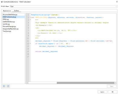
image.pngimage.png 

4. New publish tool, supporting upload of point cloud, imagery, and vector, with functions for display, browsing, and editing.
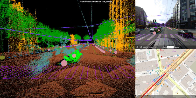
 

image.png 


Recommended Articles

HOW CAN WE HELP YOU?
Message us your questions and contact information.
We’ll get back to you right away!