Current Challenges of Powerline Inspection
Traditional manual inspection has drawbacks such as low automation, high cost, low coverage, and lack of data accumulation and interoperability. Due to its advantages of intelligence, efficiency, and time-saving, drone inspection has gradually become an important technical means for power grid operation and maintenance, and has achieved rapid development in the past five years. However, the current unmanned aerial vehicle (UAV) power inspection still faces some problems in its comprehensive promotion and application, mainly manifested in the following aspects:
1. The integrated sensors of a single inspection equipment are single, which cannot meet the needs of multi element line inspection.
2. The current autonomous driving technology highly relies on positioning signals and has poor adaptability to autonomous positioning and navigation.
3. Poor real-time processing ability, unable to detect major defects and hidden dangers such as tree obstacles in real time.
4. The level of intelligence is insufficient, making it difficult to adapt to the needs of unmanned aerial vehicle inspections in complex scenarios.
Four Major Advantages of Powerline Solutions
Given the above problems, we collaborated with the user unit to develop a high-performance integrated small intelligent transmission patrol UAV system, and its function point has been verified by the third-party inspection:
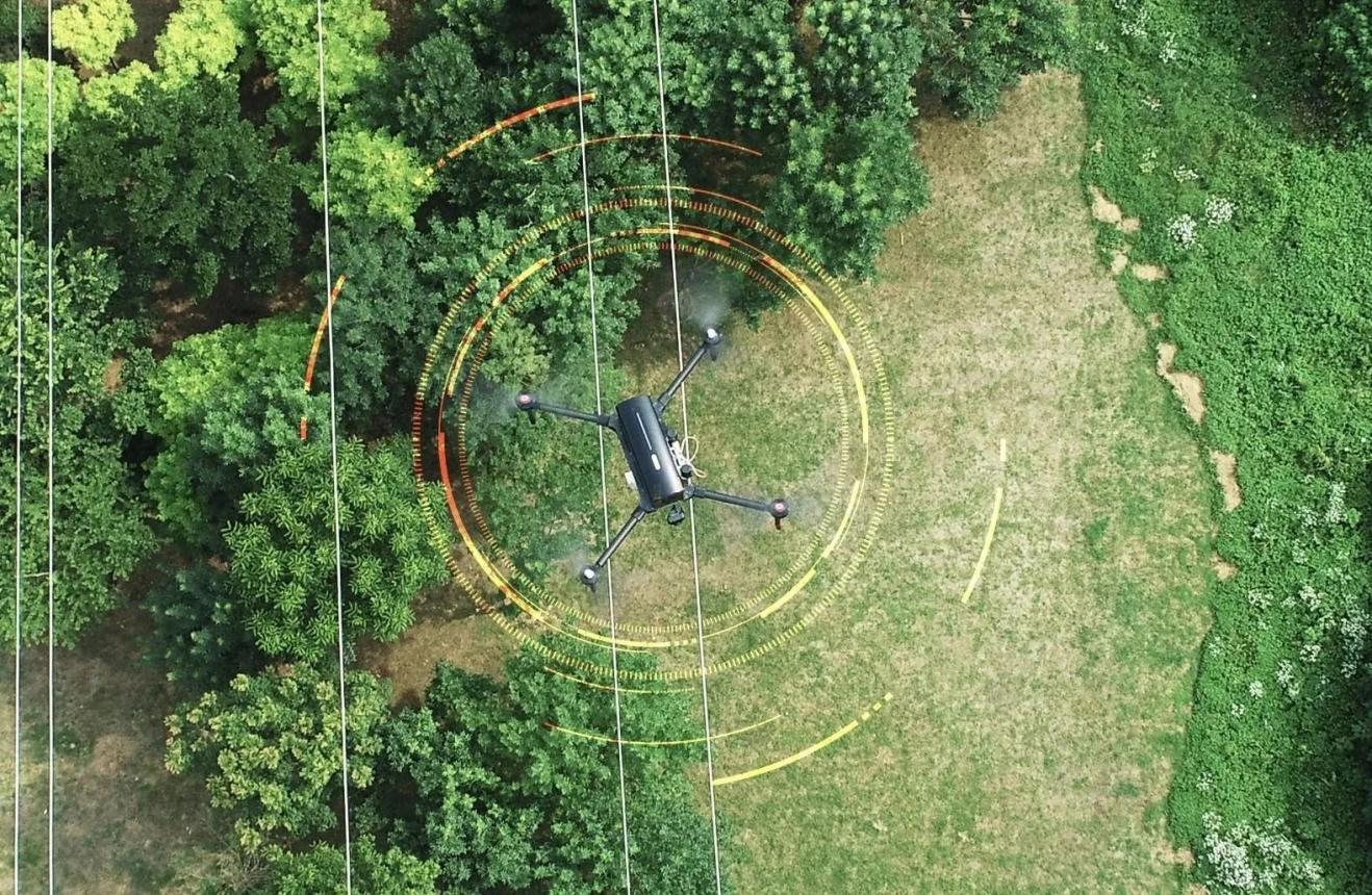
1. Support Self-tracking Ground Wire for Adaptive Flight Inspection in Complex Environment
It can automatically track the ground wire for flight, support automatic identification of branching routes, interactively select flight routes, and automatically turn.
2. Synchronous and Autonomous Acquisition of Multi-target Feature Data
Highly integrated with LiDAR, inertial navigation, visible light cameras, infrared cameras, and edge computing platforms, synchronous collection of point cloud data, POS data, and dual light image data is achieved by establishing a unified time and space benchmark for each sensor.
3. Three-dimensional Real-time Modeling of Point Cloud in the Channel of Remote Controller
Based on the developed inspection ground station and LiPowerline intelligent inspection software, combined with real-time point cloud processing algorithms, a three-dimensional point cloud model of the line channel can be constructed in real-time at the ground station for status monitoring.
4. Intelligent Identification of Airborne Front End of Typical Line Defects
The system supports real-time channel tree obstacle detection and typical line defect detection and recognition, and can display hidden danger and danger points in real time on the remote control, making it easy to quickly detect and eliminate hidden dangers on site.
Case Studies Presentation
To verify the functionality of the project results, trial runs were conducted on 10kV, 110kV, 220kV and other lines, and various functional indicators and inspection data met the application requirements. The specific details are as follows:
Simultaneous Acquisition of LiDAR Point Cloud, Visible Light, and Infrared Multi-Source Data
The system integrates high-resolution visible light and infrared cameras, which can simultaneously capture dual light image data of lines and towers while capturing laser point clouds. The data quality meets inspection requirements.
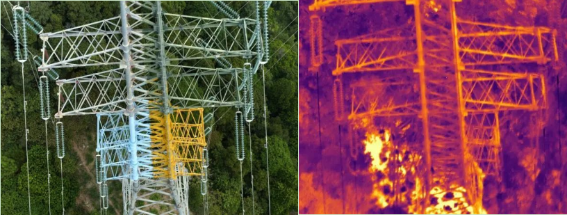
Double Light Image Data of Tower
Effortless Defect Detection and Recognition
The system supports real-time detection of channel tree obstacles. During the trial operation, multiple emergency tree obstacles and other hidden dangers were discovered, greatly improving the efficiency of hazard investigation.
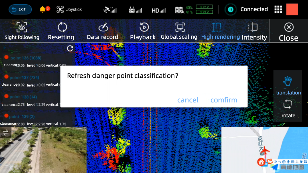
Real-Time Detection of Channel Tree Obstacles
One-stop Technical Solution with Exceptional Point Cloud Quality
Using the self-developed LiPowerline point cloud processing software of GreenValley, the overall point cloud data was not offset or distorted after calculation. During the data collection process, the GNSS signal was received normally, and the towers and wires were collected completely. After actual measurement, it was found that the average point density of the point cloud data was greater than 400pts/m ², The accuracy is better than 5cm, meeting the application requirements.
LiPowerline is a laser radar power line inspection software independently developed by GreenValley. Through processing and analyzing massive point cloud data, it quickly and accurately extracts hidden danger target information in the power channel, and provides functions such as simulated working condition warning analysis, transmission line completion acceptance, and fine inspection line planning, providing guarantees for the safe operation of power lines.
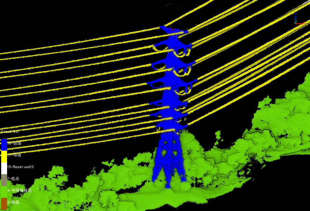
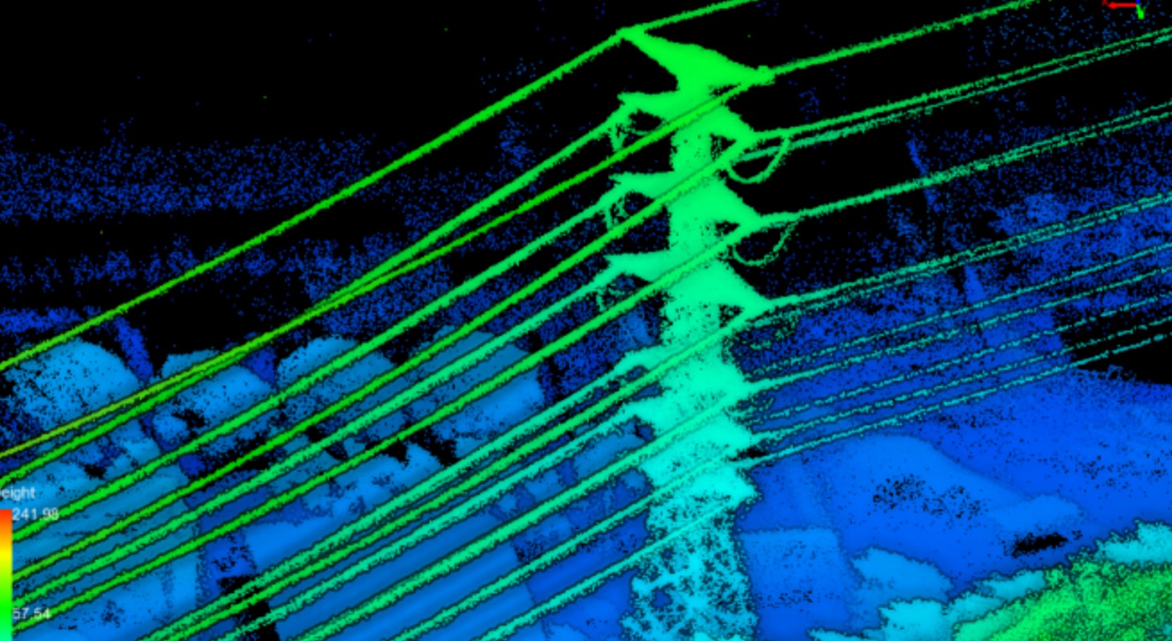
Clear and Complete Point Cloud Data for Channels and Routes
The achievements of the "Research and Application of High-Performance Integrated Small Intelligent Transmission Inspection Drones" project will provide support for the intelligent inspection of overhead power lines in the power grid, and achieve innovation in traditional inspection technology and management. This plan is beneficial for improving the operation and maintenance department's ability to accurately grasp the operation status of the power grid, reducing a large amount of manual line inspection workload, effectively improving the efficiency of line inspection, and improving the safety and reliability of power grid operation.
