Dangerous Point Detection

Power Line Applications
Electricity Infrastructure is an essential service for modern society. The task of maintaining a power network safely and efficiently poses a significant challenge for electricity departments worldwide.
At GVI,we offer a comprehensive range of cutting-edge turnkey solutions for power Line inspection and management, transmission towers inspection and management, construction planning design, and management.

Multi-Dimensional

Intelligent Inspection

Real Time Operation

Multiple Applications
Workflow
We have a complete LiDAR product line, developing team, large-scale production capacity, all this advantages lead us to a better product competitiveness and industry application ability.

Transmission Channel Risk Analysis and Early Warning


Dangerous Point Analysis Report

Tree Fall Analysis

Tree Fall Analysis Report

Wind Working Condition Simulation Analysis


Precise Measurement of Power Transmission Lines and Towers

Phase Distance Analysis

Drainage Thread Clearance Distance Analysis

Measure Clearance Distance

Sag Analysis Report

Tower Inclination Report
Autonomous Drone Inspection of Power Transmission Lines


Distribution Line Imitation Flight Data Collection


Distribution Line Power Inspection Applications

Marking Distribution Network Towers

Distribution Network Tower Route

Distribution Network Channel Route
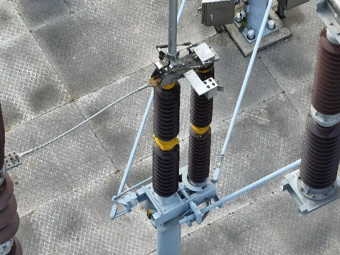
Substation Intelligent Inspection
 Substation Route
 Substation Route
 Substation Live Working
 Substation Live Working
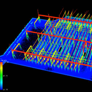
Photovoltaic Intelligent Inspection
By constructing a 3D inspection system through centimeter-level high-precision point cloud modeling and route planning, and employing fully autonomous intelligent drone inspection flights, it achieves integrated inspection and full-process monitoring of photovoltaic plant areas and associated facilities. The AI algorithm intelligently identifies defects in photovoltaic panel strings, achieving closed-loop tracking of the defect processing process.
Urban Power Analysis


Case Studies
Fully Autonomous Fine Inspection Solution for Substations
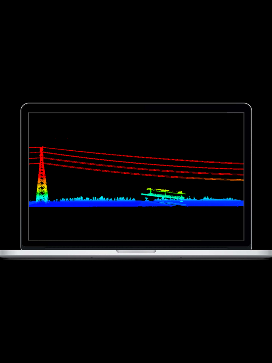
In recent years, drone technology has gained wide attention in substation inspection for its flexibility, efficiency, and ability to access complex environments. By deploying ground-based and UAV-mounted LiDAR systems, it is possible to generate high-precision 3D point cloud models that provide centimeter-level accuracy. These digital models not only enable precise route planning and obstacle avoidance but also pave the way for fully automated, unmanned aerial inspections.
Read More 
Power Line Inspection and Risk Assessment
Electricity transmission networks demand precision, safety, and efficiency—yet traditional inspection methods are slow, costly, and risky.
To overcome these challenges, GreenValley International delivers LiDAR-powered hardware and software solutions that capture high-precision 3D data of power lines and their environments. These insights enable safer, faster, and smarter inspection workflows, now proven across multiple projects in Victoria and New South Wales.
Read More

Power Line Corridor Mapping
Methodologies to Acquisition and Data ProcessingRoutine inspection of power transmission lines is critical for securing uninterrupted distribution of electricity. Traditional, ground-based inspection methods involving teams of surveyors is typically very labor-intensive and time-consuming. Methods for calculating the distance between the sag of the transmission wire and the tree often involves heavy equipment such as height measuring rods and theodolites. This is a huge workload for patrolling personnel whom may be located in deep wilderness and/or hazardous terrain.Recently, energy service pr···
Read More
Which one is right for you?
 LiPowerline
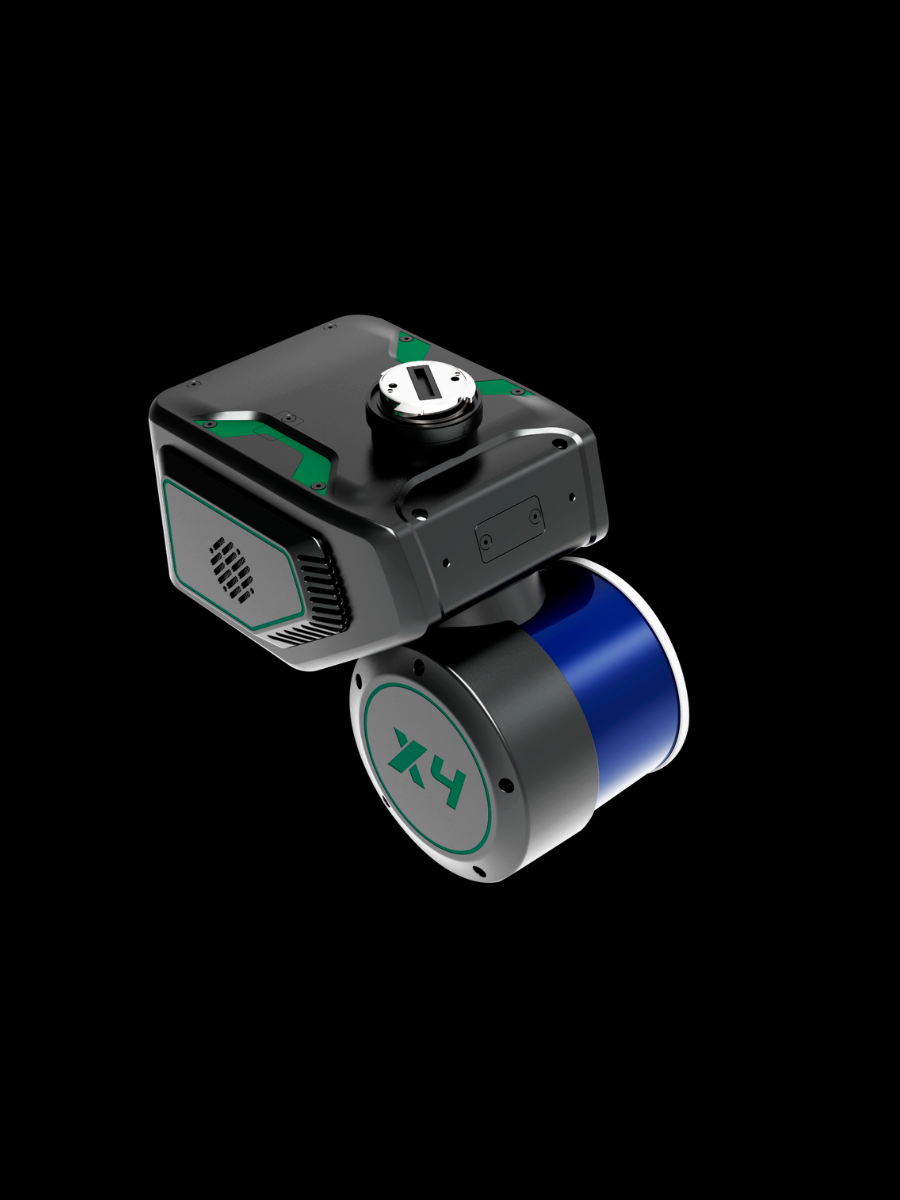 LiAir X4
 LiAir X3C-H
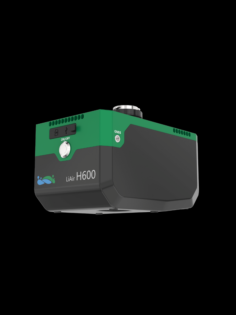 LiAir H600
GreenValley International Inc (GVI), headquartered in Berkeley, California, is a leading innovator of 3D mapping technologies. GVI provides a wide range of advanced aerial, terrestrial, and mobile LiDAR survey and mapping hardware systems and cutting-edge software as well as turnkey solutions. Our portfolio includes airborne, handheld, mobile, and backpack laser scanning platforms, as well as point cloud processing software such as the LiDAR360 LiDAR data processing platform. GVI focuses on LiDAR and image fusion technology, specializing in LiDAR, UAV, SLAM, Photogrammetry, and other technologies to achieve an accurate digital representation of three-dimensional space. As we continue to expand our reach and technological capabilities, GVI remains committed to driving innovation and pushing the boundaries of what's possible in the LiDAR space.
+1(510)345-2899info@greenvalleyintl.com 729 Heinz Avenue, Suite 9, Berkeley, California 94710, USA Subscribe
Copyright © 2022-2025 GreenValley International Inc. All Rights Reserved.