


Universal Platform

Multi-Source Data

Rendering Massive Data

Accuracy Improvement

Powerful AI

Intelligent Mapping

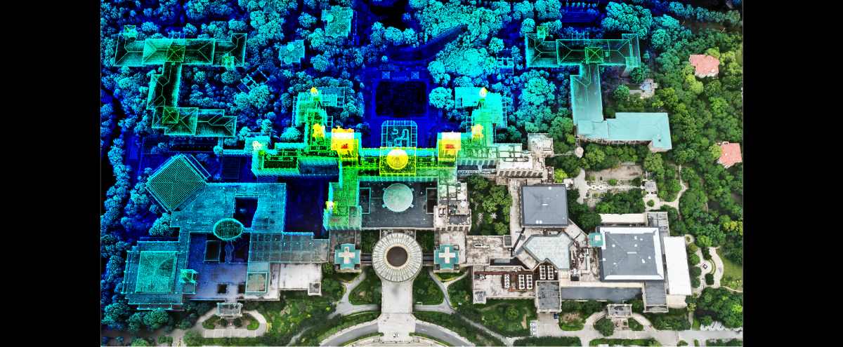
3D Analysis

Multi-Industry

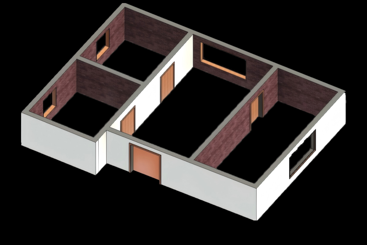
Floor Plan
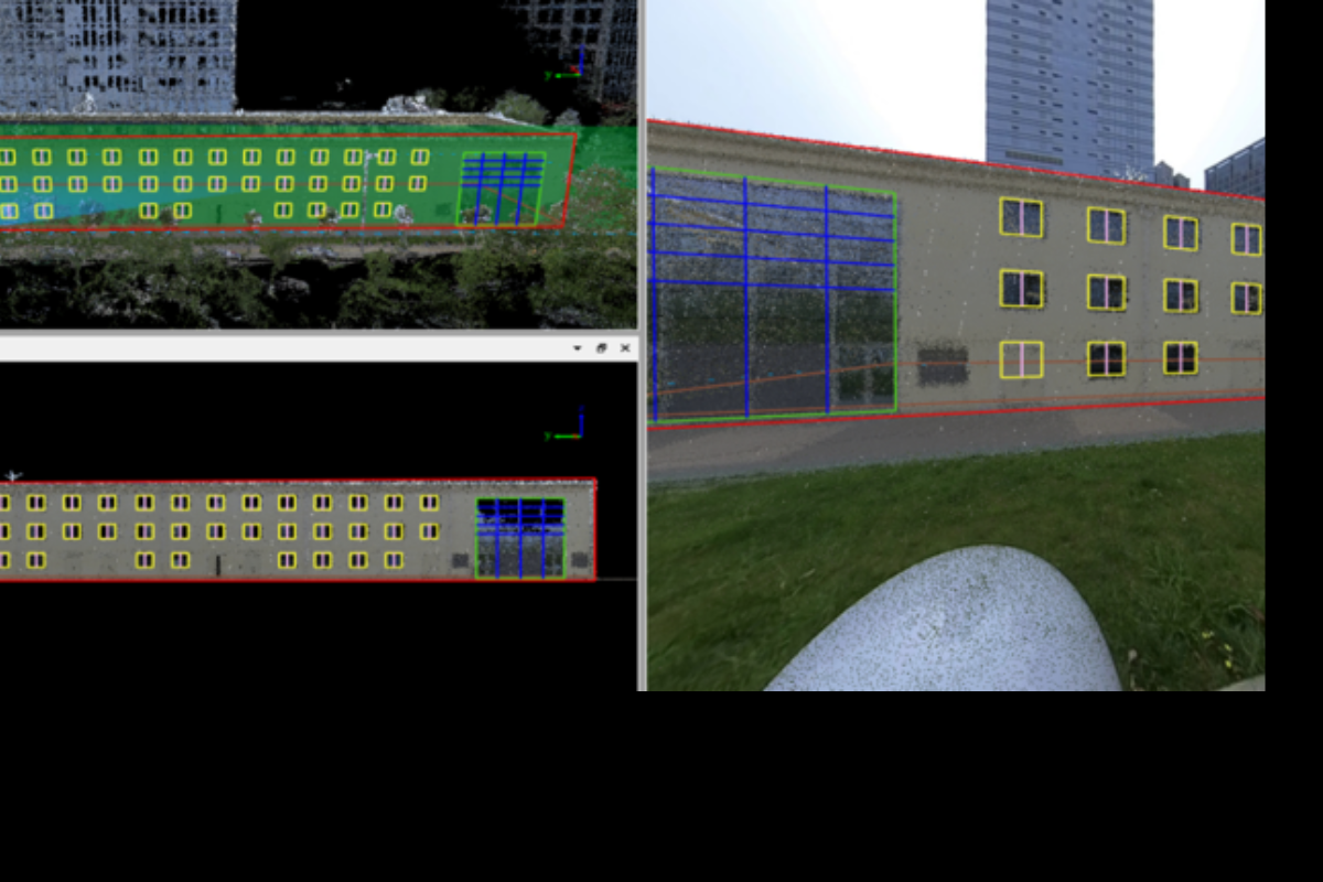
Facade Survey
BIM
Trench and Pipeline
The module enables automatic extraction of pipeline alignment and 3D trench geometry from LiDAR point clouds, supports manual annotation of pipeline features such as elbows and tees, and provides one-click calculation of trench width, depth, earthwork volume, and over-/under-excavation parameters for efficient and accurate engineering analysis.

Pip Detection
Trench Section
Gaussian Splatting Reconstruction
The industry’s first software to enable Gaussian classification. GS Reconstruction integrates LiDAR and camera data through cluster-based reconstruction to efficiently generate large-scale, centimeter-level realistic 3D models with seamless indoor–outdoor fusion and photo-like fidelity. It supports seamless Level-of-Detail (LOD) Gaussian rendering for massive point cloud datasets, provides precise editing tools such as clipping and profile editing, and enables classification labeling, individualized model analysis, 3D measurement, and mapping, with export options for Gaussian assets in multiple formats.
Large-Scale Gaussian Model Rendering with Billions of Points
Gaussian Model by Different Attributes
Gaussian Model Noise Point Editing
Gaussian Model Flattening Editing
Asset Extraction
Powered by AI, Asset Extraction automatically identifies and extracts over 100 types of map features such as roads, buildings, and poles. Users can train custom models using synthetic data from an extensible symbol library, while integrated professional tools offer interactive detection and over 100 editing options for efficient workflows. With an open attribute table, real-time imagery, and a robust field calculator, the software ensures precise editing and data integrity through flexible annotations, attribute validation, and geometric checks—delivering an end-to-end solution from extraction to management for standardized mapping and digital twin outputs.
Automatic Extraction of Road Elements Based on AI
Template Matching
AI-based Road Facilities Extraction
Road Condition
Leveraging AI-based pavement analysis, our system detects road damage and calculates the Pavement Condition Index (PCI) with precision. It also offers intelligent 3D analysis, providing one-click solutions for section assessment, clearance evaluation, visibility checks, height limit verification, and vehicle collision simulation. Additionally, it delivers accurate terrain modeling, generating DEM, DSM, and other terrain products directly from point cloud or sectional data.

Pavement Damage Analysis
Powerline Analysis
Road Section
Vehicle Passability Analysis
Viewshed Analysis

Road Scene
Urban Forestry
Harness AI to automatically classify trunks and canopies, segment individual trees, and extract 10+ key parameters. Generate and analyze ecological thematic maps to gain actionable insights for smarter urban forestry and landscape management.
Cluster Computing and Modelbulider
ModelBuilder offers customizable, one-click batch workflows for point clouds, vectors, and raster data. Its powerful cluster computing engine significantly boosts efficiency in georeferencing, point cloud processing, and 3D model reconstruction.
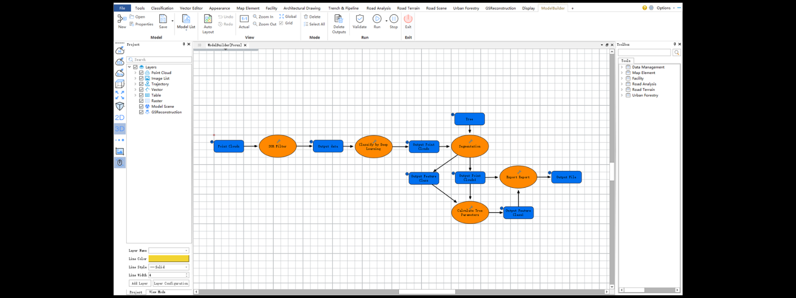
Build-In Workflow
Custom Workflow
Cluster Computing
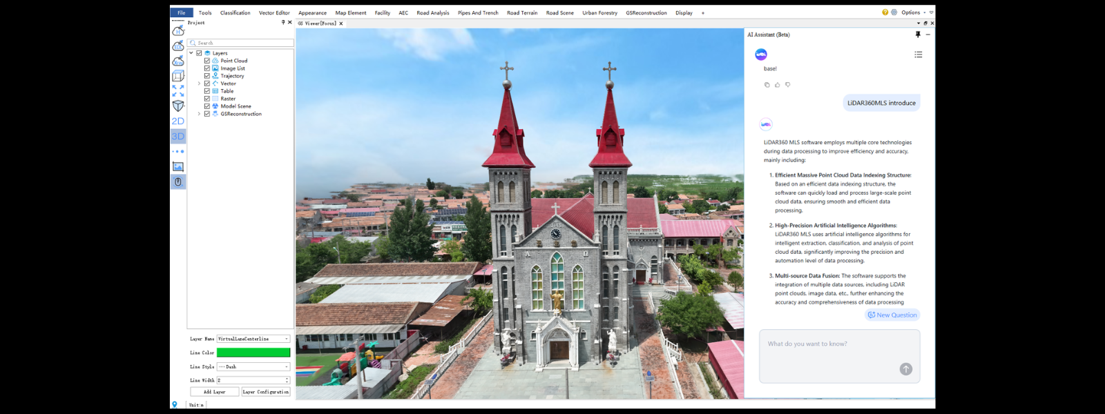
AI Assistant
Built-in Q&A and user guide. Ask and get answers instantly — easier to learn, smarter to use.
Multi-Platform Support 500+ Processing And Editing Tools
LiDAR360MLS has over 500 point cloud, vector, and raster processing tools covering extraction, registration, export, classification, coordinate projection transformation, selection and clipping, measurement, mapping, editing, type conversion, extraction analysis, overlay analysis, and proximity analysis.


One-Stop Point Cloud GeoProcessing
New Data Processing Workflow with Continuous Improvement in Algorithms and Data Quality. One click point cloud generation for LiGrip,LiBackpack, and LiMobile. Multi-source data registration for Complex Scenarios. Strictly control each stage, including data processing, data registration, control point correction, and quality inspection.

Closed-loop Editing
LiGrip Data Coloring Effect
Global Optimization
Trajectory Jumps Identify and Repair
LiMobile Data Coloring Effect
Intelligent Point Cloud Classification

Urban Road
Forestry
Underground Parking Garage
Shopping Mall
Railway
Feature Videos
 LiDAR360MLS & DJI L2 | Transforming Road Surveys with Aerial Innovation
 LiDAR360MLS V7 Highlights | Experience Advanced Machine Learning with No Coding
 LiDAR360MLS | Extract Road Surface Features with AI in one click
 LiDAR360MLS | Semantic Segmentation Results and Object Segmentation Results
 LiDAR360MLS | Real-World Case in Latvia
 LiDAR360MLS | Success Story in Latvia
 LiDAR360 MLS | Facade Survey Results
 LiDAR360MLS | Single wood picture managem
Applications
 Urban Asset Survey
 Urban Forestry Survey and Analysis
 Urban Powerline Survey and Analysis
 Road Safety Analysis
 Road Inspection and Maintenance
 Road Section Analysis
 HD Map Production and Labeling
 Digital Twin and 3D Real Scene
GreenValley International Inc (GVI), headquartered in Berkeley, California, is a leading innovator of 3D mapping technologies. GVI provides a wide range of advanced aerial, terrestrial, and mobile LiDAR survey and mapping hardware systems and cutting-edge software as well as turnkey solutions. Our portfolio includes airborne, handheld, mobile, and backpack laser scanning platforms, as well as point cloud processing software such as the LiDAR360 LiDAR data processing platform. GVI focuses on LiDAR and image fusion technology, specializing in LiDAR, UAV, SLAM, Photogrammetry, and other technologies to achieve an accurate digital representation of three-dimensional space. As we continue to expand our reach and technological capabilities, GVI remains committed to driving innovation and pushing the boundaries of what's possible in the LiDAR space.